BH2011n2 Map
 |
20 |
03/16/2015 2:54 p.m. |
3D terrestrial photogrammetric model |
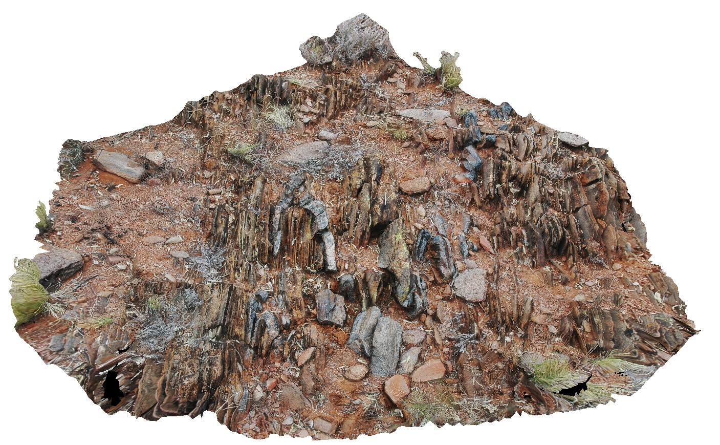
moderately plunging, tight folds in thinly bedded quartzite and mudstones metasediments. Strong cleavage also evident. Broken Hill. N.S.W. |
1.00 |
-31.63628271000 |
141.53839687000 |
-9999.000 |
fold plunge, tight fold, fold, structure, metasediments, cleavage |
metasediments |
BH2011n2 Map
|
20 |
03/16/2015 2:54 p.m. |
3D terrestrial photogrammetric model |
moderately plunging, tight folds in thinly bedded quartzite and mudstones metasediments. Strong cleavage also evident. Broken Hill. N.S.W. |
1.00 |
-31.63628271000 |
141.53839687000 |
-9999.000 |
fold plunge, tight fold, fold, structure, metasediments, cleavage |
metasediments |
BH2011n1 Map
 |
20 |
03/16/2015 2:53 p.m. |
3D terrestrial photogrammetric model |
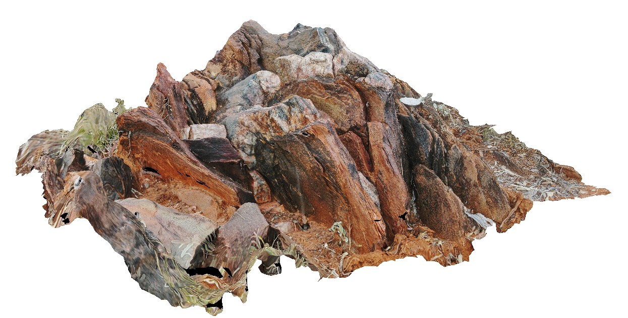
tightly folded and moderately plunging folds in Hores Gneiss. Broken Hill, N.S.W. |
0.80 |
-31.63547118000 |
141.53853471000 |
-9999.000 |
gneiss, tight fold, fold, structure |
gneiss |
BH2011n1 Map
|
20 |
03/16/2015 2:53 p.m. |
3D terrestrial photogrammetric model |
tightly folded and moderately plunging folds in Hores Gneiss. Broken Hill, N.S.W. |
0.80 |
-31.63547118000 |
141.53853471000 |
-9999.000 |
gneiss, tight fold, fold, structure |
gneiss |
BH2011n1 Map
|
20 |
03/16/2015 2:53 p.m. |
3D terrestrial photogrammetric model |
tightly folded and moderately plunging folds in Hores Gneiss. Broken Hill, N.S.W. |
0.80 |
-31.63547118000 |
141.53853471000 |
-9999.000 |
gneiss, tight fold, fold, structure |
gneiss |
BH2011n1 Map
|
20 |
03/16/2015 2:53 p.m. |
3D terrestrial photogrammetric model |
tightly folded and moderately plunging folds in Hores Gneiss. Broken Hill, N.S.W. |
0.80 |
-31.63547118000 |
141.53853471000 |
-9999.000 |
gneiss, tight fold, fold, structure |
gneiss |
Maria14 Map
 |
20 |
03/16/2015 2:31 p.m. |
3D terrestrial photogrammetric model |
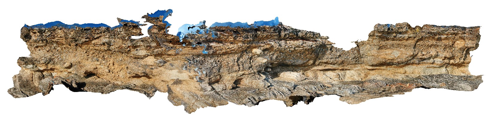
Unconformity and basal contact showing rip-up clasts of the underlying basement granite incorporated into the overlying tillite. Maria Island, Tas. |
5.00 |
-42.68617478000 |
148.08275828000 |
5.000 |
unconformity, tillite |
granite, tillite |
Maria14 Map
|
20 |
03/16/2015 2:31 p.m. |
3D terrestrial photogrammetric model |
Unconformity and basal contact showing rip-up clasts of the underlying basement granite incorporated into the overlying tillite. Maria Island, Tas. |
5.00 |
-42.68617478000 |
148.08275828000 |
5.000 |
unconformity, tillite |
granite, tillite |
Maria9 Map
 |
20 |
03/16/2015 2:33 p.m. |
3D terrestrial photogrammetric model |
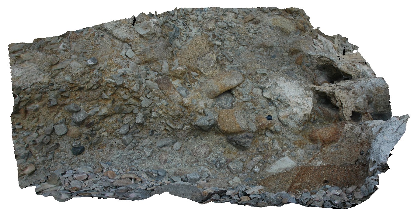
matrix supported Pleistocene talus deposit with predominantly dolerite clasts. Maria Island, Tas. |
5.00 |
-42.66113564000 |
148.10395542000 |
2.000 |
talus deposit, Pleistocene |
talus |
Maria9 Map
|
20 |
03/16/2015 2:33 p.m. |
3D terrestrial photogrammetric model |
matrix supported Pleistocene talus deposit with predominantly dolerite clasts. Maria Island, Tas. |
5.00 |
-42.66113564000 |
148.10395542000 |
2.000 |
talus deposit, Pleistocene |
talus |
Maria8 Map
 |
20 |
03/16/2015 2:32 p.m. |
3D terrestrial photogrammetric model |
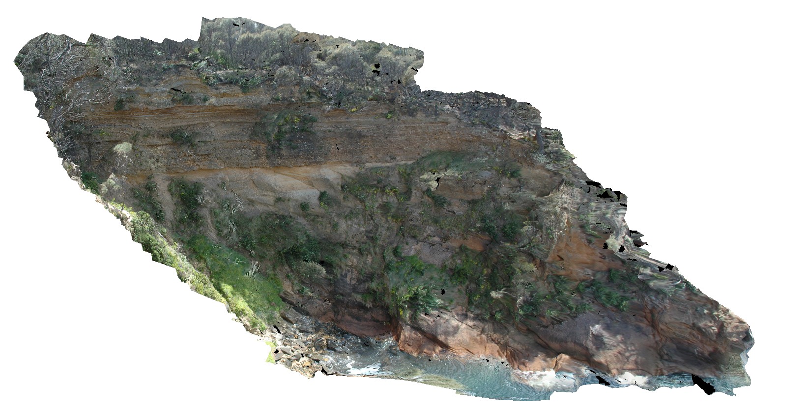
view of Unconformity between underlying Maria Island Granite and overlying flat-lying sediments of the Parmeener Supergroup. Maria Island, Tas. |
10.00 |
-42.66130222000 |
148.09977179000 |
5.000 |
unconformity, granite |
granite, sandstone |
Maria8 Map
|
20 |
03/16/2015 2:32 p.m. |
3D terrestrial photogrammetric model |
view of Unconformity between underlying Maria Island Granite and overlying flat-lying sediments of the Parmeener Supergroup. Maria Island, Tas. |
10.00 |
-42.66130222000 |
148.09977179000 |
5.000 |
unconformity, granite |
granite, sandstone |
Maria7 Map
 |
20 |
03/16/2015 2:32 p.m. |
3D terrestrial photogrammetric model |
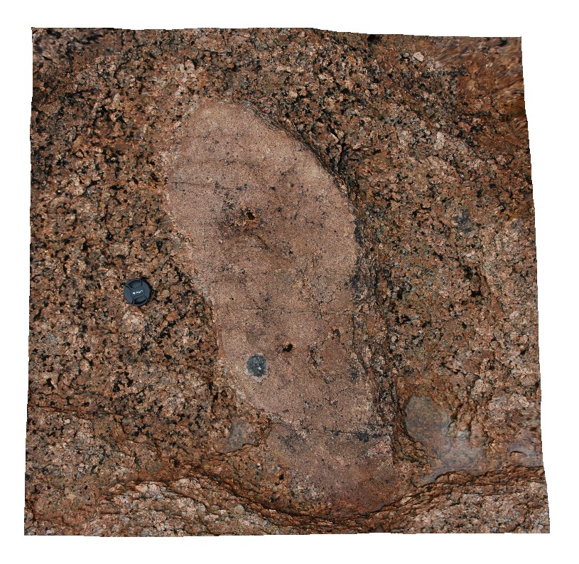
tourmaline aggregates in fine-grained bleb in coarse-grained granite. Maria Island, Tas. |
1.00 |
-42.66205155000 |
148.09875694000 |
0.000 |
granite, tourmaline aggregate |
granite |
Maria5 Map
 |
20 |
03/16/2015 2:32 p.m. |
3D terrestrial photogrammetric model |
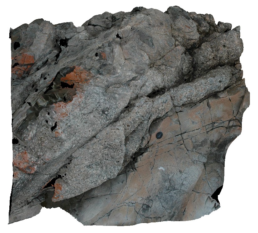
igneous contact between granite and hornfels Siluro-Devonian sediments. Maria Island, Tas. |
2.00 |
-42.68485460000 |
148.08078901000 |
5.000 |
igneous contact, igneous intrusion, hornfels |
metasediments |
Maria5 Map
|
20 |
03/16/2015 2:32 p.m. |
3D terrestrial photogrammetric model |
igneous contact between granite and hornfels Siluro-Devonian sediments. Maria Island, Tas. |
2.00 |
-42.68485460000 |
148.08078901000 |
5.000 |
igneous contact, igneous intrusion, hornfels |
metasediments |
Maria5 Map
|
20 |
03/16/2015 2:32 p.m. |
3D terrestrial photogrammetric model |
igneous contact between granite and hornfels Siluro-Devonian sediments. Maria Island, Tas. |
2.00 |
-42.68485460000 |
148.08078901000 |
5.000 |
igneous contact, igneous intrusion, hornfels |
metasediments |
Maria3 Map
 |
20 |
03/16/2015 2:32 p.m. |
3D terrestrial photogrammetric model |
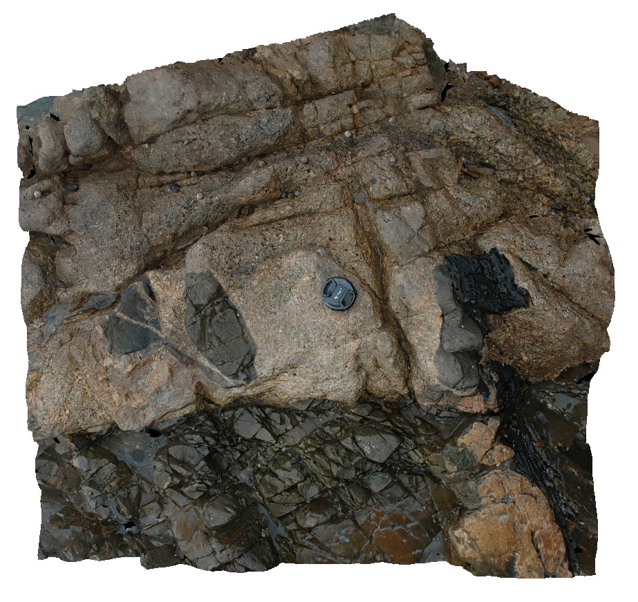
Jurassic dolerite dyke intruding granite basement. Maria Island, Tas. |
1.00 |
-42.68494814000 |
148.08071719000 |
1.000 |
dyke, intrusion |
granite, dolerite |
Maria3 Map
|
20 |
03/16/2015 2:32 p.m. |
3D terrestrial photogrammetric model |
Jurassic dolerite dyke intruding granite basement. Maria Island, Tas. |
1.00 |
-42.68494814000 |
148.08071719000 |
1.000 |
dyke, intrusion |
granite, dolerite |
Maria2 Map
 |
20 |
03/16/2015 2:32 p.m. |
3D terrestrial photogrammetric model |
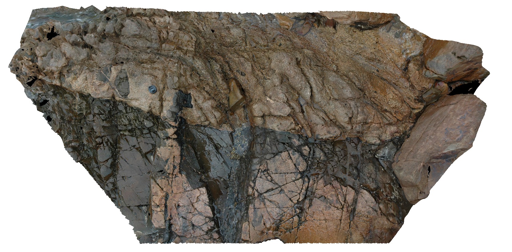
dolerite igneous intrusion into basement psammites and pelites with abundant jointing. Maria Island, Tas. |
3.00 |
-42.68498498000 |
148.08069893000 |
1.000 |
igneous intrusion, metasediments, jointing |
dolerite, psammite |
Maria2 Map
|
20 |
03/16/2015 2:32 p.m. |
3D terrestrial photogrammetric model |
dolerite igneous intrusion into basement psammites and pelites with abundant jointing. Maria Island, Tas. |
3.00 |
-42.68498498000 |
148.08069893000 |
1.000 |
igneous intrusion, metasediments, jointing |
dolerite, psammite |
Maria1 Map
 |
20 |
03/16/2015 2:30 p.m. |
3D terrestrial photogrammetric model |
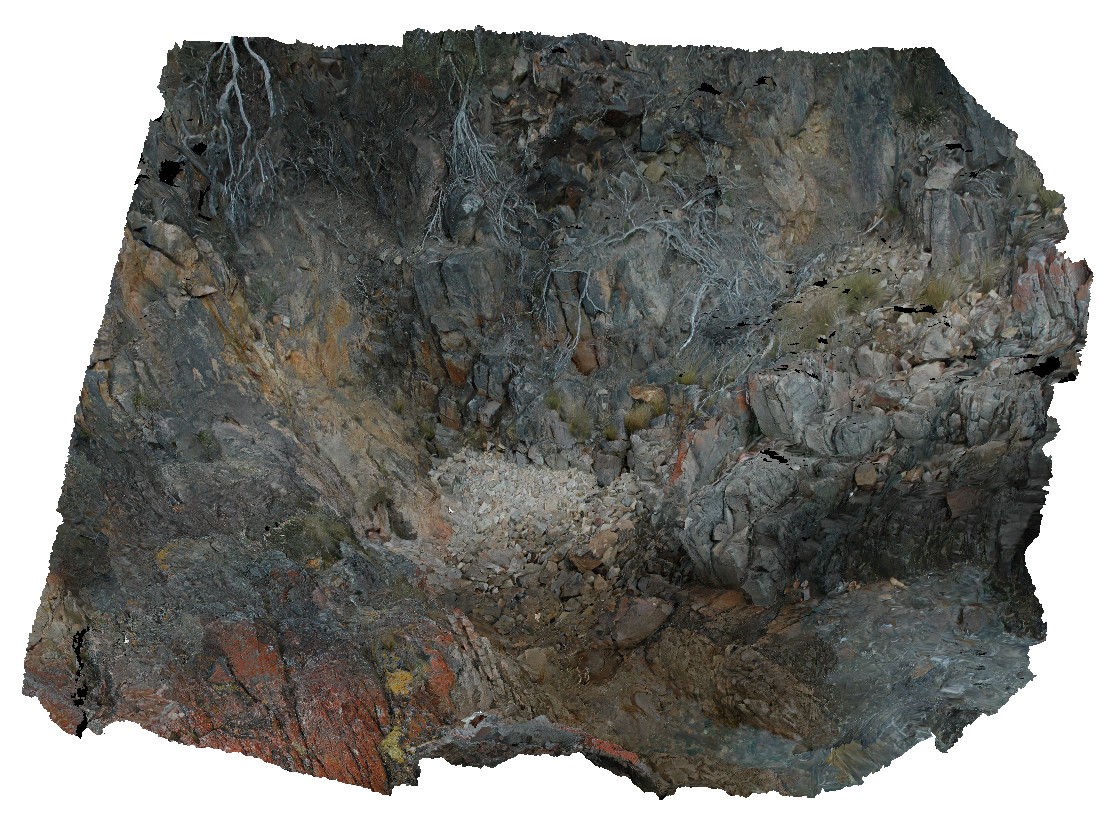
'The Great Unconformity'. Contact between metamorphic psammite and spotted pelite and Permian sediments. Maria Island, Tas. |
7.00 |
-42.68504467000 |
148.08062372000 |
0.000 |
contact, structure, unconformity |
pelite, siltstone |
SulphurCreekFSP5 Map
 |
5 |
01/01/9999 midnight |
Full Spherical Panorama |
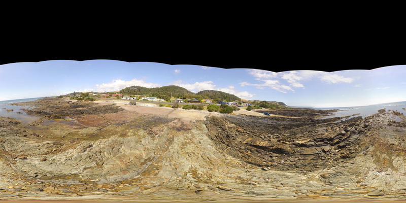
shore exposure of faulted contact between basalt and folded sediments. Sulphur Creek, north Tas. |
500.00 |
-41.09097000000 |
146.02003000000 |
1.000 |
fault, contact, metasediments, structure |
mudstone, basalt |
SulphurCreekFSP5 Map
|
5 |
01/01/9999 midnight |
Full Spherical Panorama |
shore exposure of faulted contact between basalt and folded sediments. Sulphur Creek, north Tas. |
500.00 |
-41.09097000000 |
146.02003000000 |
1.000 |
fault, contact, metasediments, structure |
mudstone, basalt |
SulphurCreekFSP5 Map
|
5 |
01/01/9999 midnight |
Full Spherical Panorama |
shore exposure of faulted contact between basalt and folded sediments. Sulphur Creek, north Tas. |
500.00 |
-41.09097000000 |
146.02003000000 |
1.000 |
fault, contact, metasediments, structure |
mudstone, basalt |
 AusGeol.org