Judbarra16 Map
 |
0 |
06/18/2016 noon |
3D terrestrial photogrammetric model |
platy breccia in wavy bedded dolostone. Wickham River access track. Judbarra / Gregory National Park. N.T. |
0.25 |
-16.67793000000 |
130.66263000000 |
-9999.000 |
platy breccia, dolostone, sedimentology |
dolostone |
Pennington3 Map
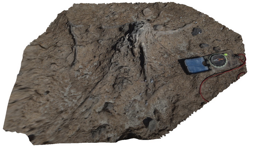 |
0 |
10/20/2015 3:32 p.m. |
3D terrestrial photogrammetric model |
detail of stump cast in calcareous sandstones. Pennington, Kangaroo Island. |
0.25 |
-35.85736000000 |
137.73445000000 |
-9999.000 |
calcareous sandstones, cast |
sandstone |
BH2014n18 Map
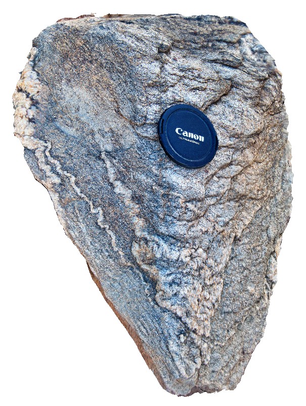 |
20 |
03/16/2015 3:04 p.m. |
3D terrestrial photogrammetric model |
ptygmatic folding of quartz veins in gneiss. Broken Hill, N.S.W. |
0.25 |
-31.61361432000 |
141.49636511000 |
-9999.000 |
ptygmatic folding, fold, gneiss, structure, metamorphic |
gneiss |
Dorat5 Map
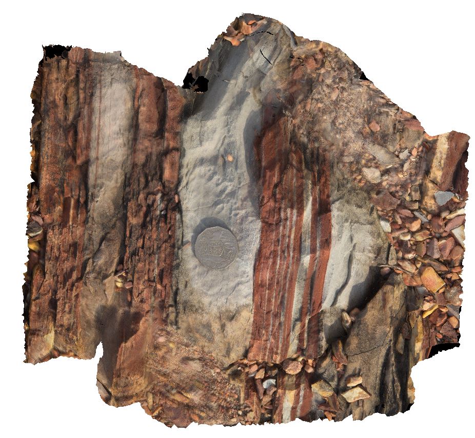 |
0 |
06/23/2016 noon |
3D terrestrial photogrammetric model |
macro of red and white banded dolostone. Dorat Road, N.T. |
0.25 |
-13.25619000000 |
131.11055000000 |
-9999.000 |
dolostone, sedimentology |
dolostone |
Eaglehawk6 Map
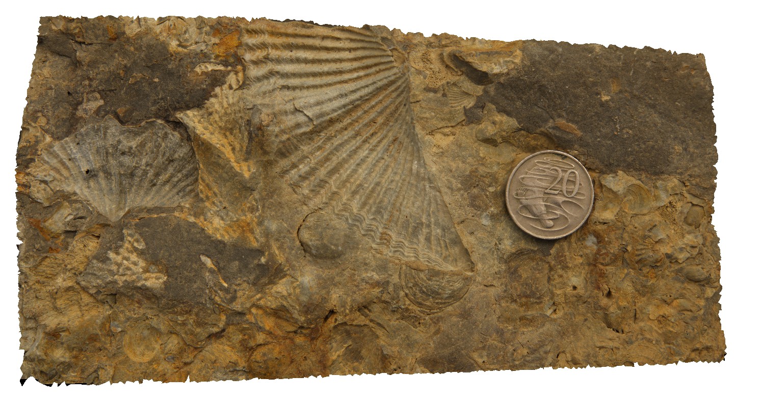 |
5 |
01/01/9999 midnight |
3D terrestrial photogrammetric model |
detail of brachiopods from site Eaglehawk5, showing Spiriferid brachiopods and Productids. Eaglehawk Neck, Tasmania. |
0.25 |
-43.03430000000 |
147.94918000000 |
-9999.000 |
Spiriferid brachiopods, Productids, brachiopod, fossil, fossiliferous, palaeontology |
siltstone |
Crowdy9 Map
 |
5 |
07/08/2015 10:40 a.m. |
3D terrestrial photogrammetric model |
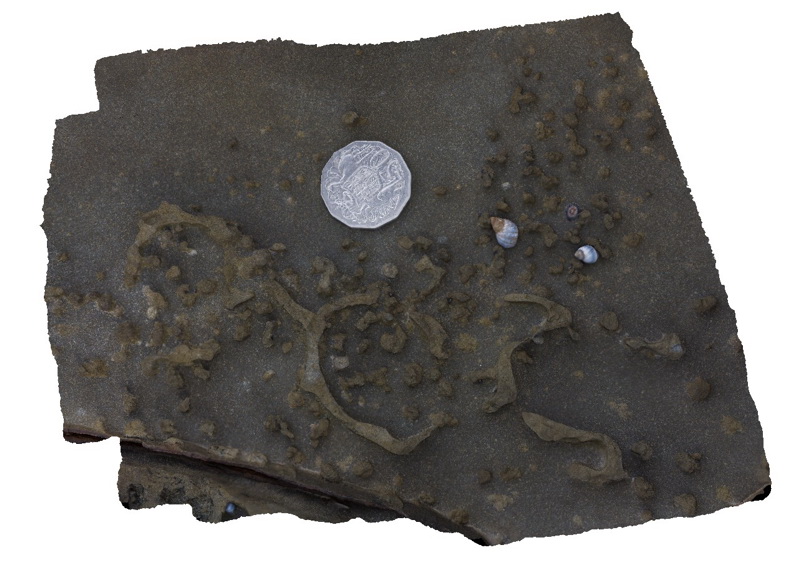
Detail of bioturbation. Crowdy Head Cliffs, N.S.W. |
0.25 |
-31.84579000000 |
152.75137000000 |
2.000 |
sandstone, bioturbation, sedimentology, palaeontology |
sandstone |
BunkerBay5 Map
 |
0 |
05/15/2016 noon |
3D terrestrial photogrammetric model |
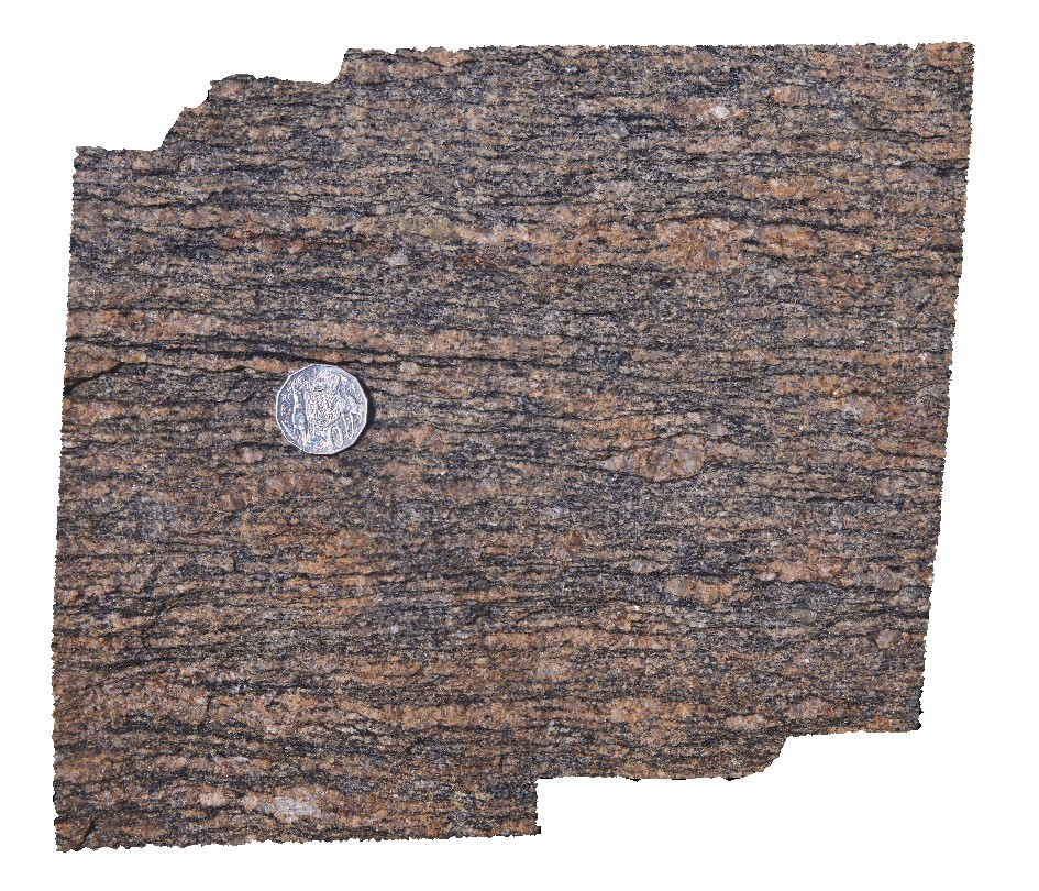
detailed view of foliation in gneiss showing sheared augen. Bunker Bay, Cape Naturaliste. W.A. This unit may also be known as high grade metamorphic rocks 74341 |
0.25 |
-33.53761000000 |
115.03266000000 |
-9999.000 |
augen, gneiss, shearing, structure |
gneiss |
Roches4 Map
 |
5 |
03/16/2015 2:21 p.m. |
3D terrestrial photogrammetric model |
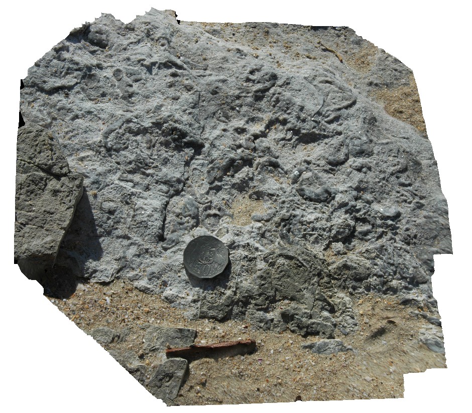
detail of bioturbation and possible fossil casts on bedding plane in Permian siltstones. Roches Beach, Tasmania. |
0.25 |
-42.88366922000 |
147.50549163000 |
5.000 |
bioturbation, sedimentology, siltstone |
siltstone |
Weetootla21 Map
 |
0 |
09/27/2015 4:24 p.m. |
3D terrestrial photogrammetric model |
finely laminated mudstone and carbonate with numerous faults / shearing. Weetootla Creek. |
0.25 |
-30.47609000000 |
139.24355000000 |
-9999.000 |
fault, structure |
carbonate |
Pedder4 Map
 |
5 |
05/04/2016 10:29 a.m. |
3D terrestrial photogrammetric model |
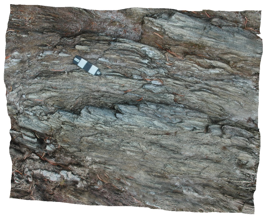
gently plunging, upright to overturned parasitic folds in quartzite with stretched and deformed quartz vein. Lake Pedder, south west Tasmania. |
0.25 |
-42.84854550000 |
146.11601940000 |
-9999.000 |
parasitic fold, fold, structure |
quartzite |
Bunbury2 Map
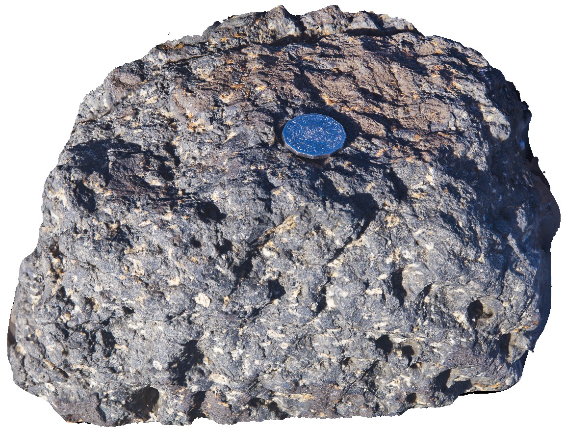 |
0 |
05/15/2016 noon |
3D terrestrial photogrammetric model |
detail of the porphyritic nature of the Bunbury Basalt, Bunbury, W.A. |
0.25 |
-33.32165000000 |
115.63119000000 |
-9999.000 |
basalt |
basalt |
Brachina11 Map
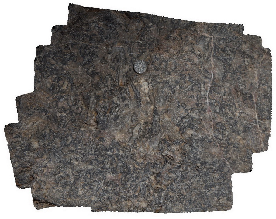 |
5 |
11/17/2015 8:23 a.m. |
3D terrestrial photogrammetric model |
detail of Archaeocyatha bearing carbonates of the Wilkawillina Limestone, Brachina Gorge. S.A. |
0.30 |
-31.33817000000 |
138.54636000000 |
-9999.000 |
Archaeocyatha, palaeontology, fossil |
limestone |
Redbanks5 Map
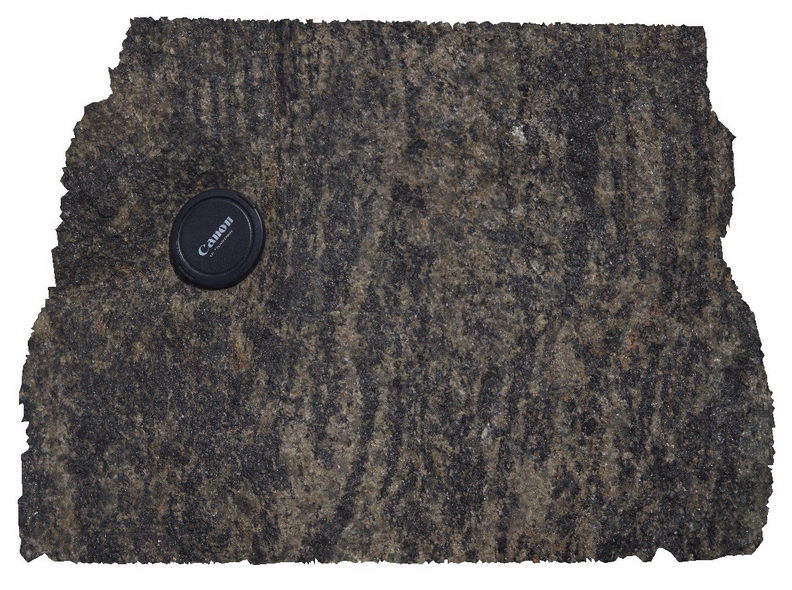 |
0 |
10/20/2015 4:50 p.m. |
3D terrestrial photogrammetric model |
detail of mafic-rich layering in Charnockite, Red Banks. |
0.30 |
-34.92388000000 |
135.61617000000 |
-9999.000 |
Charnockite, metamorphic |
Charnockite |
MtGipps6 Map
 |
0 |
06/27/2016 noon |
3D terrestrial photogrammetric model |
metasediments. Mount Gipps, N.S.W. |
0.30 |
-31.62032000000 |
141.50452000000 |
-9999.000 |
metasediments |
metasediments |
Brachina6 Map
 |
5 |
11/13/2015 2:40 p.m. |
3D terrestrial photogrammetric model |
Ripple marks in Rawnsley Quartzite, Brachina Waterhole. S.A. |
0.30 |
-31.34421000000 |
138.55521000000 |
-9999.000 |
ripple marks, sedimentology |
quartzite |
BHill120 Map
 |
5 |
09/19/2015 8:05 a.m. |
3D terrestrial photogrammetric model |
close up view of detail of crenulation cleavage in site BHill119. Broken Hill. N.S.W. |
0.30 |
-31.83357000000 |
141.42847000000 |
-9999.000 |
crenulation cleavage |
metasediment |
Mulbring4 Map
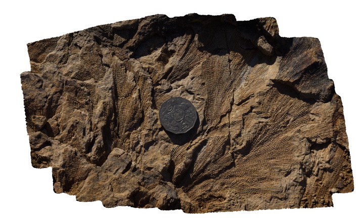 |
5 |
06/17/2015 9:43 a.m. |
3D terrestrial photogrammetric model |
Fenestellid bryozoans in the Permian Branxton Formation. Mulbring, N.S.W. |
0.30 |
-32.89844000000 |
151.46541000000 |
65.000 |
fenestella, bryozoans, palaeontology, fossil |
sandstone |
Wanna5 Map
 |
0 |
10/20/2015 4:55 p.m. |
3D terrestrial photogrammetric model |
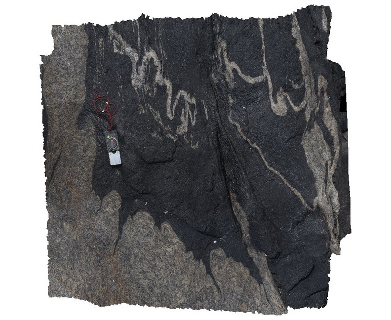
detail of ptygmatic folding and meta dolerite dyke contact with granite gneiss. Wanna, Port Lincoln. |
0.30 |
-34.89279000000 |
135.85350000000 |
-9999.000 |
folding, metamorphic, igneous contact |
granite gneiss, meta dolerite |
Stokes11 Map
 |
0 |
10/20/2015 3:55 p.m. |
3D terrestrial photogrammetric model |
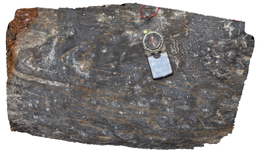
small scale faulting and folds in finely bedded mudstone and sandstone. Stratigraphy unknown. Snelling Beach, Kangaroo Island. |
0.30 |
-35.66823000000 |
137.06271000000 |
-9999.000 |
folding, faulting, structure, mudstone |
mudstone |
Harveys6 Map
 |
0 |
11/17/2015 10:44 a.m. |
3D terrestrial photogrammetric model |
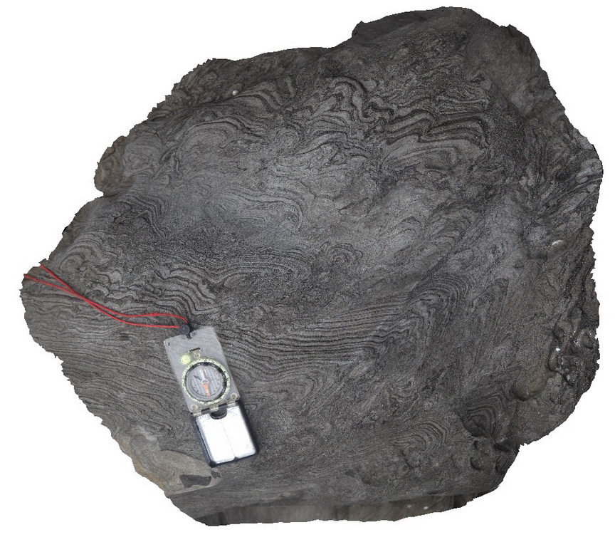
small-scale disharmonic folds / soft sediment deformation in finely laminated sandstone. Harvey's Bay, Kangaroo Island. S.A. |
0.30 |
-35.74823000000 |
136.63890000000 |
-9999.000 |
disharmonic folding, soft sediment deformation |
sandstone |
Trial1 Map
 |
0 |
08/11/2016 noon |
3D terrestrial photogrammetric model |
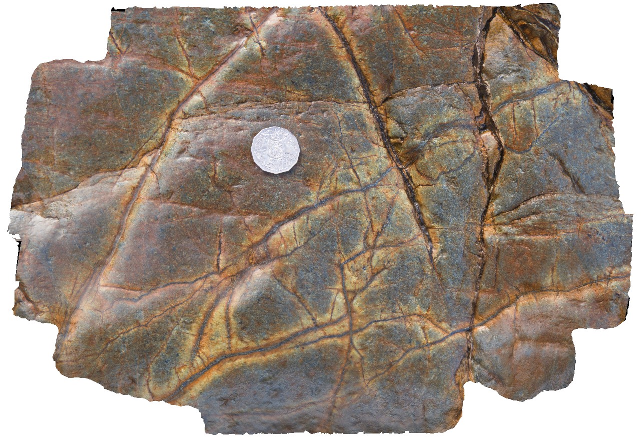
Magnetite veins in mafic / ultramafic Cambrian? Rocks. Possibly with serpentinite selvages? Trial Harbour, West Coast Tas. |
0.30 |
-41.92640000000 |
145.16794000000 |
-9999.000 |
ultramafic, allochthonous blocks, serpentinite |
serpentinite |
MountNyulasy1 Map
 |
0 |
01/01/9999 midnight |
3D terrestrial photogrammetric model |
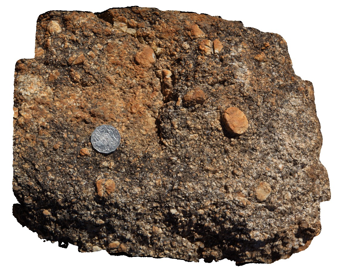
weathered surface of rapakivi textured granite. Near Mount Nyulasy. Great Northern Highway, W.A. |
0.30 |
-16.74412000000 |
128.28265000000 |
-9999.000 |
rapakivi texture, Mount Nyulasy Granite, weathered surface |
granite |
Bingi17 Map
 |
5 |
06/06/2016 1:34 p.m. |
3D terrestrial photogrammetric model |
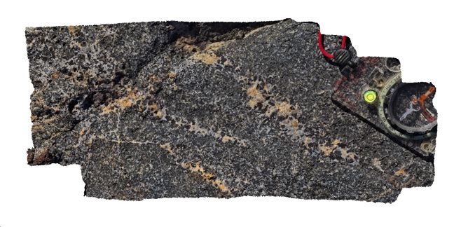
detail of vein mineralogy in gabbro. Bingi, N.S.W. |
0.30 |
-36.01306000000 |
150.16377000000 |
3.000 |
veins, gabbro, igneous, structure |
gabbro |
Mitchell14 Map
 |
0 |
06/08/2016 noon |
3D terrestrial photogrammetric model |
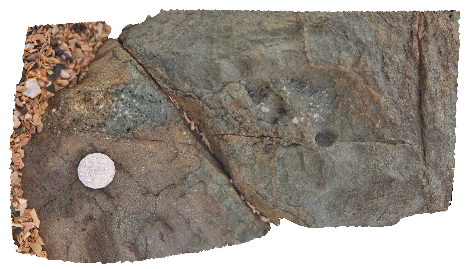
detail of tube vesicles in long section. Port Warrender Road, Kimberley. W.A. |
0.30 |
-14.56894000000 |
125.84576000000 |
-9999.000 |
vesicles, basalt, Carson Volcanics |
basalt |
BHill111 Map
 |
5 |
09/19/2015 7:48 a.m. |
3D terrestrial photogrammetric model |
detail of large garnets with early sillimanite inclusions. Allendale Metasediments, Broken Hill. N.S.W. |
0.30 |
-31.84558000000 |
141.41388000000 |
-9999.000 |
garnet, sillimanite, porphyroblast, schist |
metasediments |
 AusGeol.org