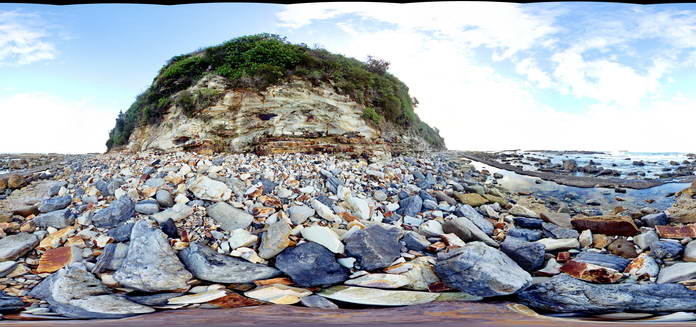
SwanseaFSP3 Map
 |
5 |
06/17/2015 10:01 a.m. |
Full Spherical Panorama |
View of tuffaceous rocks of the Permian Boolaroo Formation and blocks of coal from the underlying Lower Pilot Seam. Swansea, N.S.W. |
50.00 |
-33.08854000000 |
151.66481000000 |
0.000 |
volcanology, coal |
tuff |
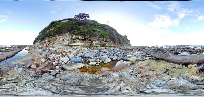
SwanseaFSP4 Map
 |
5 |
06/17/2015 10:01 a.m. |
Full Spherical Panorama |
View of tuffaceous rocks of the Permian Boolaroo Formation and blocks of coal from the underlying Lower Pilot Seam. Linear feature is concrete covering a pipe. Swansea, N.S.W. |
50.00 |
-33.08834000000 |
151.66476000000 |
0.000 |
volcanology, coal |
tuff |
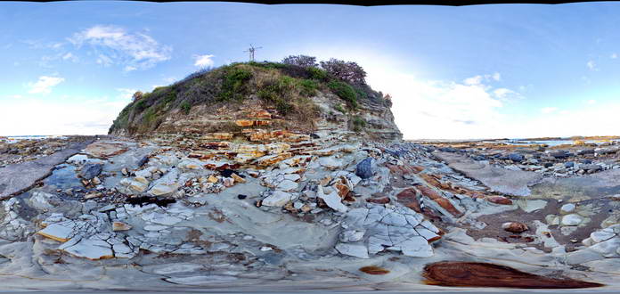
SwanseaFSP5 Map
 |
5 |
06/17/2015 10:02 a.m. |
Full Spherical Panorama |
View of tuffaceous rocks of the Permian Boolaroo Formation and blocks of coal from the underlying Lower Pilot Seam. Linear feature is concrete covering a pipe. Swansea, N.S.W. |
50.00 |
-33.08834000000 |
151.66476000000 |
0.000 |
volcanology, sedimentology |
tuff |
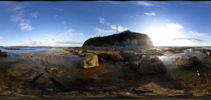
SwanseaFSP6 Map
 |
5 |
06/17/2015 10:02 a.m. |
Full Spherical Panorama |
View of tuffaceous rocks of the Permian Boolaroo Formation and blocks of coal from the underlying Lower Pilot Seam (which crops out in the water). Horizontal petrified/coalified trees are apparent on a bedding surface. Swansea, N.S.W. |
50.00 |
-33.08834000000 |
151.66476000000 |
0.000 |
coalified log, petrified log, palaeontology, volcanology |
tuff |
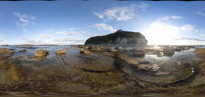
SwanseaFSP7 Map
 |
5 |
06/17/2015 10:03 a.m. |
Full Spherical Panorama |
View of tuffaceous rocks of the Permian Boolaroo Formation. The underlying Lower Pilot Seam crops out in the water. Horizontal petrified/coalified trees are apparent on a bedding surface as well as an in-situ petrified tree stump. Swansea, N.S.W. |
50.00 |
-33.08834000000 |
151.66476000000 |
0.000 |
Dadoxylon, palaeontology, volcanology, petrified log, coalified log |
tuff |
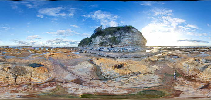
SwanseaFSP8 Map
 |
5 |
06/17/2015 10:03 a.m. |
Full Spherical Panorama |
View of tuffaceous rocks of the Permian Boolaroo Formation. The underlying Lower Pilot Seam crops out in the water. In-situ petrified tree stumps up to 0.3m in diameter. Swansea, N.S.W. |
50.00 |
-33.08834000000 |
151.66476000000 |
0.000 |
volcanology, petrified stump, palaeontology |
tuff |
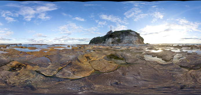
SwanseaFSP9 Map
 |
5 |
06/17/2015 10:04 a.m. |
Full Spherical Panorama |
View of tuffaceous rocks of the Permian Boolaroo Formation. The underlying Lower Pilot Seam crops out in the water. In-situ petrified tree stumps up to 0.3m in diameter. Swansea, N.S.W. |
50.00 |
-33.08834000000 |
151.66476000000 |
0.000 |
volcanology |
tuff |
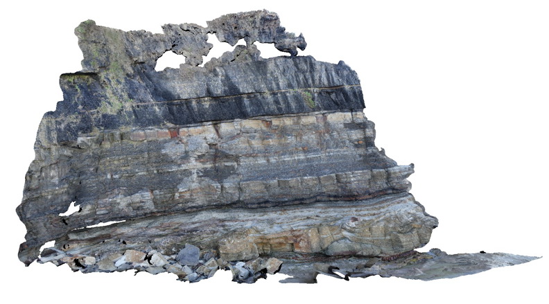
DudleyPole1 Map
 |
5 |
06/17/2015 10:15 a.m. |
3D terrestrial photogrammetric model |
View of the Dudley cliff face showing the top of the Nobbys Tuff at the base, overlain by floodplain sediments and then the base of the Victoria Tunnel coal seam. Dudley Beach, N.S.W. |
10.00 |
-32.96896000000 |
151.73640000000 |
0.000 |
coal, fluvial, sedimentology, tuff |
coal, tuff, mudstone |
Kiewa1 Map
 |
5 |
06/17/2015 10:16 a.m. |
3D terrestrial photogrammetric model |
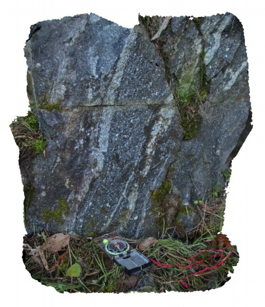
mylonitic fabric in the Siluro-Devonian Dederang Granite adjacent to the Kiewa Fault. Kiewa, Vic. |
1.00 |
-36.63150000000 |
147.11908000000 |
286.000 |
mylonite, structure, Kiewa Fault Zone |
granite |
Kiewa2 Map
 |
5 |
06/17/2015 10:17 a.m. |
3D terrestrial photogrammetric model |
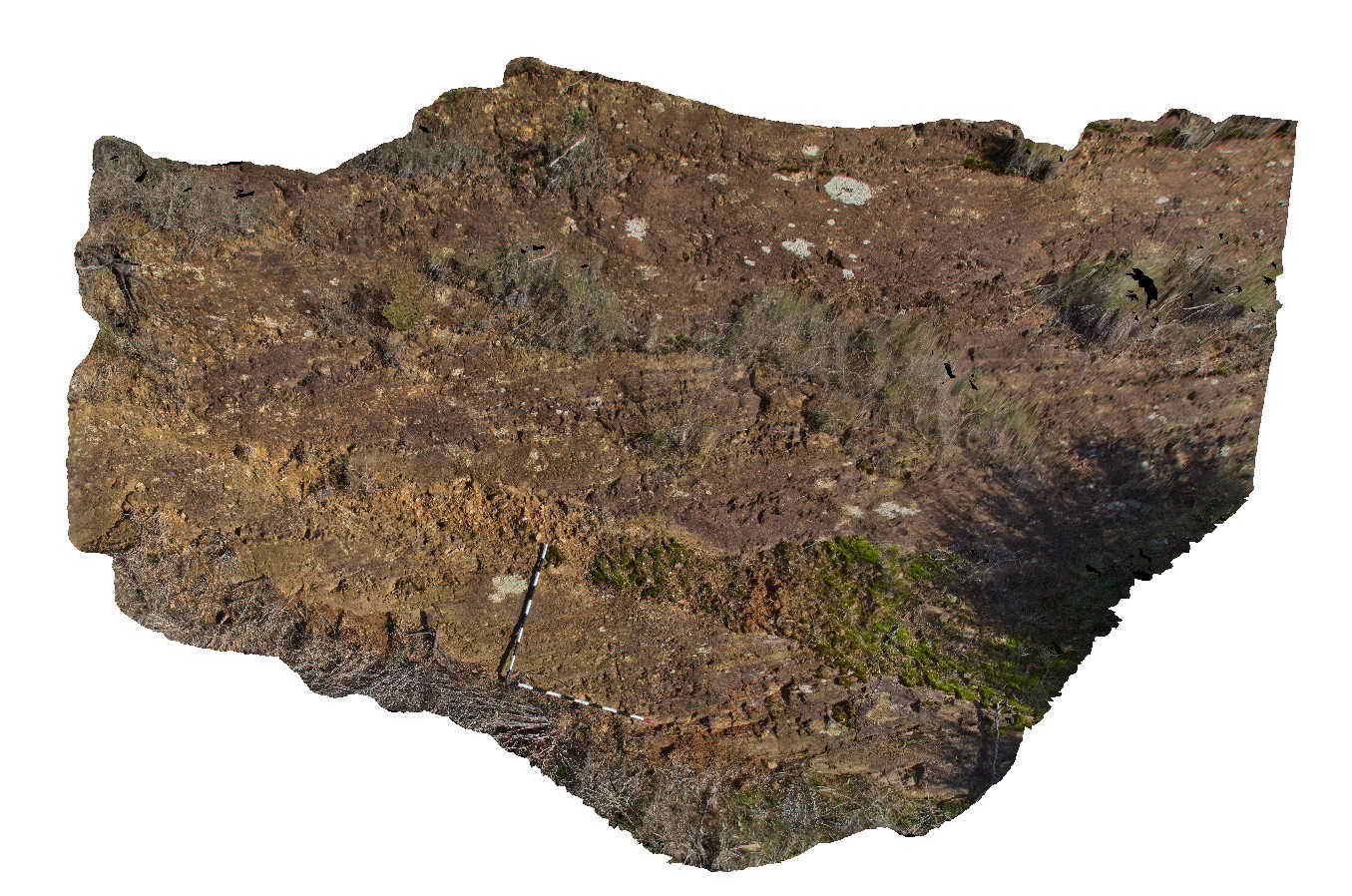
mylonitic layering in gneissic metamorphic rocks of the Silurian Omeo Metamorphic Complex. Kiewa, Vic. |
6.00 |
-36.70951271000 |
147.14309159000 |
387.000 |
mylonite, structure |
mylonite |
Kiewa3 Map
 |
5 |
06/17/2015 10:18 a.m. |
3D terrestrial photogrammetric model |
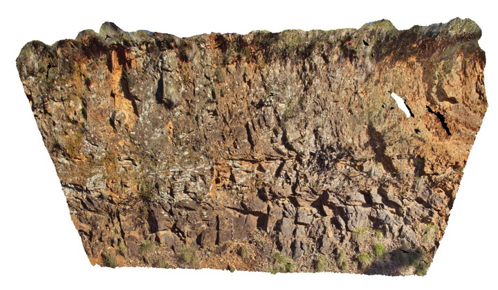
Horizontal high temperature shear zone in gneissic rocks of the Silurian Omeo Metamorphic Complex. Kiewa, Vic. |
15.00 |
-36.72313706000 |
147.13280305000 |
611.000 |
shear zone, structure |
gneiss |
Kiewa4 Map
 |
5 |
06/17/2015 10:21 a.m. |
3D terrestrial photogrammetric model |
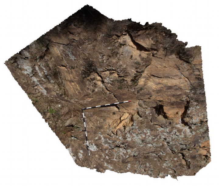
migmatite segregations in gneissic metamorphic rocks of the Silurian Omeo Metamorphic Complex. Kiewa, Vic. |
3.00 |
-36.72432166000 |
147.12949028000 |
711.000 |
migmatite, structure, igneous |
migmatite |
CanberraFSP1 Map
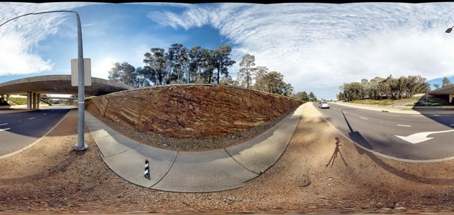 |
5 |
06/17/2015 10:22 a.m. |
Full Spherical Panorama |
Open folds and faults in Silurian sandstone and mudstone of the Camp Hill Sandstone. A.C.T. |
50.00 |
-35.30497000000 |
149.12817000000 |
580.000 |
folds, faults, structure |
sandstone |
Kiewa5 Map
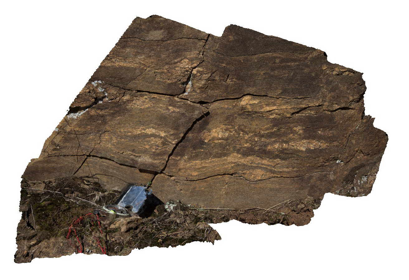 |
5 |
06/17/2015 10:22 a.m. |
3D terrestrial photogrammetric model |
Migmatitic segregations in gneissic rocks of the Silurian Omeo Metamorphic Complex. Kiewa, Vic. |
1.00 |
-36.72432166000 |
147.12949028000 |
711.000 |
migmatite, structure, igneous |
migmatite |
Kiewa6 Map
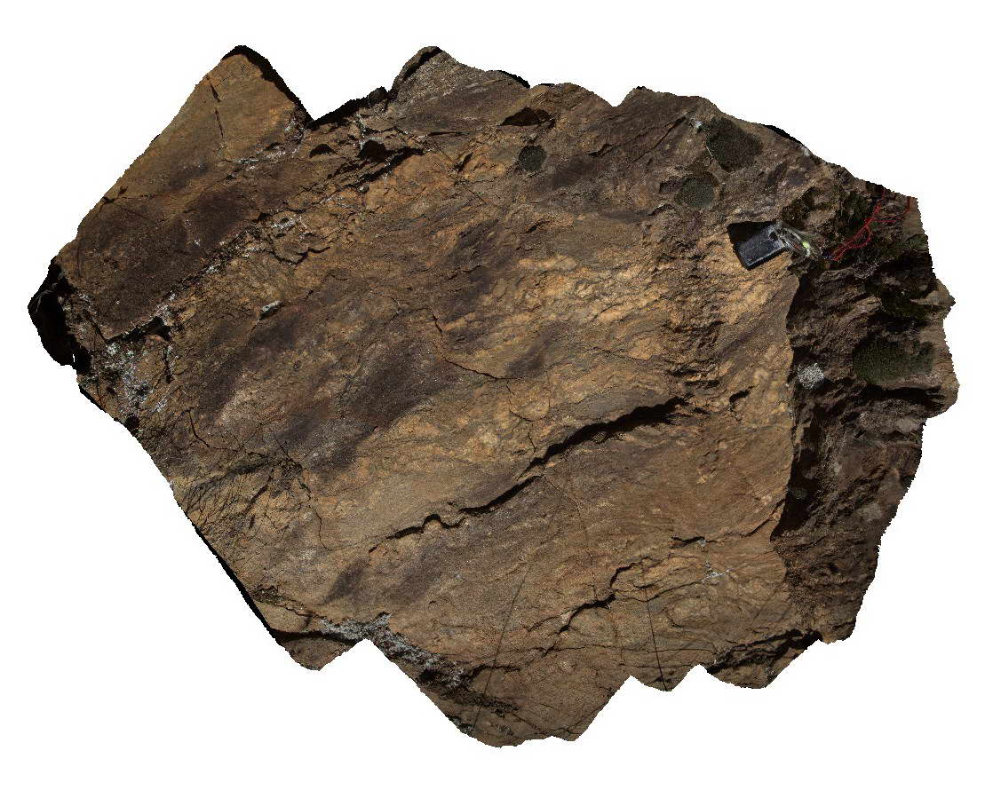 |
5 |
06/17/2015 10:22 a.m. |
3D terrestrial photogrammetric model |
detailed view of migmatite in Silurian rocks of the Omeo Metamorphic Complex showing folded leucosomes. Kiewa, Vic. |
1.00 |
-36.72436000000 |
147.12953000000 |
726.000 |
migmatite, structure |
migmatite |
MansfieldRd1 Map
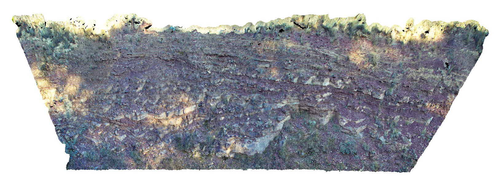 |
5 |
06/17/2015 10:24 a.m. |
3D terrestrial photogrammetric model |
low angle fault in bedded sandstone and mudstone of the Devonian to Carboniferous Snowy Plains Formation. Mansfield Road, Vic. |
15.00 |
-36.88522000000 |
146.30833000000 |
900.000 |
fault, structure, sedimentology |
sandstone, mudstone |
CanberraFSP3 Map
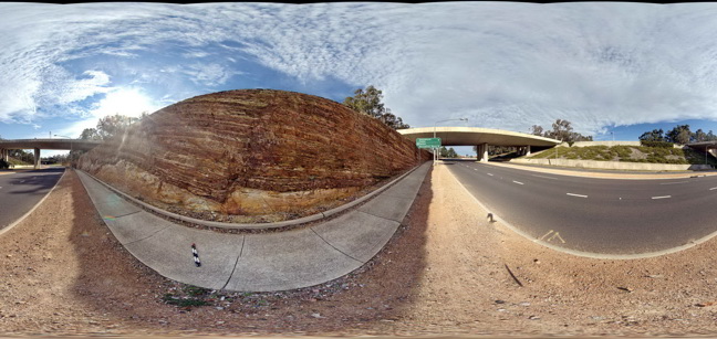 |
5 |
06/17/2015 10:24 a.m. |
Full Spherical Panorama |
Open folds and faults in Silurian sandstone and mudstone of the Camp Hill Sandstone unconformably overlying Silurian State Circle Shale. A.C.T. |
50.00 |
-35.30463000000 |
149.12769000000 |
580.000 |
folds, faults, structure, unconformity, sedimentology |
sandstone, shale |
MansfieldRd2 Map
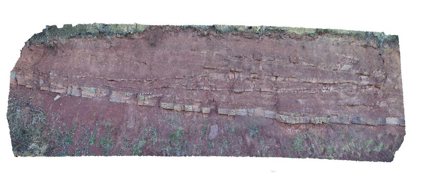 |
5 |
06/17/2015 10:25 a.m. |
3D terrestrial photogrammetric model |
Large scale cross stratification in interbedded sandstone and mudstone of the Devonian-Carboniferous Snowy Plains Formation. Mansfield Road, Vic. |
20.00 |
-36.93927000000 |
146.20639000000 |
900.000 |
cross stratification, sedimentology |
mudstone, sandstone |
CanberraFSP4 Map
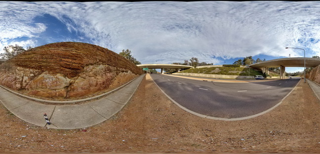 |
5 |
06/17/2015 10:25 a.m. |
Full Spherical Panorama |
Open folds and faults in Silurian sandstone and mudstone of the Camp Hill Sandstone unconformably overlying Silurian State Circle Shale. A.C.T. |
50.00 |
-35.30456000000 |
149.12755000000 |
580.000 |
folds, faults, unconformity, sedimentology, structure |
sandstone, shale |
MansfieldRd3 Map
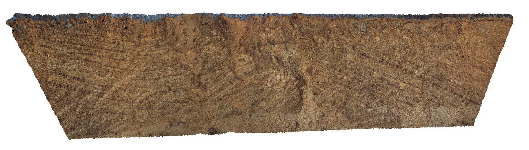 |
5 |
06/17/2015 10:26 a.m. |
3D terrestrial photogrammetric model |
folded and faulted sandstone units of the Devonian Norton Gully Sandstone. Mansfield Road, Vic. |
20.00 |
-37.02679000000 |
145.95461000000 |
337.000 |
folds, faults, structure |
sandstone |
CanberraGiga1 Map
 |
1 |
06/17/2015 10:27 a.m. |
Gigapixel image |
— |
0.00 |
-35.30408000000 |
149.12651000000 |
-9999.000 |
|
|
MansfieldRd4 Map
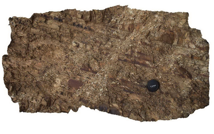 |
5 |
06/17/2015 10:28 a.m. |
3D terrestrial photogrammetric model |
detail of bedding/cleavage relationship in Devonian Norton Gully Sandstone. Mansfield Road, Vic. |
1.50 |
-37.02679000000 |
145.95461000000 |
337.000 |
cleavage, bedding, structure |
sandstone |
MansfieldRd5 Map
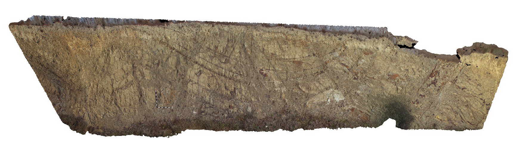 |
5 |
06/17/2015 10:29 a.m. |
3D terrestrial photogrammetric model |
open fold in bedded sandstone of the Devonian Norton Gully Sandstone. Mansfield Road, Vic. |
20.00 |
-37.02049000000 |
145.89662000000 |
332.000 |
fold, structure |
sandstone |
CanberraGiga2 Map
 |
0 |
06/17/2015 10:29 a.m. |
Gigapixel image |
— |
0.00 |
-35.30408000000 |
149.12651000000 |
-9999.000 |
|
|
CanberraGiga3 Map
 |
1 |
06/17/2015 10:30 a.m. |
Gigapixel image |
— |
0.00 |
-35.30408000000 |
149.12651000000 |
-9999.000 |
|
|
 AusGeol.org