Armidale3 Map
 |
5 |
07/27/2015 10:33 a.m. |
3D terrestrial photogrammetric model |
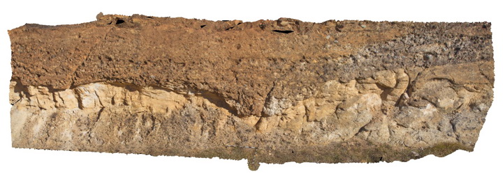
Conglomerate channel cut into underlying sandstone in the Eocene-Oligocene Armidale beds. Armidale, N.S.W |
12.00 |
-30.49301000000 |
151.65099000000 |
-9999.000 |
conglomerate, sandstone, channel |
sandstone, conglomerate |
Armidale4 Map
 |
5 |
07/27/2015 10:33 a.m. |
3D terrestrial photogrammetric model |
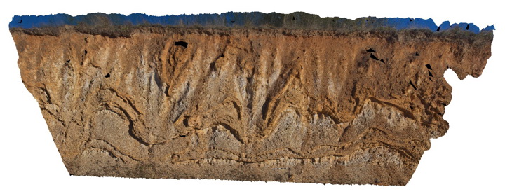
Liesegang bands in Eocene-Oligocene sandstone of the Armidale beds. Armidale, N.S.W |
20.00 |
-30.49326000000 |
151.65179000000 |
-9999.000 |
sandstone, liesegang bands |
sandstone |
Armidale5 Map
 |
5 |
10/06/2015 10:52 a.m. |
3D terrestrial photogrammetric model |
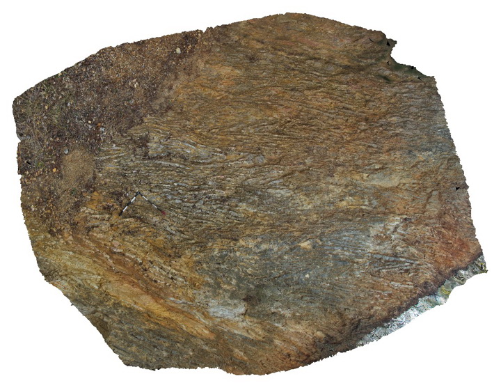
Tightly folded chert and mudstone beds within the Devonian to Carboniferous Sandon Beds. Armidale, N.S.W |
5.00 |
-30.57193000000 |
151.64053000000 |
-9999.000 |
chert, mudstone, fold |
chert, mudstone |
Armidale6 Map
 |
5 |
07/27/2015 10:35 a.m. |
3D terrestrial photogrammetric model |
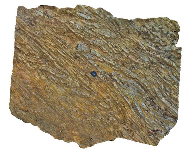
Detail of the folded chert layers and mudstone layers within the Devonian-Carboniferous Sandon Beds. Armidale, N.S.W |
2.00 |
-30.57193000000 |
151.64053000000 |
-9999.000 |
chert, mudstone, reclined fold |
chert, mudstone |
Armidale7 Map
 |
5 |
07/27/2015 10:35 a.m. |
3D terrestrial photogrammetric model |
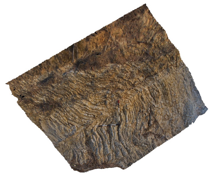
Folded and faulted thin chert and mudstone layers of the Devonian to Carboniferous Sandon Beds with overlying transported regolith. Armidale, N.S.W |
4.00 |
-30.57199000000 |
151.64069000000 |
-9999.000 |
chert, mudstone, fold, fault, regolith |
chert, mudstone |
Armidale8 Map
 |
5 |
10/06/2015 1:43 p.m. |
3D terrestrial photogrammetric model |
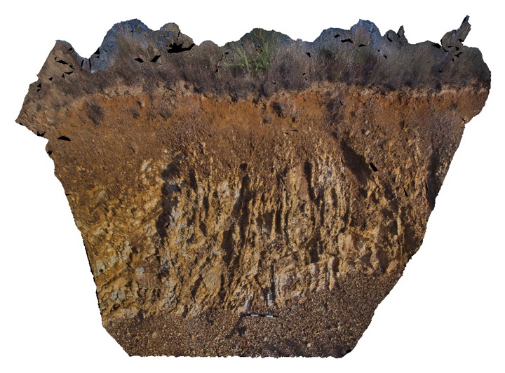
Regolith profile over folded Devonian to Carboniferous Sandon Beds. Armidale, N.S.W |
4.00 |
-30.56921000000 |
151.64027000000 |
-9999.000 |
regolith, chert, mudstone |
chert, mudstone |
BH2014n15 Map
 |
20 |
03/24/2015 2:41 p.m. |
3D terrestrial photogrammetric model |
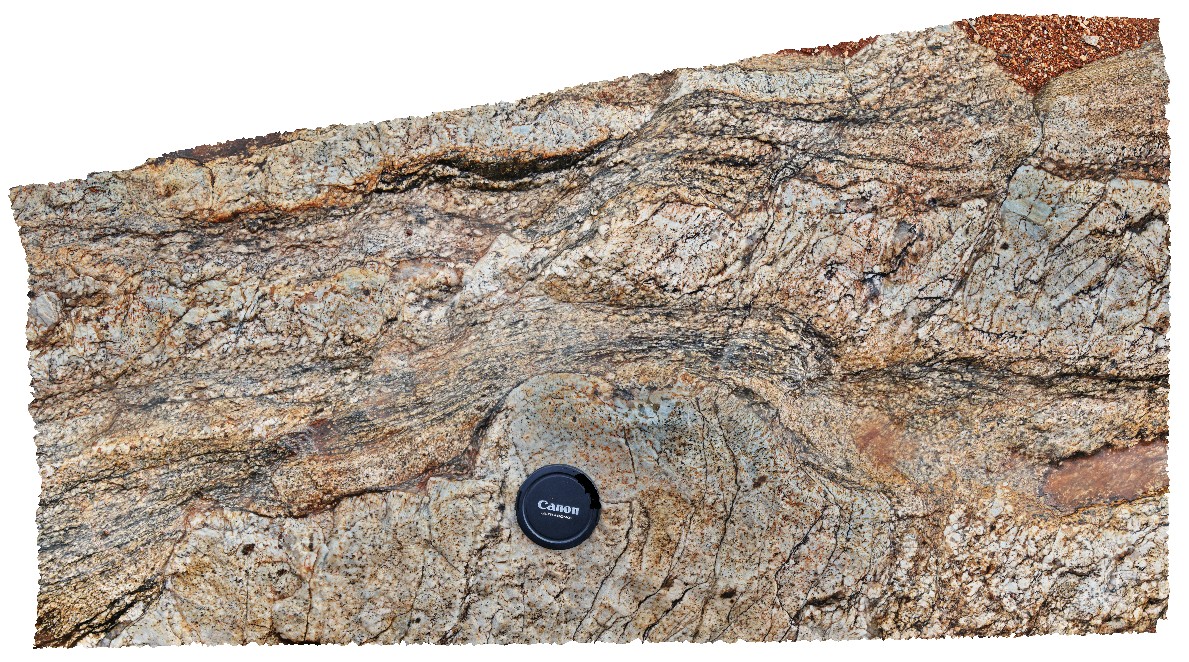
folds and small fault offsets / S-C fabric in sheared quartz pegmatite. Broken Hill, N.S.W. |
0.50 |
-31.61762936000 |
141.49430254000 |
-9999.000 |
S-C fabric, structure, pegmatite, shear |
pegmatite |
BHill80 Map
 |
5 |
09/16/2015 11:25 a.m. |
3D terrestrial photogrammetric model |
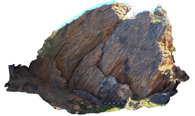
Outcrop, showing 'Hobb's Fold' in layered garnet gneiss of the Sundown Group. Broken Hill. N.S.W. |
4.00 |
-31.93096000000 |
141.51889000000 |
-9999.000 |
fold, structure |
garnet gneiss |
BH2014n11 Map
 |
20 |
03/17/2015 11:06 a.m. |
3D terrestrial photogrammetric model |
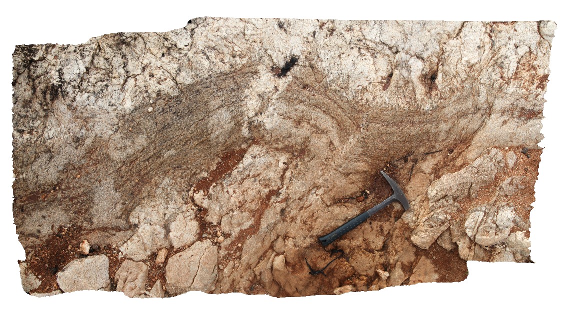
folded shear in quartz pegmatite. Broken Hill, N.S.W. |
2.00 |
-31.61754962000 |
141.49437202000 |
-9999.000 |
pegmatite, fold, structure, shear |
pegmatite |
BH2014n12 Map
 |
20 |
03/18/2015 3:58 p.m. |
3D terrestrial photogrammetric model |
detail of S-C fabric developed in quartz pegmatite. Broken Hill, N.S.W. |
0.20 |
-31.61758375000 |
141.49437432000 |
-9999.000 |
pegmatite, S-C fabric, structure |
pegmatite |
Wongwibinda3 Map
 |
1 |
06/16/2015 5:46 p.m. |
3D terrestrial photogrammetric model |
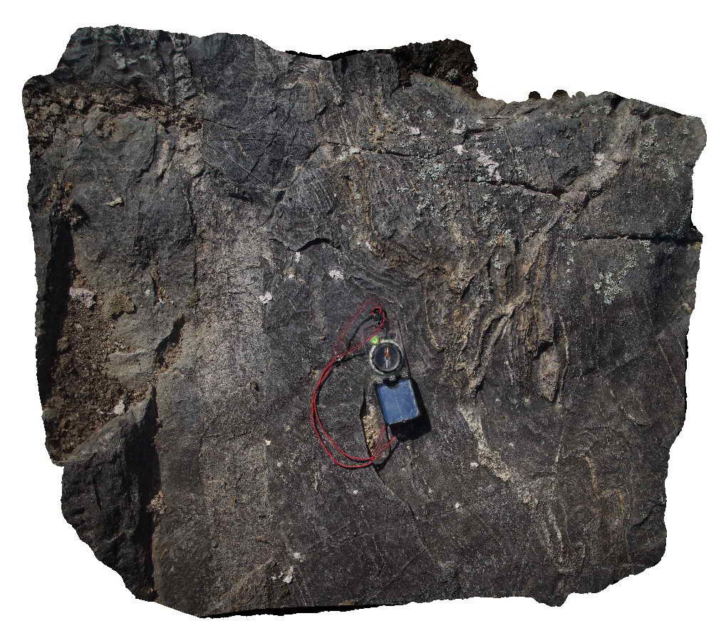
Detail of folded leucosomes and a thin granitic dyke in metasedimentary rocks of the Carboniferous Wongwibinda Complex. Guyra Road, N.S.W. |
1.00 |
-30.27490000000 |
152.10399000000 |
-9999.000 |
leucosome, migmatite, high temperature metamorphism, dyke, fold, structure |
migmatite, microgranite |
BH2014n14 Map
 |
20 |
03/24/2015 2:36 p.m. |
3D terrestrial photogrammetric model |
shear zone in quartz pegmatite. Broken Hill, N.S.W. |
0.50 |
-31.61766698000 |
141.49435668000 |
-9999.000 |
pegmatite, shear zone, structure |
pegmatite |
BH2014n13 Map
 |
20 |
03/17/2015 11:29 a.m. |
3D terrestrial photogrammetric model |
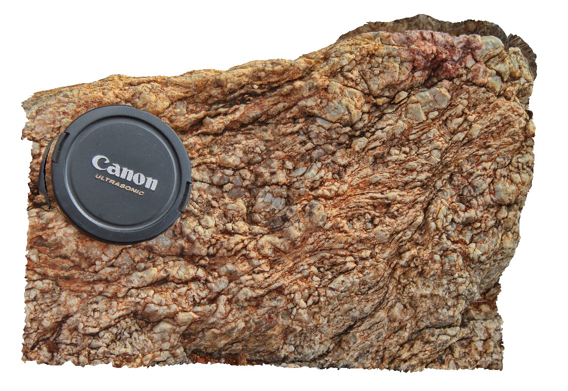
S-C fabric developed in quartz pegmatite. Broken Hill, N.S.W. |
0.20 |
-31.61759888000 |
141.49437438000 |
-9999.000 |
S-C fabric, quartz pegmatite |
pegmatite |
BHill79 Map
 |
5 |
09/16/2015 11:17 a.m. |
3D terrestrial photogrammetric model |
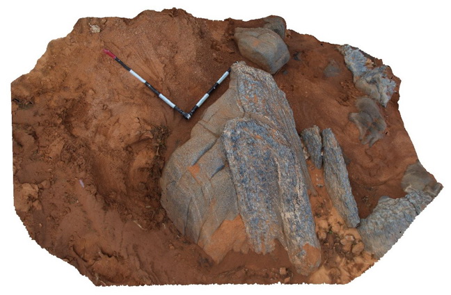
creek exposure near 9 Mile road, showing folded pelitic and psammitic layers with sillimanite. Broken Hill. N.S.W. |
2.00 |
-31.84014000000 |
141.44077000000 |
-9999.000 |
fold, psammite, pelitic, sillimanite |
pelite |
DaisyBanksPit4 Map
 |
20 |
03/17/2015 1:45 p.m. |
3D terrestrial photogrammetric model |
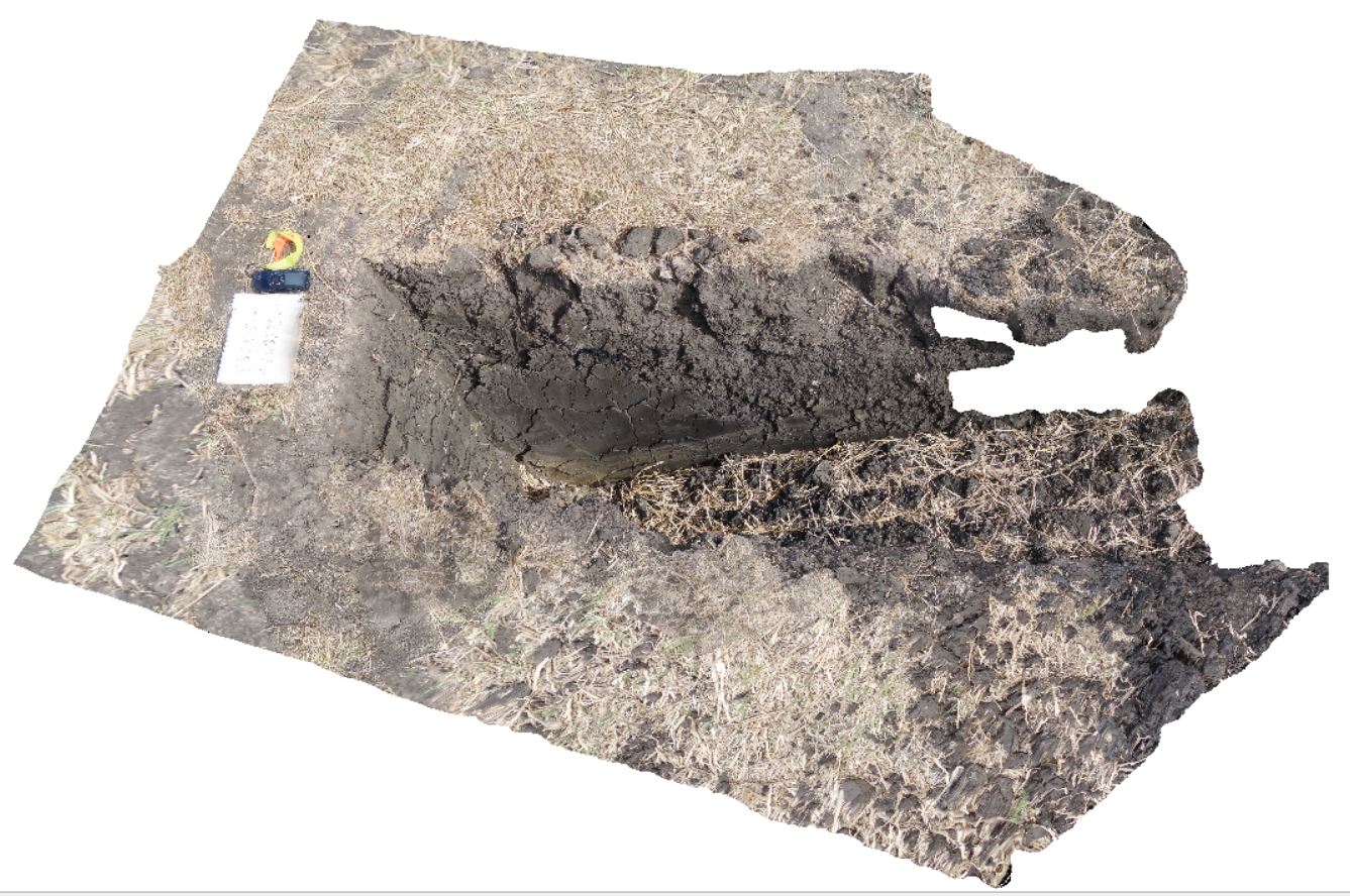
~80cm deep pit into soil and clays overlying Quaternary alluvial and marsh deposits of modern flood plains; of gravel, sand, silt and clay. Richmond, Tas. |
2.00 |
-42.73176200000 |
147.42817100000 |
-9999.000 |
Clay, alluvium, regolith |
Clay |
CanberraGiga2 Map
 |
0 |
06/17/2015 10:29 a.m. |
Gigapixel image |
— |
0.00 |
-35.30408000000 |
149.12651000000 |
-9999.000 |
|
|
BH2014n18 Map
 |
20 |
03/16/2015 3:04 p.m. |
3D terrestrial photogrammetric model |
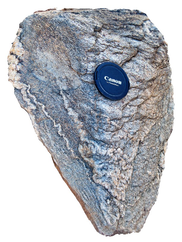
ptygmatic folding of quartz veins in gneiss. Broken Hill, N.S.W. |
0.25 |
-31.61361432000 |
141.49636511000 |
-9999.000 |
ptygmatic folding, fold, gneiss, structure, metamorphic |
gneiss |
BH2014n20 Map
 |
20 |
01/01/9999 midnight |
3D terrestrial photogrammetric model |
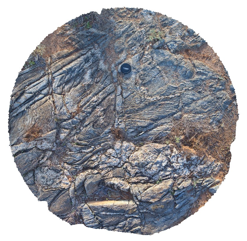
folded gneiss, with developed S-C fabric and disrupted quartz vein. Broken Hill, N.S.W. |
0.50 |
-31.61390352000 |
141.49519117000 |
-9999.000 |
fold, gneiss, structure, S-C fabric |
gneiss |
BHill84 Map
 |
5 |
09/18/2015 11:02 a.m. |
3D terrestrial photogrammetric model |
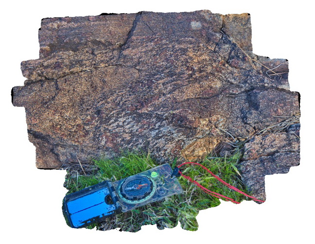
detail of fold with axial plane sillimanite in banded garnet, sillimanite gneiss. Broken Hill. N.S.W. |
0.40 |
-31.93103000000 |
141.51883000000 |
-9999.000 |
axial planar cleavage, garnet sillimanite gneiss |
garnet gneiss` |
BHill97 Map
 |
5 |
09/18/2015 11:10 a.m. |
3D terrestrial photogrammetric model |
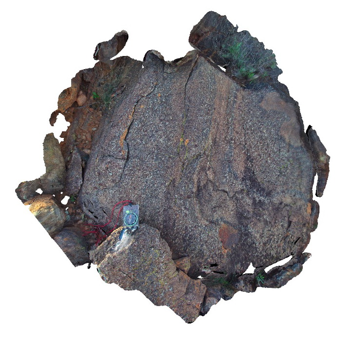
view of bedding and foliation cross cutting relationships in garnet gneiss. Broken Hill. N.S.W. |
0.50 |
-31.83472000000 |
141.42847000000 |
-9999.000 |
fold, cleavage |
gneiss |
Weetootla7 Map
 |
0 |
09/27/2015 4:30 p.m. |
3D terrestrial photogrammetric model |
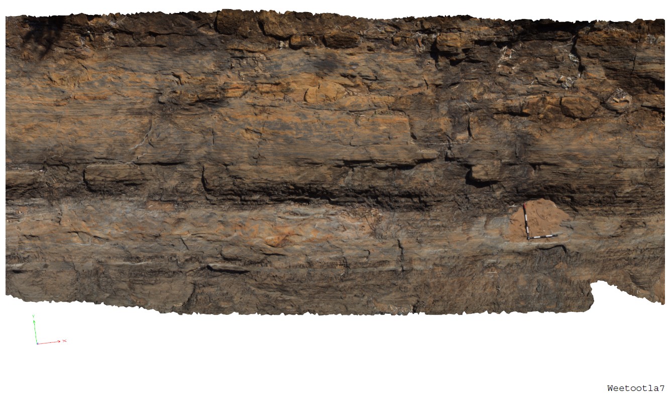
bedded carbonate with numerous clasts of carbonate (brown) and breccia horizons. Weetootla Gorge. |
9.00 |
-30.48117000000 |
139.22685000000 |
-9999.000 |
bedding, sedimentology |
carbonate |
Weetootla8 Map
 |
0 |
09/27/2015 4:34 p.m. |
3D terrestrial photogrammetric model |
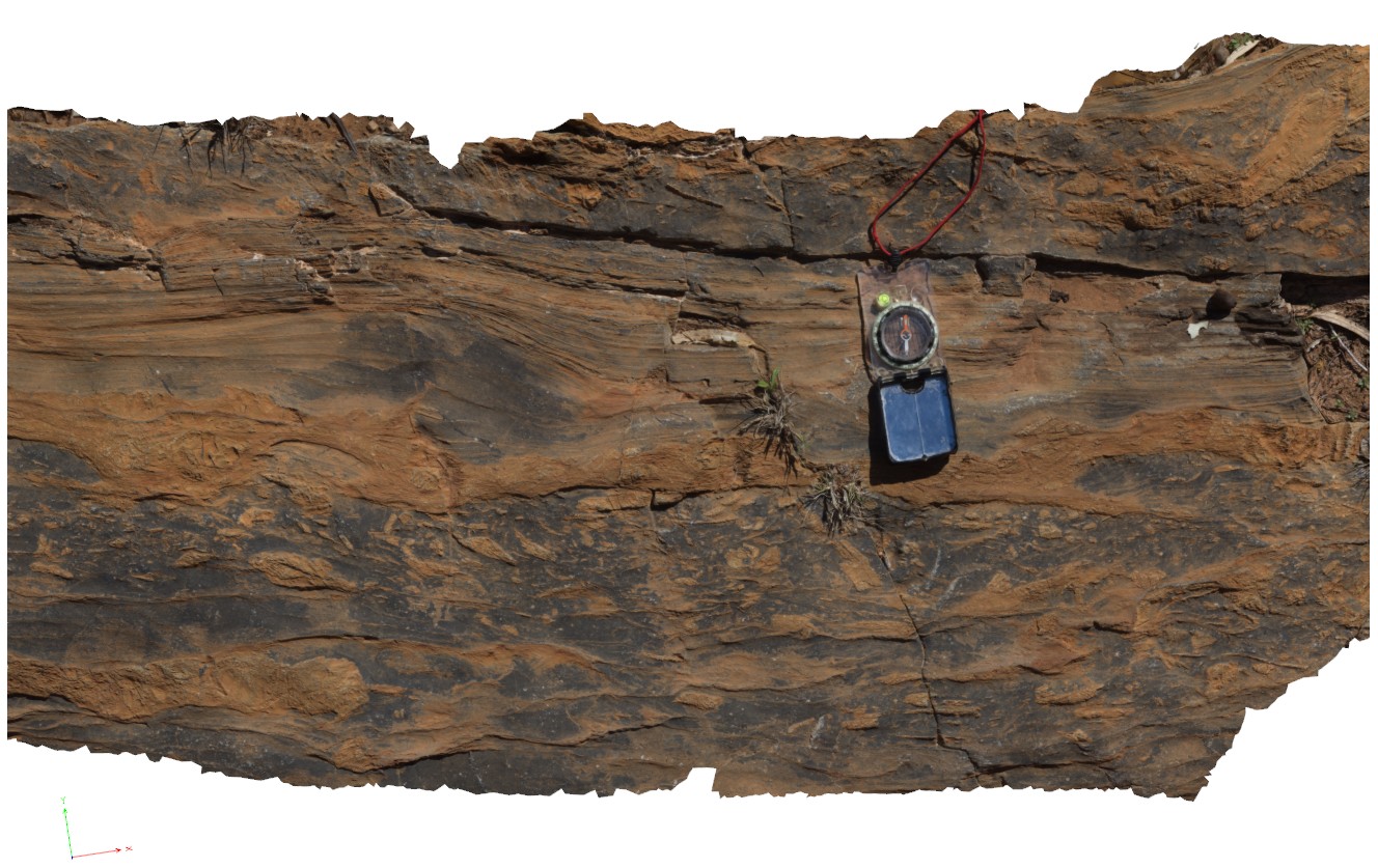
detail of carbonate breccia within bedding. Weetootla gorge. |
0.00 |
-30.48112000000 |
139.22684000000 |
-9999.000 |
breccia, sedimentology |
carbonate |
BHill87 Map
 |
5 |
09/18/2015 11:04 a.m. |
3D terrestrial photogrammetric model |
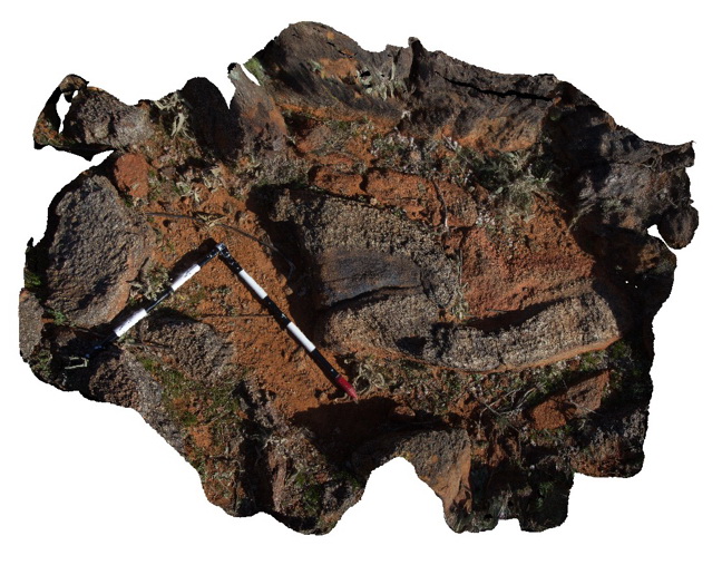
detail of F1 fold with cross cutting S2 fabric. Broken Hill. N.S.W. |
2.00 |
-31.83340000000 |
141.42754000000 |
-9999.000 |
F1 fold, S2 fabric, structure |
pelite |
BHill88 Map
 |
5 |
09/18/2015 11:05 a.m. |
3D terrestrial photogrammetric model |
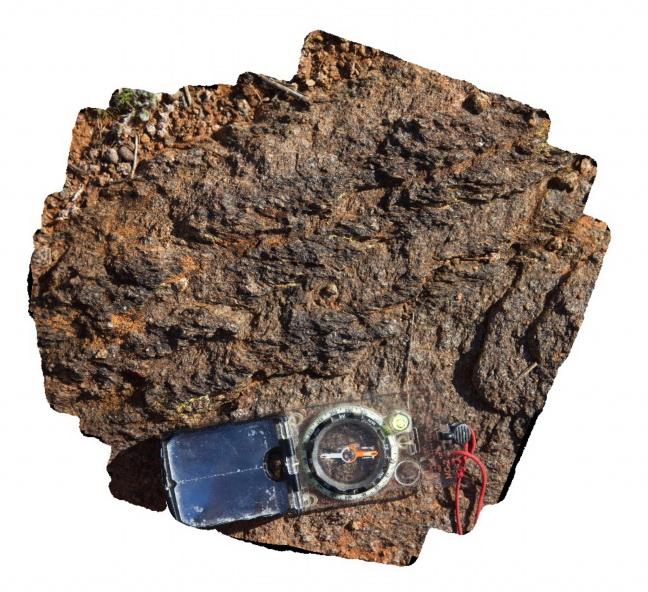
detail of S1 fabric cross cutting S0 and crenulated by S2, which is locally parallel to S0. Broken Hill. N.S.W. |
0.30 |
-31.83367000000 |
141.42719000000 |
-9999.000 |
crenulation cleavage, bedding to cleavage relationships |
pelite |
WeetootlaFSP3 Map
 |
0 |
09/27/2015 4:38 p.m. |
Full Spherical Panorama |
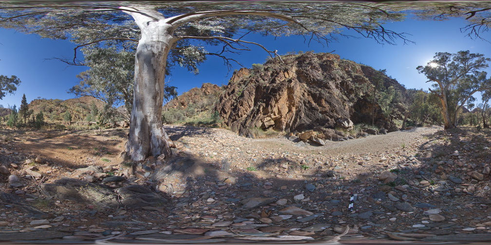
folded carbonate mudstone hills of the Balcanoona Formation, Weetootla gorge |
0.00 |
-30.48111000000 |
139.22438000000 |
-9999.000 |
folded, structure |
carbonate |
 AusGeol.org