Wilka9 Map
 |
0 |
09/27/2015 5:19 p.m. |
3D terrestrial photogrammetric model |
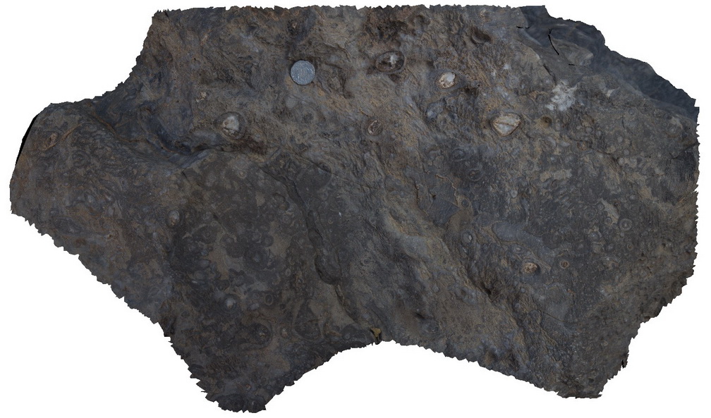
Out crop of archaeocyatha bearing carbonates, Wilkawillina Trail, Flinders Ranges. |
0.30 |
-31.29892000000 |
138.90530000000 |
-9999.000 |
Archaeocyatha |
limestone |
Bellthorpe4 Map
 |
5 |
04/12/2016 11:38 a.m. |
3D terrestrial photogrammetric model |
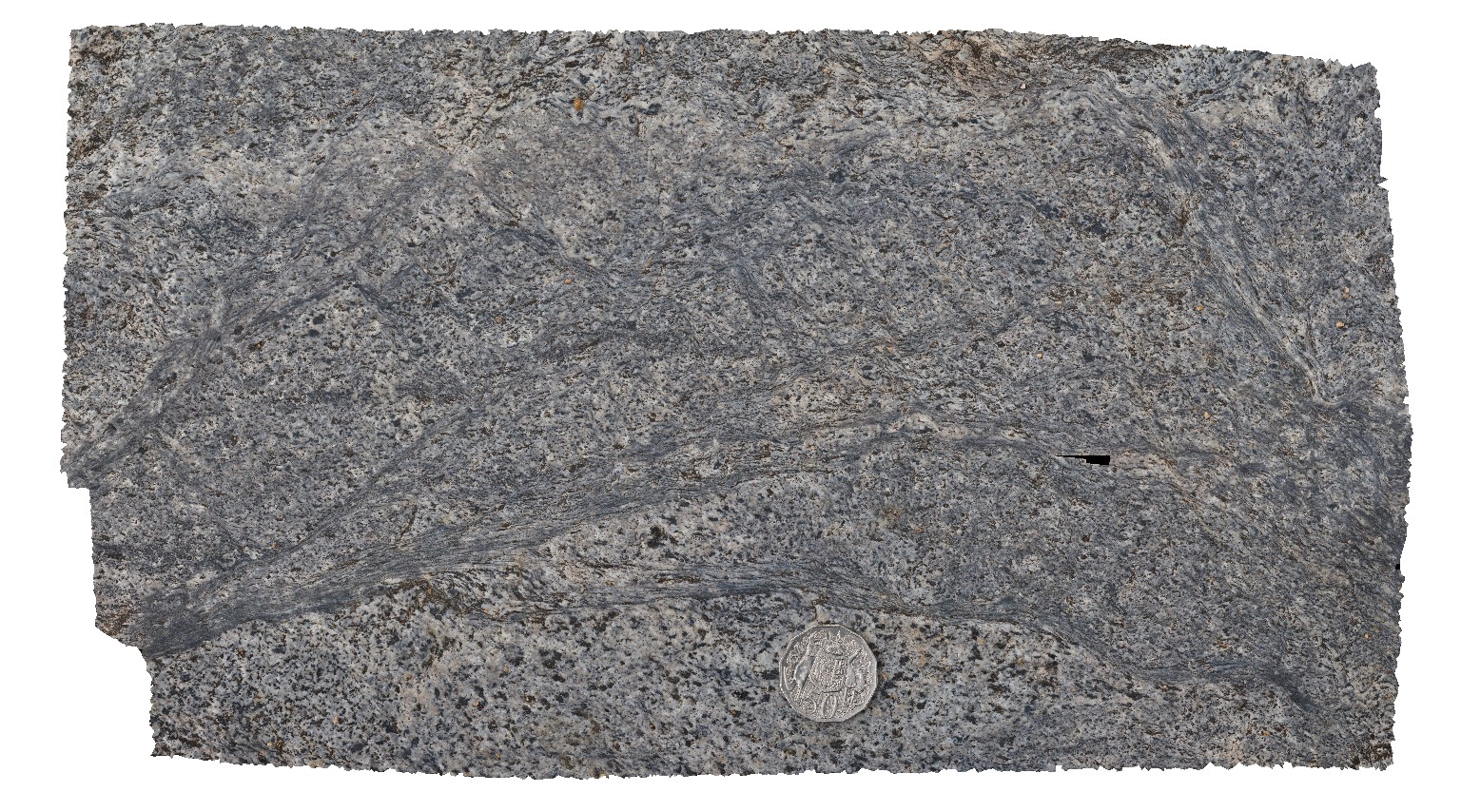
shear textures in granite, Bellthorpe, QLD. |
0.30 |
-26.82764000000 |
152.62271000000 |
-9999.000 |
shearing, granite |
granite |
Olary23 Map
 |
5 |
07/14/2015 11:22 a.m. |
3D terrestrial photogrammetric model |
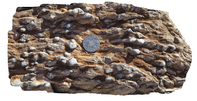
weathered pelite, showing exposed prismatic andalusite forms. Weekaroo, Olary. S.A. |
0.30 |
-32.17537000000 |
139.99341000000 |
-9999.000 |
andalusite, pelite |
pelite |
BHill100 Map
 |
5 |
09/18/2015 11:12 a.m. |
3D terrestrial photogrammetric model |
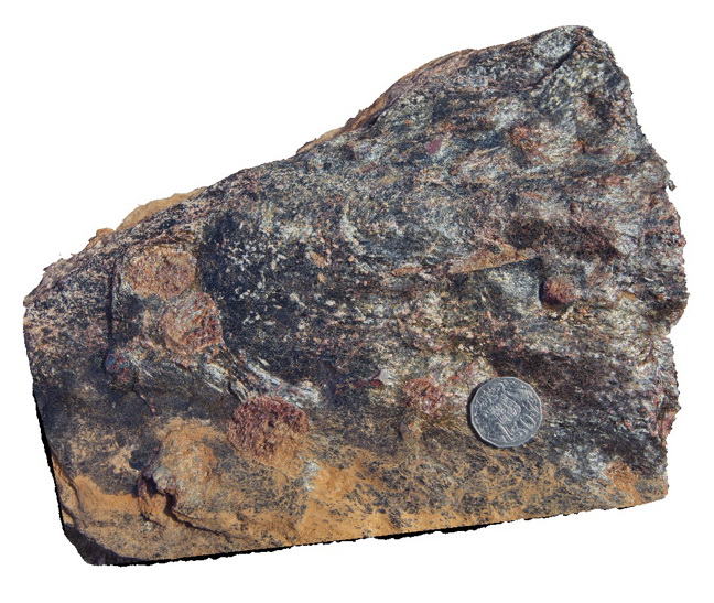
block of Bi-gt-staurolite schist in Cues Formation, Broken Hill. N.S.W. |
0.30 |
-32.19953000000 |
141.01125000000 |
-9999.000 |
Bi-garnet-staurolite schist |
schist |
Weetootla25 Map
 |
0 |
09/27/2015 4:27 p.m. |
3D terrestrial photogrammetric model |
finely laminated carbonate folded by small scale open folds. Weetootla Creek. |
0.30 |
-30.47748000000 |
139.24298000000 |
-9999.000 |
fold, structure |
carbonate |
Windjana4 Map
 |
0 |
06/05/2016 noon |
3D terrestrial photogrammetric model |
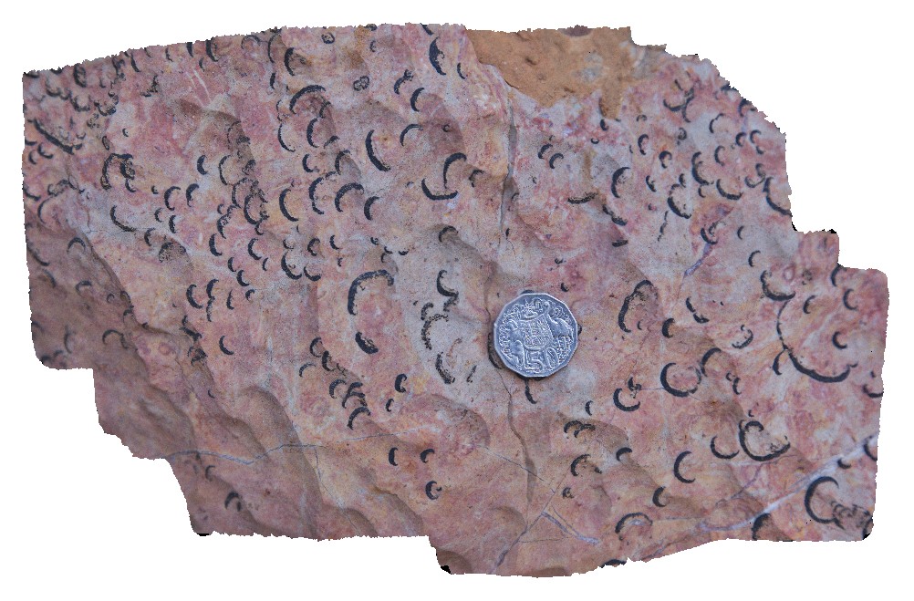
detail of fossils from site Windjana3. East Windjana Gorge, W.A. |
0.30 |
-17.41121000000 |
124.97224000000 |
-9999.000 |
fossiliferous limestone, fossil, palaeontology |
limestone |
Arkaroola47 Map
 |
5 |
11/12/2015 10:06 a.m. |
3D terrestrial photogrammetric model |
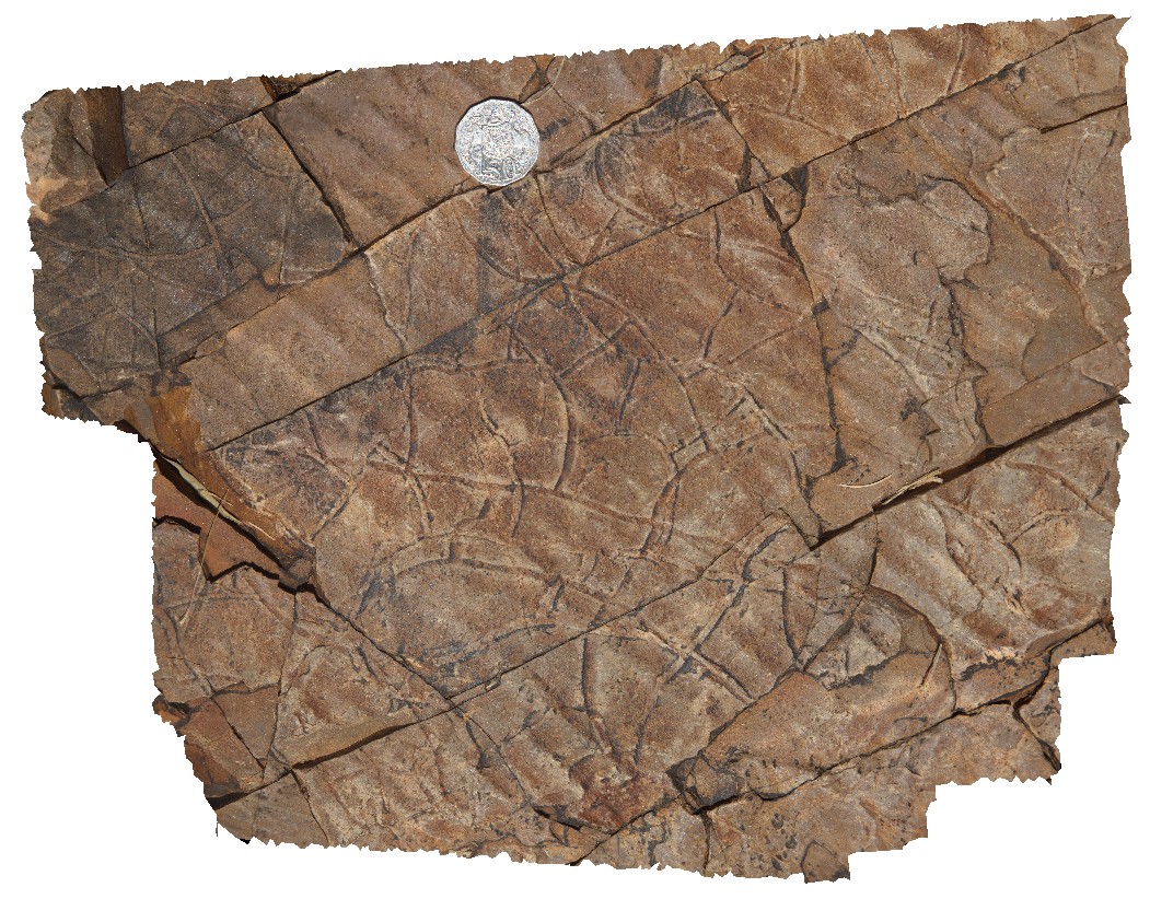
detail in preserved pavement of mud cracks in Wartupa Quartzite, Groan Creek, Arkaroola. Northern Flinders Ranges, S.A. |
0.30 |
-30.29617000000 |
139.43236000000 |
-9999.000 |
mud cracks, sedimentology |
quartzite |
Purnululu9 Map
 |
0 |
06/12/2016 noon |
3D terrestrial photogrammetric model |
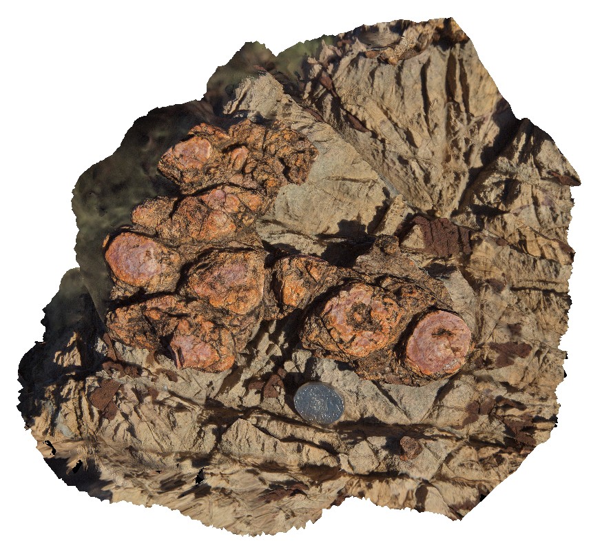
layer of stromatolites within dolomitic rock. Purnululu National Park, W.A. |
0.30 |
-17.40900000000 |
128.20374000000 |
-9999.000 |
calcite cement, stromatolite, fossil, sedimentology, dolostone |
dolostone |
Brachina6 Map
 |
5 |
11/13/2015 2:40 p.m. |
3D terrestrial photogrammetric model |
Ripple marks in Rawnsley Quartzite, Brachina Waterhole. S.A. |
0.30 |
-31.34421000000 |
138.55521000000 |
-9999.000 |
ripple marks, sedimentology |
quartzite |
Arkaroola36 Map
 |
5 |
11/12/2015 9:59 a.m. |
3D terrestrial photogrammetric model |
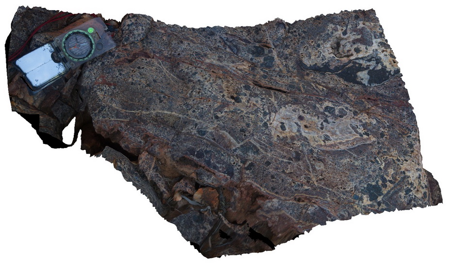
breccia, showing multiple phases of brecciation. Quartz veining cross cutting and hosting breccia clasts. Northern Flinders Ranges, S.A. |
0.30 |
-30.22387000000 |
139.34239000000 |
-9999.000 |
breccia, quartz veining |
sinter |
PtMacquarie19 Map
 |
5 |
01/01/9999 midnight |
3D terrestrial photogrammetric model |
Detail of garnets in an exotic eclogite block from within the Cambrian Port Macquarie Serpentinite melange |
0.30 |
-31.43724000000 |
152.92532000000 |
1.000 |
eclogite, exotic block, garnet, structure |
eclogite |
Falmouth1 Map
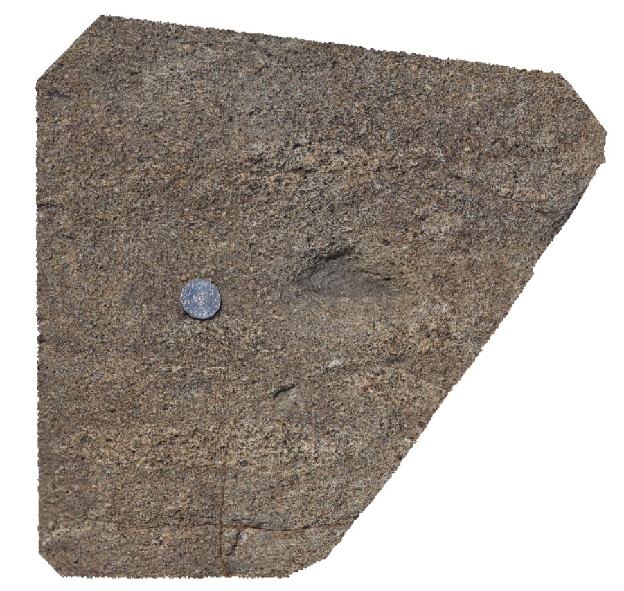 |
0 |
03/22/2016 10:41 a.m. |
3D terrestrial photogrammetric model |
fiamme textures in St Mary's Porphyrite. Fulmouth, Tasmania. |
0.30 |
-41.50288000000 |
148.27066000000 |
-9999.000 |
fiamme texture, porphyrite |
porphyrite |
Whiteside6 Map
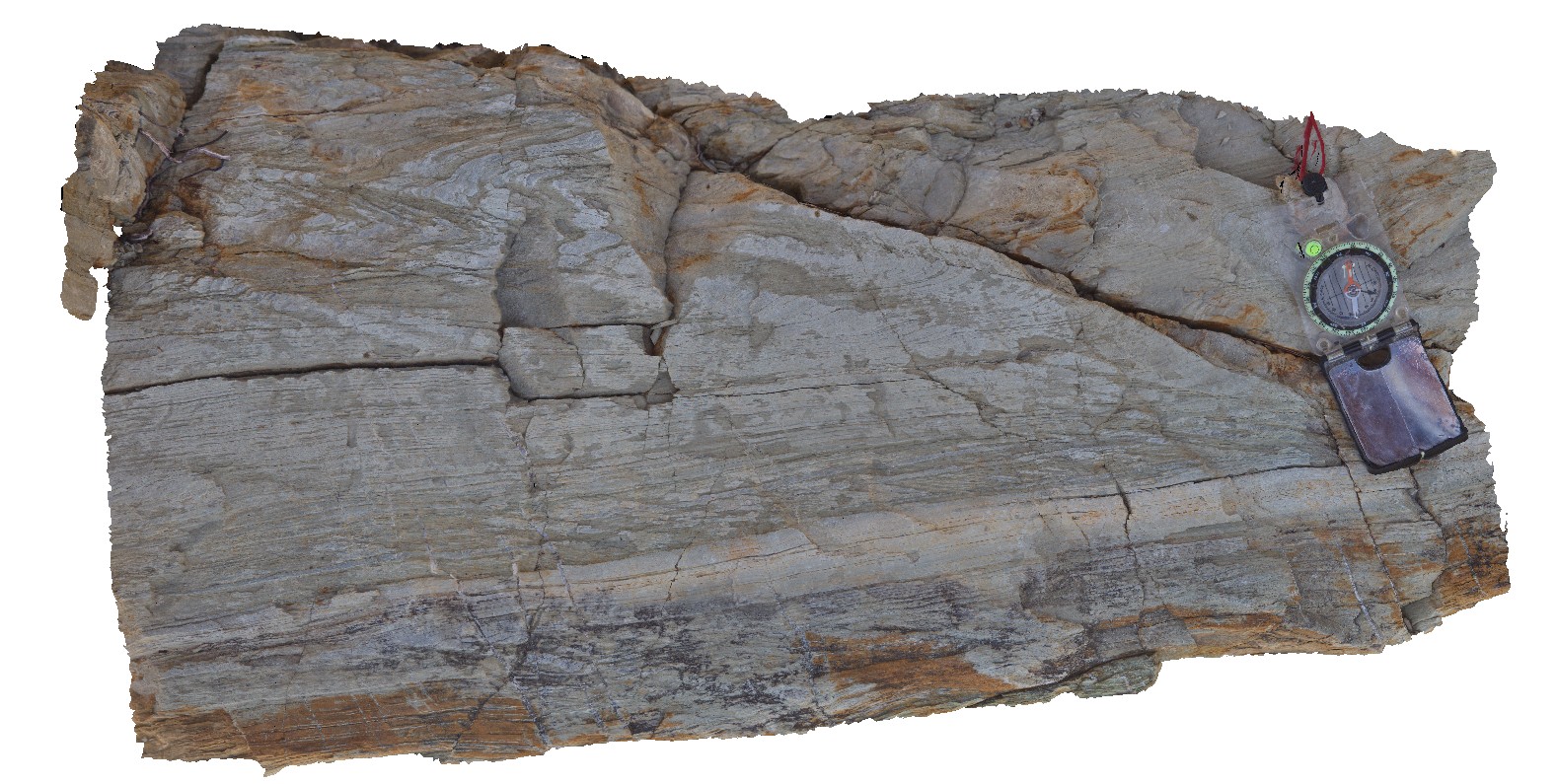 |
0 |
02/23/2016 12:37 p.m. |
3D terrestrial photogrammetric model |
detail of bedding and cleavage relationships in folded metasediment. Lake Kurwongbah, QLD. |
0.30 |
-27.25844000000 |
152.95766000000 |
-9999.000 |
cleavage, bedding, structure, folding |
metasediment |
Whiteside2 Map
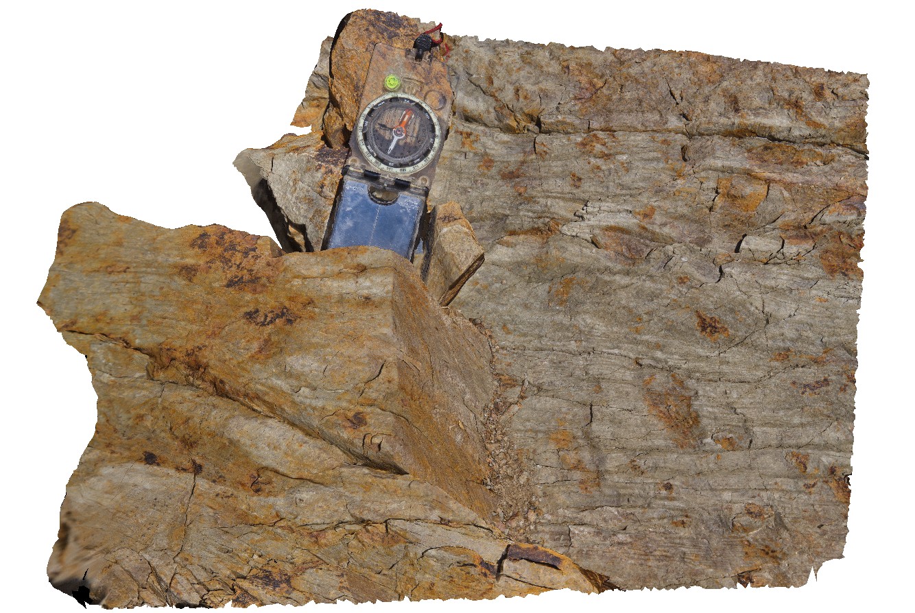 |
0 |
02/23/2016 12:35 p.m. |
3D terrestrial photogrammetric model |
crenulated metasediments, Lake Kurwongbah, QLD. |
0.30 |
-27.25765000000 |
152.95741000000 |
-9999.000 |
open fold, cleavage, structure, phyllite |
phyllite |
Trial1 Map
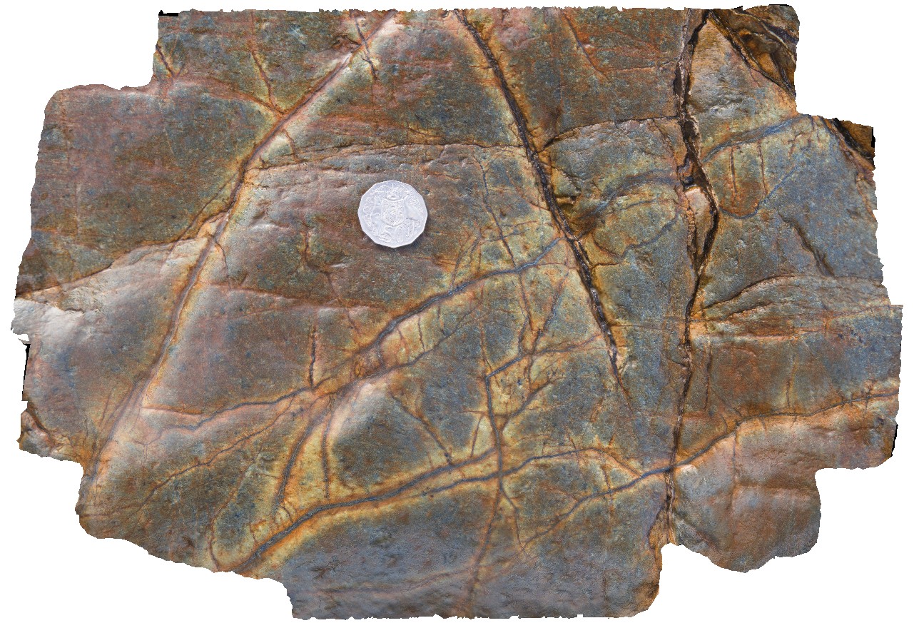 |
0 |
08/11/2016 noon |
3D terrestrial photogrammetric model |
Magnetite veins in mafic / ultramafic Cambrian? Rocks. Possibly with serpentinite selvages? Trial Harbour, West Coast Tas. |
0.30 |
-41.92640000000 |
145.16794000000 |
-9999.000 |
ultramafic, allochthonous blocks, serpentinite |
serpentinite |
Olary18 Map
 |
5 |
07/14/2015 11:20 a.m. |
3D terrestrial photogrammetric model |
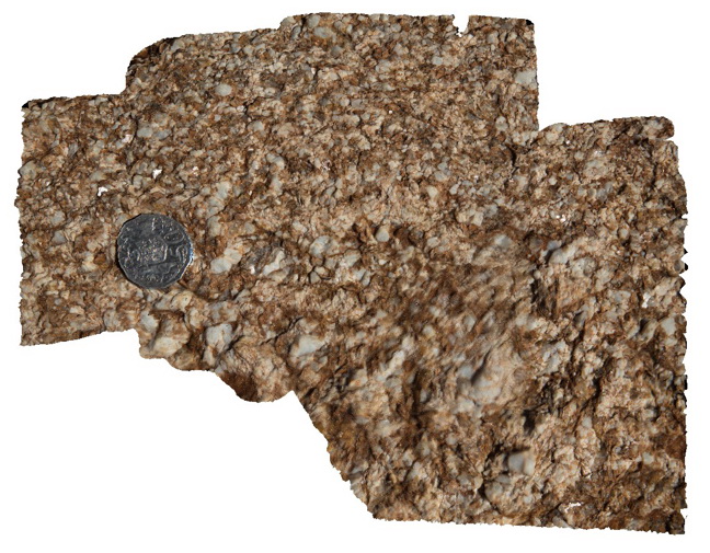
quartz-feldspar-mica pegmatitic texture in rock. Weekaroo, Olary, S.A. |
0.30 |
-32.17111000000 |
139.98607000000 |
-9999.000 |
pegmatitic texture |
pegmatite |
Arkaroola33 Map
 |
5 |
11/06/2015 1:55 p.m. |
3D terrestrial photogrammetric model |
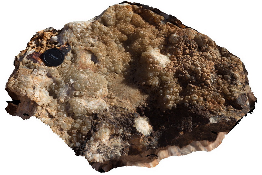
boulder exhibiting excellent terminating quartz crystals, encrusting side of vugh. Some form radiating aggregates. Mt Gee, Arkaroola. Northern Flinders Ranges, S.A. |
0.30 |
-30.22897000000 |
139.34520000000 |
-9999.000 |
radiating quartz |
quartz |
MtGipps6 Map
 |
0 |
06/27/2016 noon |
3D terrestrial photogrammetric model |
metasediments. Mount Gipps, N.S.W. |
0.30 |
-31.62032000000 |
141.50452000000 |
-9999.000 |
metasediments |
metasediments |
BHill120 Map
 |
5 |
09/19/2015 8:05 a.m. |
3D terrestrial photogrammetric model |
close up view of detail of crenulation cleavage in site BHill119. Broken Hill. N.S.W. |
0.30 |
-31.83357000000 |
141.42847000000 |
-9999.000 |
crenulation cleavage |
metasediment |
Bellthorpe2 Map
 |
5 |
04/12/2016 2:02 p.m. |
3D terrestrial photogrammetric model |
This image is related to image Bellthope1. Detailed view of intrusive contact of aplite into xenolith. Bellthorpe, QLD. |
0.30 |
-26.82774000000 |
152.62268000000 |
-9999.000 |
intrusive contact, xenolith |
granodiorite |
Arkaroola35 Map
 |
5 |
11/12/2015 9:59 a.m. |
3D terrestrial photogrammetric model |
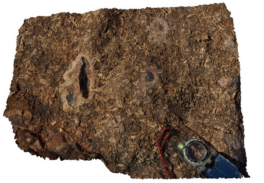
Voids after Calcite? Or other mineral rimmed by finely crystalline quartz and silica. Fragments of hematite enclosed in cryptocrystalline silica. Mt Gee, Arkaroola. Northern Flinders Ranges, S.A. |
0.30 |
-30.22387000000 |
139.34242000000 |
-9999.000 |
cryptocrystalline silica, quartz mineral casts |
sinter |
BHill94 Map
 |
5 |
09/18/2015 11:09 a.m. |
3D terrestrial photogrammetric model |
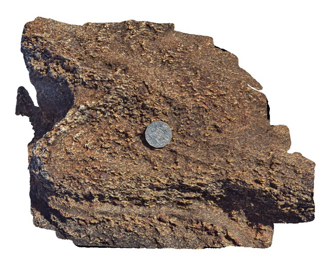
same location as BHill86, showing detail of foliation schistosity in folded pelitic layer with sillimanite. Broken Hill. N.S.W. |
0.30 |
-31.83270000000 |
141.42863000000 |
-9999.000 |
garnet sillimanite schist, fold, foliation |
schist |
BHill53 Map
 |
5 |
09/16/2015 8:23 a.m. |
3D terrestrial photogrammetric model |
gneiss boulder near railway cutting, showing banding and garnets. Broken Hill. N.S.W. |
0.30 |
-31.96414000000 |
141.48654000000 |
-9999.000 |
gneiss |
gneiss |
BH2014n9 Map
 |
20 |
03/18/2015 3:42 p.m. |
3D terrestrial photogrammetric model |
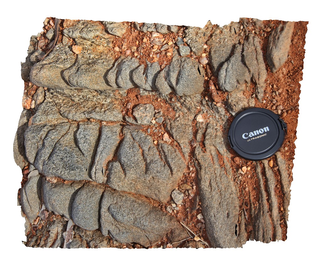
spaced cleavage in gneiss after metasediments. Broken Hill, N.S.W. |
0.30 |
-31.62006366000 |
141.49296080000 |
-9999.000 |
spaced cleavage, structure |
gneiss |
BHill111 Map
 |
5 |
09/19/2015 7:48 a.m. |
3D terrestrial photogrammetric model |
detail of large garnets with early sillimanite inclusions. Allendale Metasediments, Broken Hill. N.S.W. |
0.30 |
-31.84558000000 |
141.41388000000 |
-9999.000 |
garnet, sillimanite, porphyroblast, schist |
metasediments |
 AusGeol.org