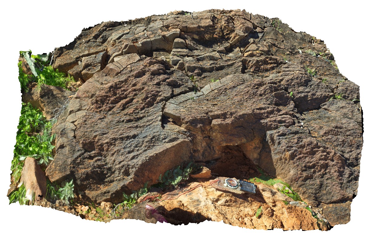
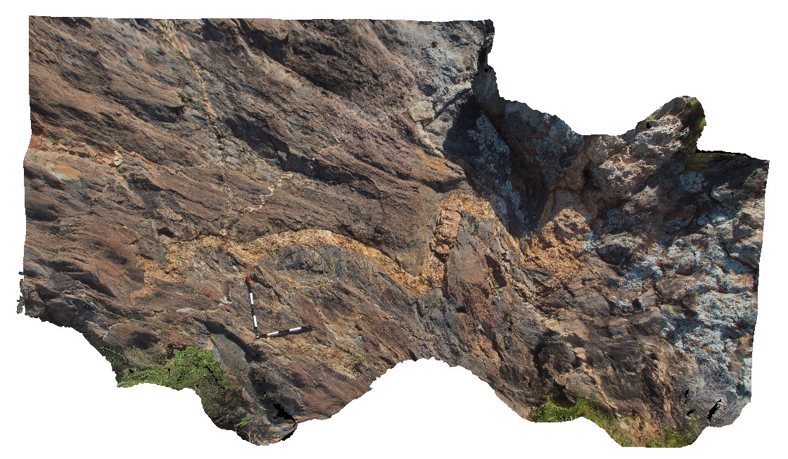
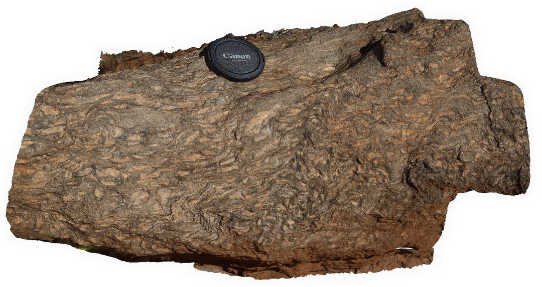
MtGipps44 Map
 |
0 |
06/30/2016 noon |
3D |
metasediments, Mount Gipps, N.S.W. |
1.40 |
-31.61661000000 |
141.50067000000 |
-9999.000 |
metasediment |
metasediment |
Olary43 Map
 |
0 |
09/27/2015 6:23 p.m. |
3D |
view of hydrothermal breccia in boulder, showing relic layering in clasts. Cathedral Rock, Olary, S.A. |
1.50 |
-32.08998000000 |
140.31932000000 |
-9999.000 |
breccia |
breccia |
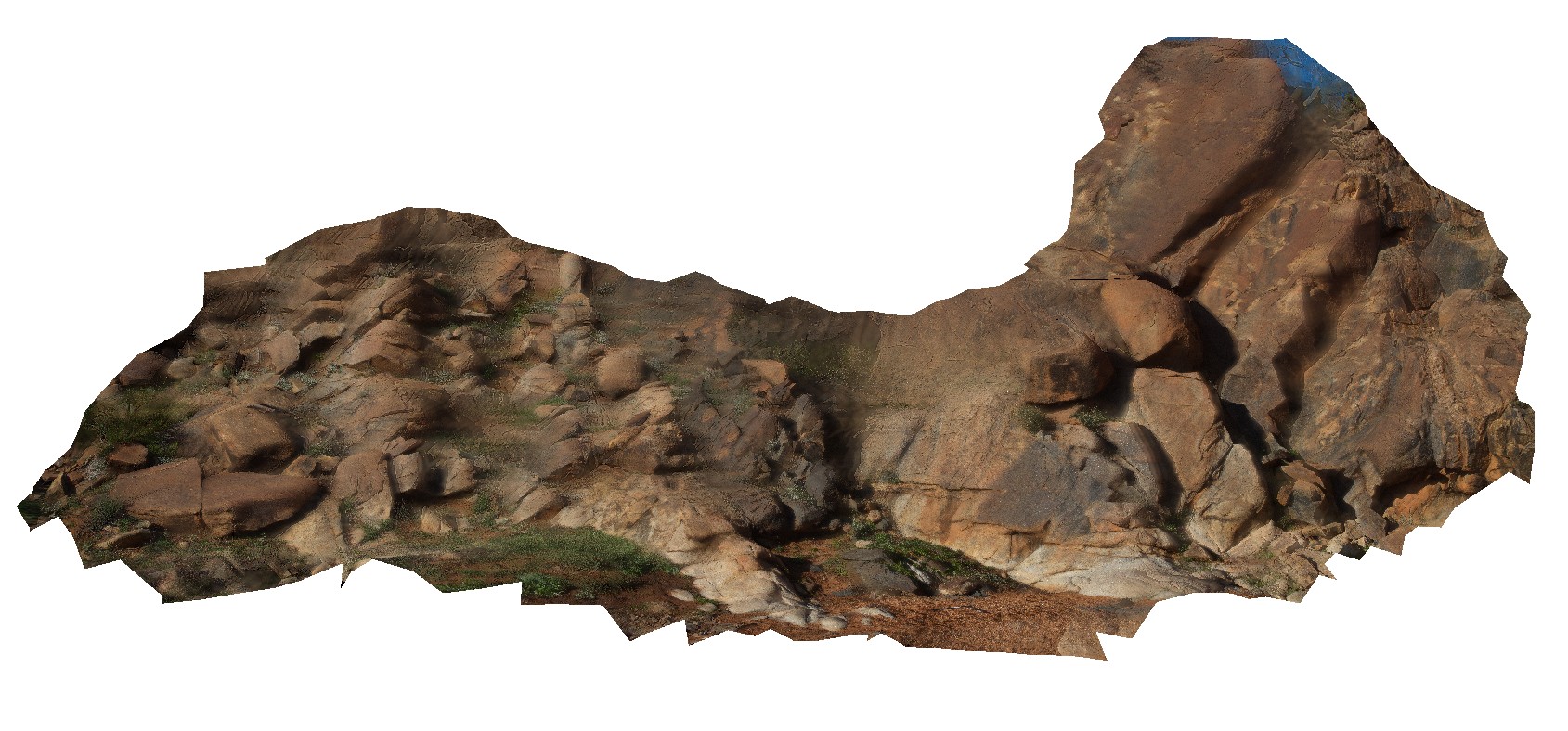
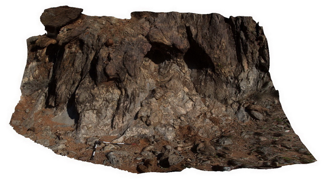
Olary44 Map
 |
0 |
09/27/2015 6:23 p.m. |
3D |
out crop of breccia, with angular and randomly orientated clasts. Cathedral Rock, Olary, S.A |
3.20 |
-32.09000000000 |
140.31943000000 |
-9999.000 |
breccia, calc-silicate |
breccia |
Olary47 Map
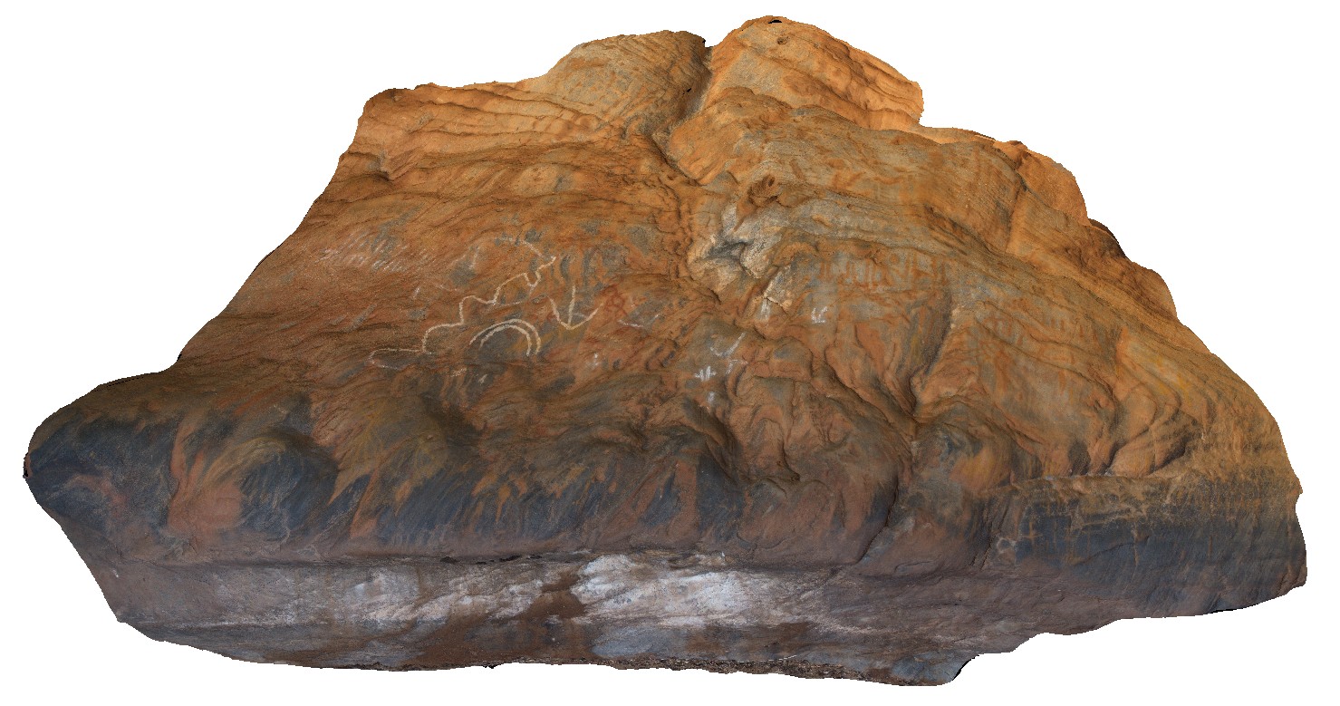 |
0 |
09/27/2015 6:25 p.m. |
3D |
view of inside of cave from image Olary47, showing Aboriginal rock art. Cathedral Rock, Olary. S.A. |
5.00 |
-32.09034000000 |
140.31938000000 |
-9999.000 |
cave, rock art |
metasediments |
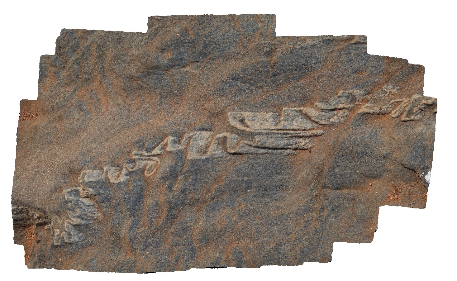
Olary48 Map
 |
0 |
09/27/2015 6:26 p.m. |
3D |
folded pegmatite dyke and quartz veins in the
Ethiudna Subgroup at Cathedral Rock. Olary, S.A. |
5.00 |
-32.09031000000 |
140.32009000000 |
-9999.000 |
pegmatite dyke, quartz vein, fold, structure |
metasediments, pegmatite |
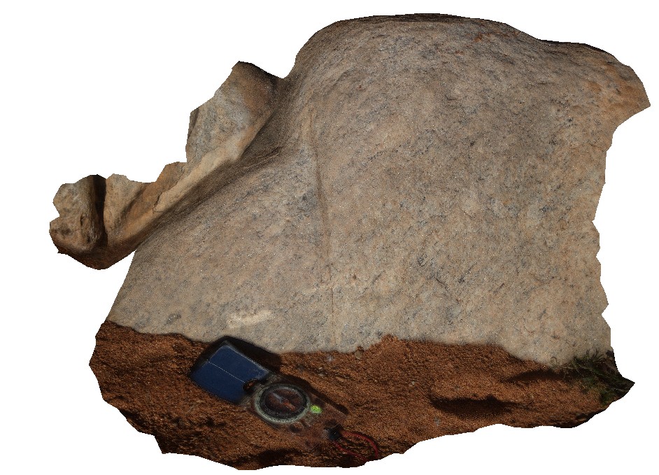
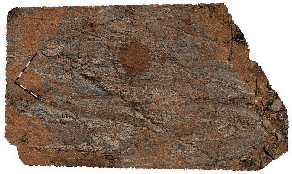
Olary50 Map
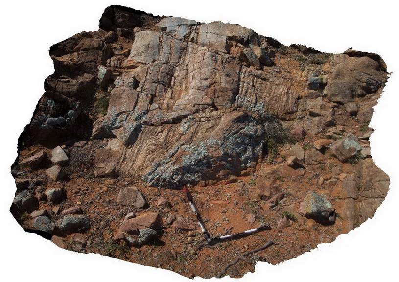 |
0 |
09/27/2015 6:27 p.m. |
3D |
folded migmatite layer cut by later E-W orientated brittle faults. Olary, S.A. |
2.50 |
-32.05560000000 |
140.41620000000 |
-9999.000 |
migmatite, fold, metamorphic, fault, structure |
migmatite |
Olary51 Map
 |
0 |
09/27/2015 6:27 p.m. |
3D |
recumbent F2 fold in migmatised psammitic metasediments. Olary. S.A. |
0.70 |
-32.05543000000 |
140.41632000000 |
-9999.000 |
fold, migmatite, recumbent fold, metamorphism |
psammite |
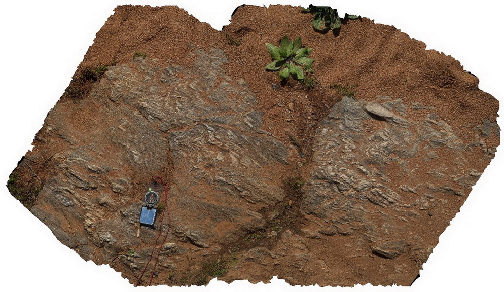
Olary56 Map
 |
0 |
09/27/2015 6:29 p.m. |
3D |
large radiating aggregates of muscovite in pegmatite or quartz lode. N/E of Cathedral Rock. Olary, S.A. |
1.00 |
-32.08189000000 |
140.32874000000 |
-9999.000 |
muscovite, pegmatite |
pegmatite |
Olary55 Map
 |
0 |
09/27/2015 6:29 p.m. |
3D |
view of large aggregates of muscovite in pegmatite / quartz lode. N/E of Cathedral Rock. Olary, S.A. |
1.00 |
-32.08189000000 |
140.32864000000 |
-9999.000 |
muscovite, pegmatite |
pegmatite |
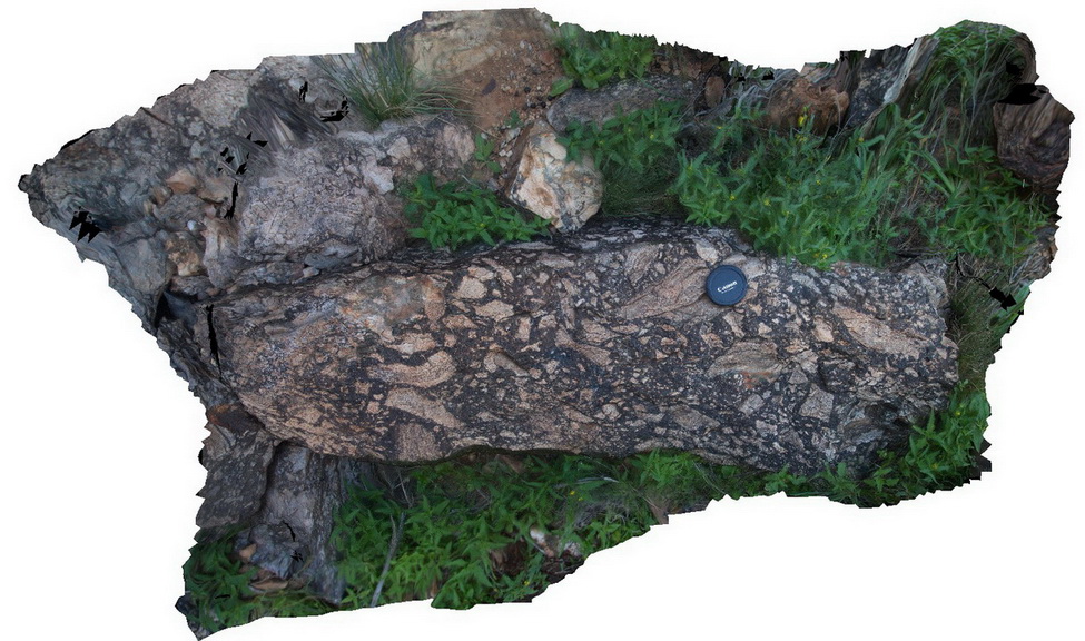
Olary57 Map
 |
0 |
09/27/2015 6:30 p.m. |
3D |
view of metagranite of the Basso suite, intruded by mafic dykes of the Lady Louise Suite. Olary, S.A. |
12.00 |
-32.11528000000 |
140.31561000000 |
-9999.000 |
metagranite, mafic dyke |
metagranite, mafic |
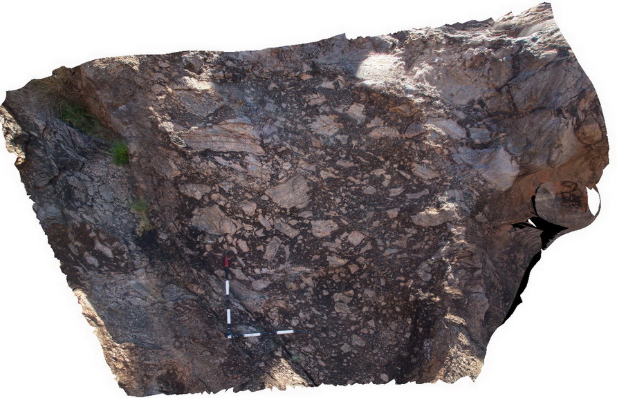
Olary58 Map
 |
0 |
09/27/2015 6:30 p.m. |
3D |
detail of foliated Basso Granite at Site Olary57, showing foliation defined by biotite and muscovite. Olary, S.A. |
0.60 |
-32.11535000000 |
140.31554000000 |
-9999.000 |
mineral foliation, metagranite |
metagranite |
Olary61 Map
 |
0 |
09/27/2015 6:32 p.m. |
3D |
psammitic and pelitic layers cut by pegmatite with pegmatitic (migmatite?) segregations. Olary, S.A. |
5.00 |
-32.11344000000 |
140.30649000000 |
-9999.000 |
metamorphic, pegmatitic segregations |
psammite, pegmatite |
Olary62 Map
 |
0 |
09/27/2015 6:33 p.m. |
3D |
magnetite-bearing quartzite of the Cathedral Rock Formation. Olary, S.A. |
3.00 |
-32.11269000000 |
140.30518000000 |
-9999.000 |
quartzite, banded |
quartzite |
Olary64 Map
 |
0 |
09/27/2015 6:33 p.m. |
3D |
view of a loose block of pelitic metasediments displaying tight folding and foliation. Foliation is defined by large white retrogressed porphyroblasts. Olary, S.A. |
0.50 |
-32.11338000000 |
140.30014000000 |
-9999.000 |
fold, structure, foliation, porphyroblast |
metasediment |
Olary65 Map
 |
0 |
09/27/2015 6:34 p.m. |
3D |
view of folded and disrupted pegmatitic segregations in psammopelitic metasediments. Olary, S.A. |
3.00 |
-32.11353000000 |
140.30011000000 |
-9999.000 |
fold, pegmatitic segregations |
metasediments |
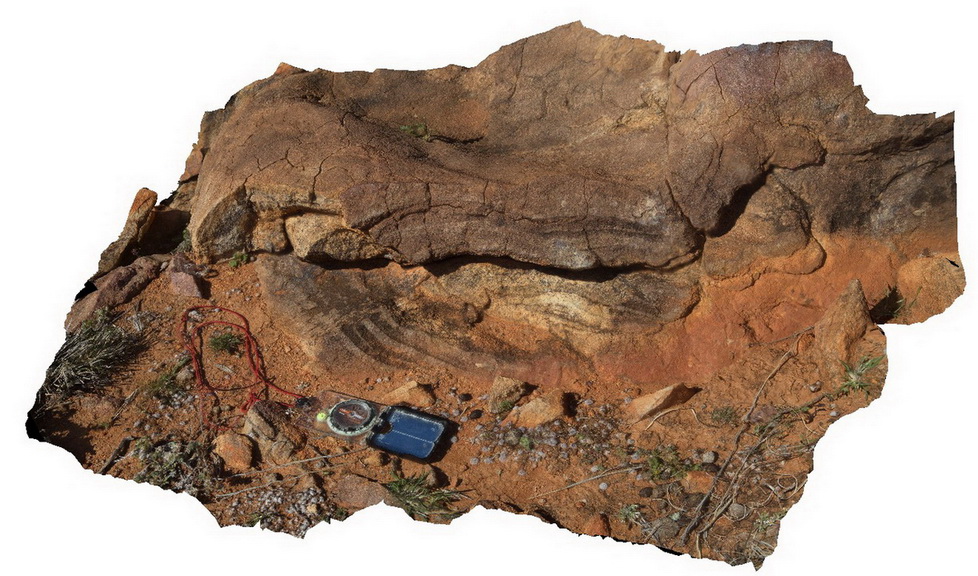
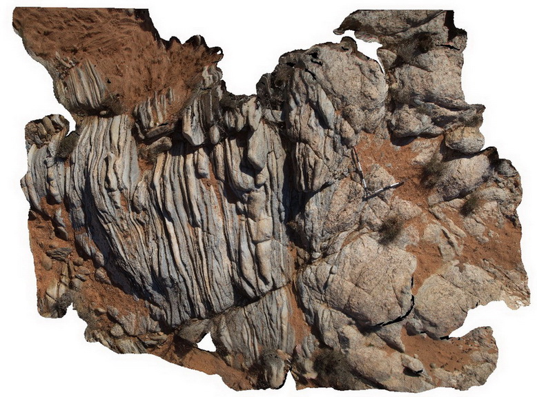
Olary73 Map
 |
0 |
09/27/2015 6:42 p.m. |
3D |
view of isoclinal F2 folds, folding D1 migmatite layers in pelitic metasediments. Olary, S.A. |
4.00 |
-32.11532000000 |
140.29810000000 |
-9999.000 |
isoclinal fold, structure |
pelite |
Olary74 Map
 |
0 |
09/27/2015 6:43 p.m. |
3D |
Tightly folded leucosomes in psammopelitic metasediments. May represent F2 folds. Olary, S.A. |
1.40 |
-32.11573000000 |
140.29848000000 |
-9999.000 |
refolded folds, leucosome, structure |
psammopelite |
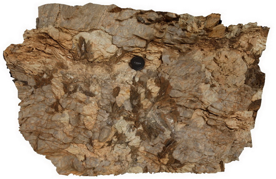
Olary76 Map
 |
0 |
09/27/2015 6:46 p.m. |
3D |
detail of small-scale ptygmatic folding from site Olary75. Olary, S.A. |
0.30 |
-32.11575000000 |
140.29852000000 |
-9999.000 |
ptygmatic fold, fold, structure |
metasediment |
Olary77 Map
 |
0 |
09/27/2015 6:46 p.m. |
3D |
isoclinal, recumbent F2 fold in psammopelitic metasediments with early pegmatite and late-stage epidote alteration. Olary, S.A. |
3.00 |
-32.11578000000 |
140.29861000000 |
-9999.000 |
isoclinal fold, recumbent fold, structure, epidote alteration |
psammopelite, pegmatite |
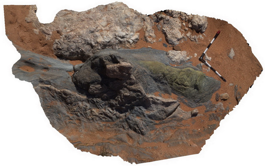
Olary80 Map
 |
0 |
09/27/2015 6:48 p.m. |
3D |
diamictite with mainly quartzite and granite clasts up to 0.2m. Weekaroo, Olary. S.A. |
3.00 |
-32.17703000000 |
139.96997000000 |
-9999.000 |
diamictite, silicate clasts |
diamictite |
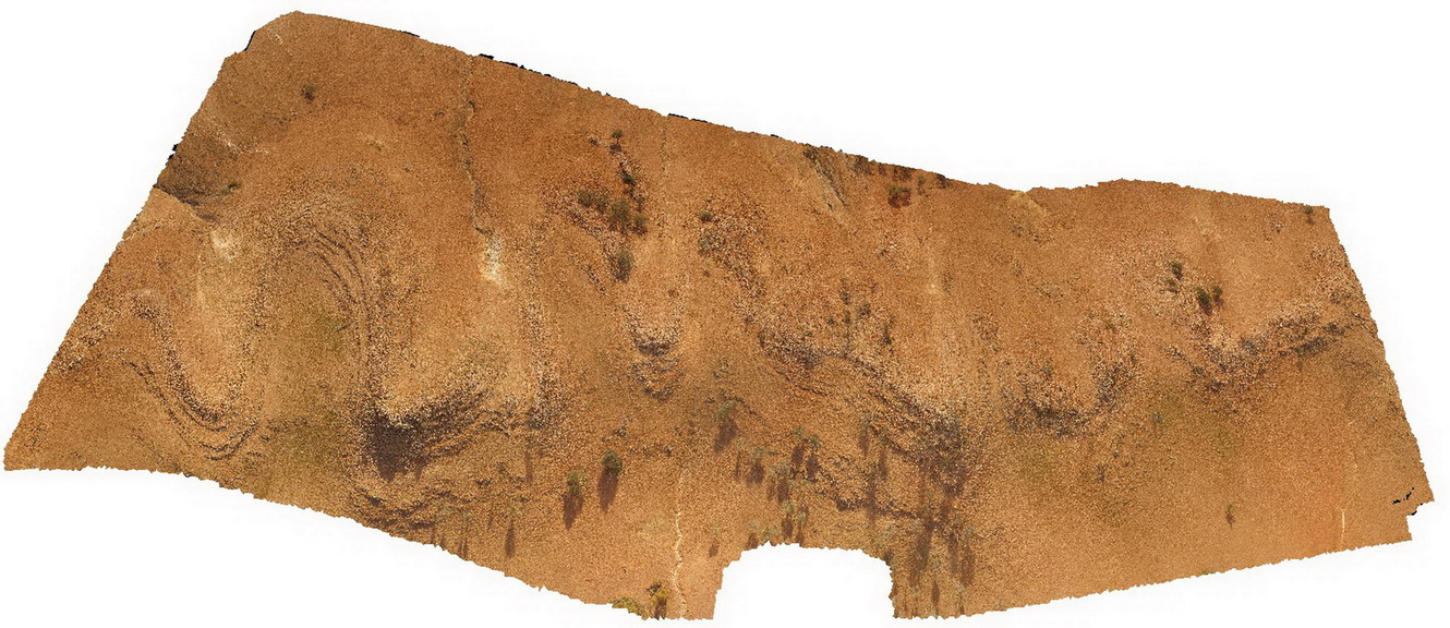
OlaryUAV3 Map
 |
0 |
09/27/2015 6:50 p.m. |
UAV |
aerial view of 'Wiggly quartzite'. A folded quartzite unit at Weekaroo, Olary. S.A. |
100.00 |
-32.18229700000 |
139.95783400000 |
-9999.000 |
quartzite, fold, structure |
quartzite |
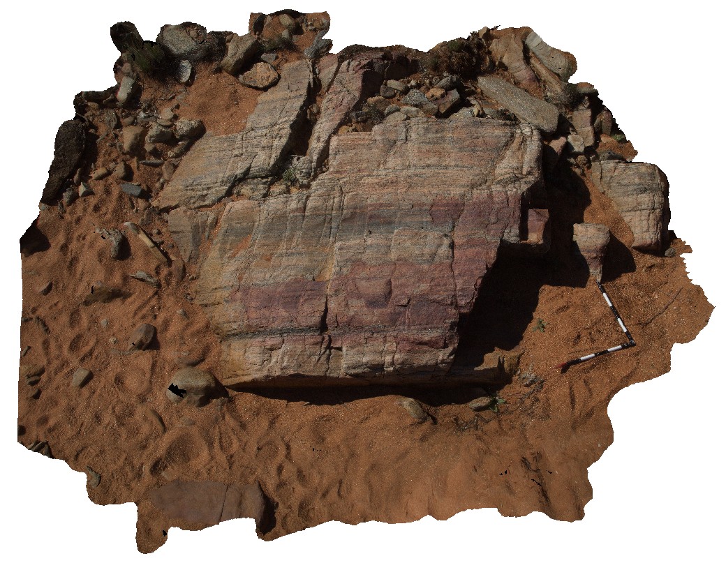
Weetootla2 Map
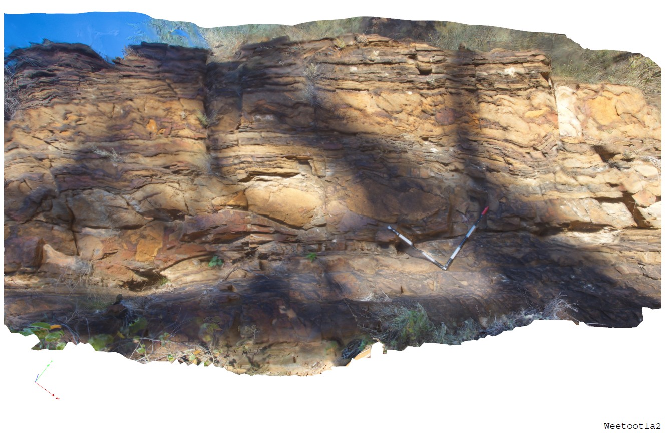 |
0 |
09/27/2015 4:23 p.m. |
3D |
bedded carbonate / dolomite and mudstone of the Balcanoona Formation. Layered units are gently folded around large LS clasts with discordant bedding. Balcanoona Creek, Weetootla. |
4.00 |
-30.48152000000 |
139.22220000000 |
-9999.000 |
bedding, sedimentology |
carbonate |
Weetootla3 Map
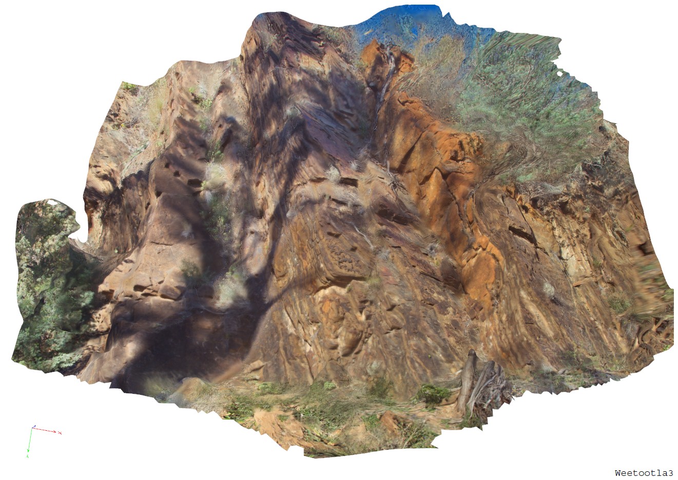 |
0 |
09/27/2015 4:29 p.m. |
3D |
outcrop view of sites Weetootla1 & 2. Showing bedded carbonate and mudstone. Balcanoona Creek, Weetootla. |
8.00 |
-30.48160000000 |
139.22211000000 |
-9999.000 |
clasts, discordant bedded |
carbonate |
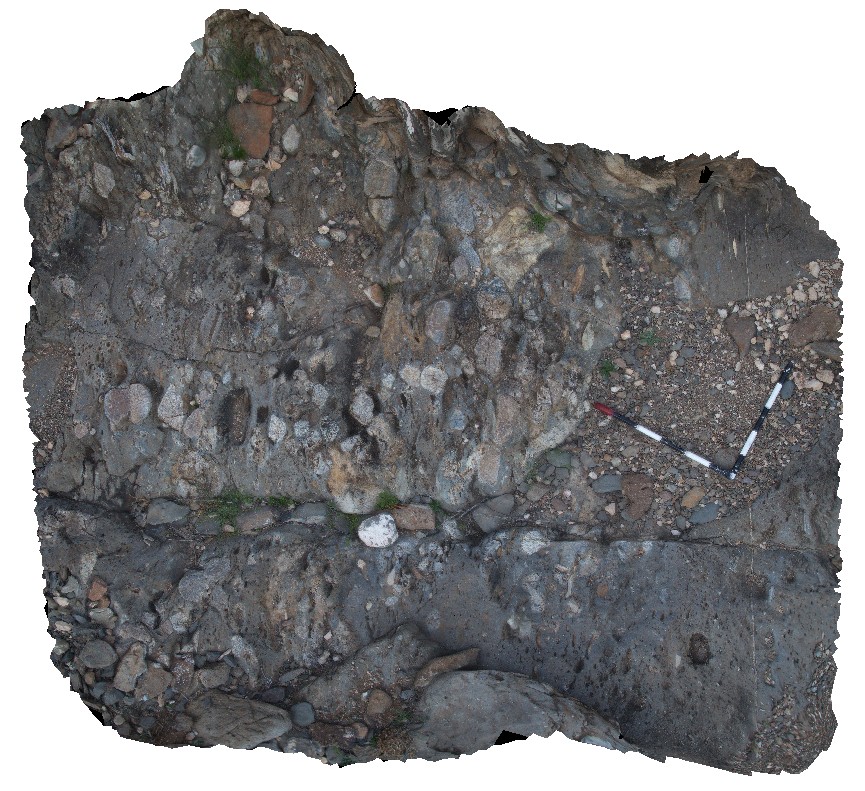
Weetootla7 Map
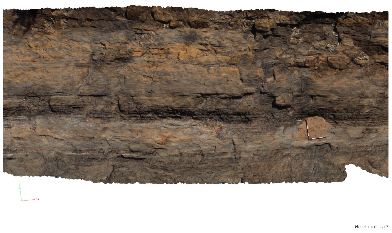 |
0 |
09/27/2015 4:30 p.m. |
3D |
bedded carbonate with numerous clasts of carbonate (brown) and breccia horizons. Weetootla Gorge. |
9.00 |
-30.48117000000 |
139.22685000000 |
-9999.000 |
bedding, sedimentology |
carbonate |
Wilka9 Map
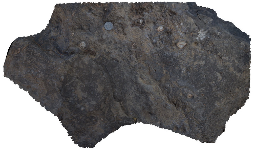 |
0 |
09/27/2015 5:19 p.m. |
3D |
Out crop of archaeocyatha bearing carbonates, Wilkawillina Trail, Flinders Ranges. |
0.30 |
-31.29892000000 |
138.90530000000 |
-9999.000 |
Archaeocyatha |
limestone |