GeoVis3D
GeoVis3D - freeware for analysis and annotation of virtual 3D geological models
GeoVis3D provides tools for measurement of planar and linear geometric elements of 3D geological models and provides tools for 3D annotation and labelling. GeoVis3D currently only accepts 3D models as Google KMZ files that were created using the Photoscan photogrammetry software. Models suitable for GeoVis3D can be downloaded from the AusGeol.org site and have .KMZ extensions.
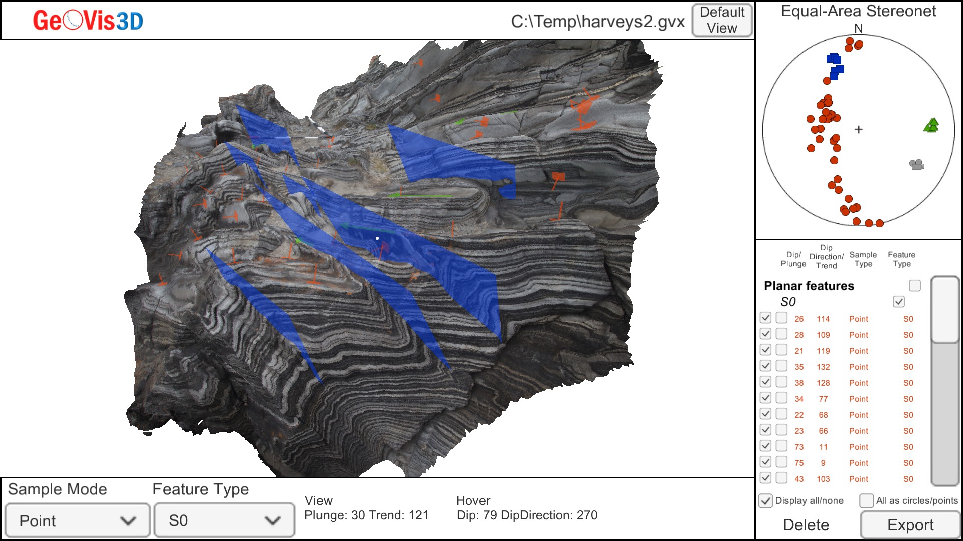
GeoVis3D screen showing a 3D geological model with measured structural features and associated data table and stereonet
The GeoVis3D software is still under development and has been released in Beta form. Every effort has been made to ensure that GeoVis3D produces accurate measurements of geometric features in 3D models but the software comes with no guarantee or warranty. It is the responsibility of the user to ensure that the program is appropriate for the intended use and to independently validate measurements.
GeoVis3D runs on both Windows-based platforms and also on Macintosh computers running Mac OS 10.8 or later.
The software is provided for download as ZIP archives and will run without installation after the archive has been uncompressed. The default expander on Macintosh computers (Mac Archive Utility) may not open the zipped file; you may need to download Unarchiver (http://unarchiver.c3.cx/unarchiver).
Examples of 3D models for use with GeoVis3D are provided in the GeoVis3D Example Data Files archive but a large number of additional models are available as KMZ files from the Atlas or Sites pages of AusGeol.org
The current version of GeoVis3D is 2.0
Downloads:
GeoVis3D Mac
GeoVis3D Windows
GeoVis3D Example Data Files
Tutorials:
GeoVis3D Tutorial 1
GeoVis3D Tutorial 2