AMADFSP3
Site:
AMADFSP3
Downloads:
Map
Description:
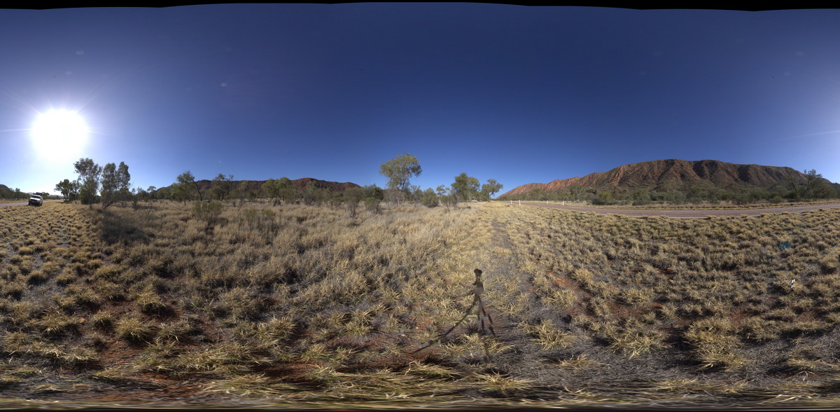
geological contact between Bitter Springs Group dolostone (brown) and Heavitree Sandstone (red), west of Corroboree Rock, Amadeus Basin. N.T.
| Capture Date: | July 28, 2016, 10:18 a.m. |
| Latitude: | -23.70432000000 degrees |
| Longitude: | 134.18723900000 degrees |
| Elevation: | 539.275 metres |
| Visualisation Type: | FSP |
| Location Accuracy: | 5 metres |
Keywords:
- sedimentology
- geological contact
- Amadeus Basin
| dolostone | |
|---|---|
| Form Type: | bedded |
| Description: | Dolomite, stromatolitic dolomite, siltstone, and sandstone; evaporitic in subsurface. Limestone, siltstone, mudstone. |
| Min Geological Age: | Cryogenian |
| Max Geological Age: | Tonian |
| Min Numerical Age: | 767.000 |
| Max Numerical Age: | 896.000 |
| Strat No: | 79261 |
| Supergroup: | |
| Group: | Bitter Springs Group |
| Subgroup: | |
| Formation: | |
| Member: | |
| Province: | Amadeus Basin |
| sandstone | |
|---|---|
| Form Type: | bedded |
| Description: | Fine-, medium- or coarse-grained, planar and cross-bedded, variably feldspathic quartzose sandstone, pink, grey, pinkish-brown, purple or white weathering, and rare laminated mudstone or conglomerate intervals. |
| Min Geological Age: | Cryogenian |
| Max Geological Age: | Cryogenian |
| Min Numerical Age: | 635.000 |
| Max Numerical Age: | 720.000 |
| Strat No: | 8223 |
| Supergroup: | |
| Group: | |
| Subgroup: | |
| Formation: | Heavitree Formation |
| Member: | |
| Province: | Amadeus Basin |