AlbanyFSP2
Site:
AlbanyFSP2
Downloads:
Map
Description:
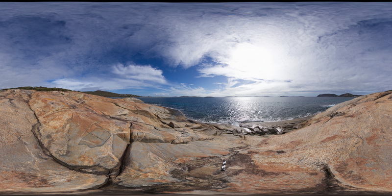
shoreline outcrop, showing complex intrusive relationships between porphyry granite, intruded by grey granodiorite and cross cut by porphyry dykes. Albany, W.A.
| Capture Date: | June 5, 2016, 10:39 a.m. |
| Latitude: | -35.08977000000 degrees |
| Longitude: | 117.95050000000 degrees |
| Elevation: | NA |
| Visualisation Type: | FSP |
| Location Accuracy: | 0 metres |
Keywords:
- igneous contact
- intrusive contact
- xenolith
| granite | |
|---|---|
| Form Type: | pluton |
| Description: | Weakly to moderately deformed and recrystallised feldspar-quartz phyric granite. |
| Min Geological Age: | Stenian |
| Max Geological Age: | Stenian |
| Min Numerical Age: | 1138.000 |
| Max Numerical Age: | 1200.000 |
| Strat No: | 78596 |
| Supergroup: | Esperance Supersuite |
| Group: | |
| Subgroup: | |
| Formation: | |
| Member: | |
| Province: | Albany-Fraser Orogen |
| granodiorite | |
|---|---|
| Form Type: | dyke |
| Description: | fine to medium-grained granodiorite. |
| Min Geological Age: | |
| Max Geological Age: | |
| Min Numerical Age: | 0.000 |
| Max Numerical Age: | 0.000 |
| Strat No: | 0 |
| Supergroup: | |
| Group: | |
| Subgroup: | |
| Formation: | |
| Member: | |
| Province: | Albany-Fraser Orogen |
| porphyry | |
|---|---|
| Form Type: | dyke |
| Description: | |
| Min Geological Age: | |
| Max Geological Age: | |
| Min Numerical Age: | 0.000 |
| Max Numerical Age: | 0.000 |
| Strat No: | 0 |
| Supergroup: | |
| Group: | |
| Subgroup: | |
| Formation: | |
| Member: | |
| Province: |