AlvieFSP4
Site:
AlvieFSP4
Downloads:
Map
Description:
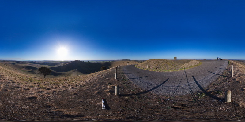
view from Red Rocks carpark of old maar volcano and cinder cones. Alvie, Vic.
| Capture Date: | June 5, 2016, 10:33 a.m. |
| Latitude: | -38.25128000000 degrees |
| Longitude: | 143.50841000000 degrees |
| Elevation: | NA |
| Visualisation Type: | FSP |
| Location Accuracy: | 0 metres |
Keywords:
- maar volcano
- cinder cone
- volcanic topography
| volcanics | |
|---|---|
| Form Type: | |
| Description: | Basaltic volcanoes and cinder cones, with associated scoria and ash deposits and Lava flows. |
| Min Geological Age: | Holocene |
| Max Geological Age: | Miocene |
| Min Numerical Age: | 0.100 |
| Max Numerical Age: | 8.500 |
| Strat No: | 38291 |
| Supergroup: | |
| Group: | Newer Volcanic Group |
| Subgroup: | |
| Formation: | |
| Member: | |
| Province: | Bendigo Zone, Lachlan Orogen, Stawell Zone, Torquay Sub-basin |