Armidale4
Site:
Armidale4

Downloads:
Map
3D Model:
Description:
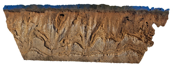
Liesegang bands in Eocene-Oligocene sandstone of the Armidale beds. Armidale, N.S.W
| Capture Date: | July 27, 2015, 10:33 a.m. |
| Latitude: | -30.49326000000 degrees |
| Longitude: | 151.65179000000 degrees |
| Elevation: | NA |
| Visualisation Type: | 3D |
| Location Accuracy: | 5 metres |
Keywords:
- sandstone
- liesegang bands
| sandstone | |
|---|---|
| Form Type: | bedded |
| Description: | silty sandstone with well developed liesegang bands defined by iron oxide cement |
| Min Geological Age: | Eocene |
| Max Geological Age: | Oligocene |
| Min Numerical Age: | 40.000 |
| Max Numerical Age: | 30.000 |
| Strat No: | 37004 |
| Supergroup: | |
| Group: | |
| Subgroup: | |
| Formation: | Armidale Beds |
| Member: | |
| Province: | New England Orogen |