BH2011n7
Site:
BH2011n7
Downloads:
Map
3D Model:
Description:
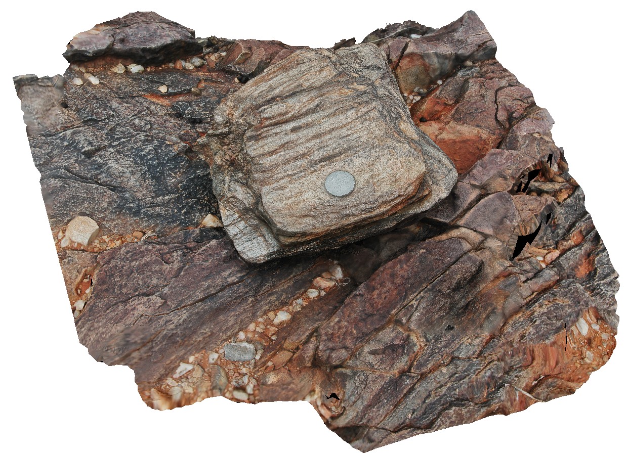
mica rich schist, with small folds and cross cutting cleavage. Broken Hill, N.S.W.
| Capture Date: | March 16, 2015, 2:55 p.m. |
| Latitude: | -31.63596042000 degrees |
| Longitude: | 141.53388023000 degrees |
| Elevation: | NA |
| Visualisation Type: | 3D |
| Location Accuracy: | 20 metres |
Keywords:
- cleavage
- fold
- structure
| schist | |
|---|---|
| Form Type: | bedded |
| Description: | medium-grained mica schist. |
| Min Geological Age: | Statherian |
| Max Geological Age: | Statherian |
| Min Numerical Age: | 1600.000 |
| Max Numerical Age: | 1691.000 |
| Strat No: | 23328 |
| Supergroup: | Willyama Supergroup |
| Group: | |
| Subgroup: | |
| Formation: | Allendale Metasediments |
| Member: | |
| Province: |