BHill65
Site:
BHill65
Downloads:
Map
3D Model:
Description:
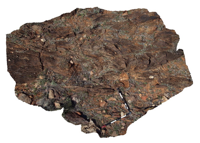
'S' shaped plunging anticline in psammopelitic metasediments. Allens Tank area, Broken Hill. N.S.W.
| Capture Date: | Sept. 16, 2015, 11:08 a.m. |
| Latitude: | -31.61755000000 degrees |
| Longitude: | 141.48842000000 degrees |
| Elevation: | NA |
| Visualisation Type: | 3D |
| Location Accuracy: | 5 metres |
Keywords:
- psammopelitic metasediments
- S folding
| metasediment | |
|---|---|
| Form Type: | bedded |
| Description: | fine-grained psammitic to pelitic/psammopelitic metasediments. |
| Min Geological Age: | Paleoproterozoic |
| Max Geological Age: | Paleoproterozoic |
| Min Numerical Age: | 1600.000 |
| Max Numerical Age: | 1750.000 |
| Strat No: | 23602 |
| Supergroup: | Willyama Supergroup |
| Group: | |
| Subgroup: | |
| Formation: | Freyers Metasediments |
| Member: | |
| Province: |