BHill71
Site:
BHill71
Downloads:
Map
3D Model:
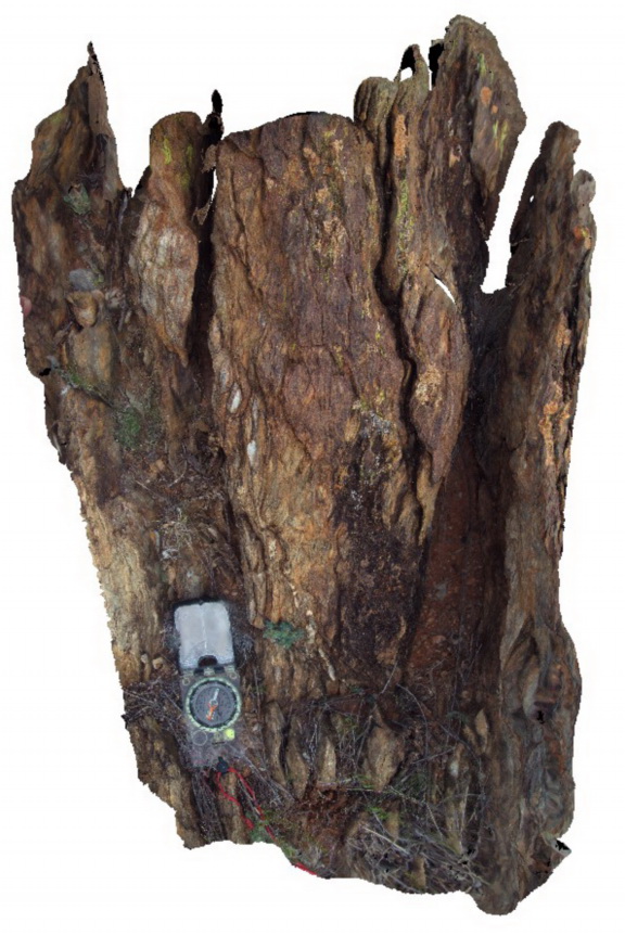
Description:
shear bands in retrograde shear, showing sinistral movement and boudinaged quartz vein. Allans Bore Area, Broken Hill. N.S.W.
| Capture Date: | Sept. 16, 2015, 11:11 a.m. |
| Latitude: | -31.61037000000 degrees |
| Longitude: | 141.49367000000 degrees |
| Elevation: | NA |
| Visualisation Type: | 3D |
| Location Accuracy: | 5 metres |
Keywords:
- shear zone
- boudinage
| metasediment | |
|---|---|
| Form Type: | bedded |
| Description: | Pelitic to psammitic metasediments |
| Min Geological Age: | Statherian |
| Max Geological Age: | Statherian |
| Min Numerical Age: | 1600.000 |
| Max Numerical Age: | 1691.000 |
| Strat No: | 23328 |
| Supergroup: | Willyama Supergroup |
| Group: | |
| Subgroup: | |
| Formation: | Allendale Metasediments |
| Member: | |
| Province: |