BHill76
Site:
BHill76
Downloads:
Map
3D Model:
Description:
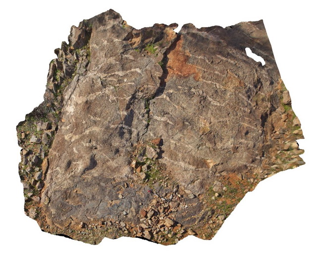
pavement outcrop showing contact between mafic (dark area under scale bar) and felsic gneisses with apparent lensoidal leucosomes. 9 Mile road, Broken Hill. N.S.W.
| Capture Date: | Sept. 16, 2015, 11:14 a.m. |
| Latitude: | -31.87205000000 degrees |
| Longitude: | 141.42947000000 degrees |
| Elevation: | NA |
| Visualisation Type: | 3D |
| Location Accuracy: | 5 metres |
Keywords:
- leucosome
- gneiss
| gneiss | |
|---|---|
| Form Type: | zoned |
| Description: | Quartz-feldspar-biotite-garnet gneiss intruded by / in contact with mafic gneiss. |
| Min Geological Age: | Statherian |
| Max Geological Age: | Statherian |
| Min Numerical Age: | 1685.000 |
| Max Numerical Age: | 1690.000 |
| Strat No: | 8489 |
| Supergroup: | Willyama Supergroup |
| Group: | |
| Subgroup: | |
| Formation: | Hores Gneiss |
| Member: | |
| Province: |