BHill79
Site:
BHill79
Downloads:
Map
3D Model:
Description:
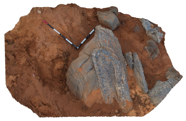
creek exposure near 9 Mile road, showing folded pelitic and psammitic layers with sillimanite. Broken Hill. N.S.W.
| Capture Date: | Sept. 16, 2015, 11:17 a.m. |
| Latitude: | -31.84014000000 degrees |
| Longitude: | 141.44077000000 degrees |
| Elevation: | NA |
| Visualisation Type: | 3D |
| Location Accuracy: | 5 metres |
Keywords:
- fold
- psammite
- pelitic
- sillimanite
| pelite | |
|---|---|
| Form Type: | bedded |
| Description: | Pelitic to psammitic metasediments with sillimanite. |
| Min Geological Age: | Statherian |
| Max Geological Age: | Statherian |
| Min Numerical Age: | 1672.000 |
| Max Numerical Age: | 1685.000 |
| Strat No: | 17531 |
| Supergroup: | Willyama Supergroup |
| Group: | Sundown Group |
| Subgroup: | |
| Formation: | |
| Member: | |
| Province: | Curnamona Province |