BHillFSP12
Site:
BHillFSP12
Downloads:
Map
Description:
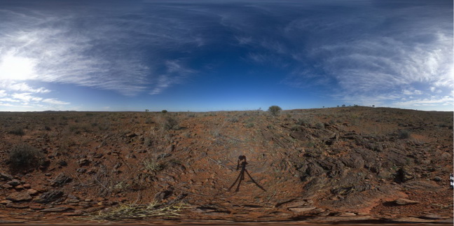
overview of outcropping folded and banded / bedded Sundown Group Metasediments, Broken Hill. N.S.W.
| Capture Date: | Oct. 19, 2015, 10:33 a.m. |
| Latitude: | -31.83396000000 degrees |
| Longitude: | 141.43024000000 degrees |
| Elevation: | NA |
| Visualisation Type: | FSP |
| Location Accuracy: | 0 metres |
Keywords:
- Sundown Group
- metasediment
- fold
- structure
| metasediment | |
|---|---|
| Form Type: | bedded |
| Description: | Pelitic to psammitic metasediments. |
| Min Geological Age: | Statherian |
| Max Geological Age: | Statherian |
| Min Numerical Age: | 1672.000 |
| Max Numerical Age: | 1685.000 |
| Strat No: | 17531 |
| Supergroup: | Willyama Supergroup |
| Group: | Sundown Group |
| Subgroup: | |
| Formation: | |
| Member: | |
| Province: | Curnamona Province |