BHillFSP20
Site:
BHillFSP20
Downloads:
Map
Description:
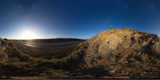
road cutting exposure, showing banded gneiss with paler, meta-pegmatite? Intrusion within the Rasp Ridge Granite Gneiss. Broken Hill. N.S.W.
| Capture Date: | Oct. 19, 2015, 11:09 a.m. |
| Latitude: | -32.00630000000 degrees |
| Longitude: | 141.28955000000 degrees |
| Elevation: | NA |
| Visualisation Type: | FSP |
| Location Accuracy: | 0 metres |
Keywords:
- pegmatite
- gneiss
| gneiss | |
|---|---|
| Form Type: | |
| Description: | banded gneiss. |
| Min Geological Age: | Statherian |
| Max Geological Age: | Statherian |
| Min Numerical Age: | 1683.000 |
| Max Numerical Age: | 1683.000 |
| Strat No: | 70120 |
| Supergroup: | |
| Group: | |
| Subgroup: | |
| Formation: | Rasp Ridge Granite Gneiss |
| Member: | |
| Province: |