Ballarat10
Site:
Ballarat10
Downloads:
Map
3D Model:
Description:
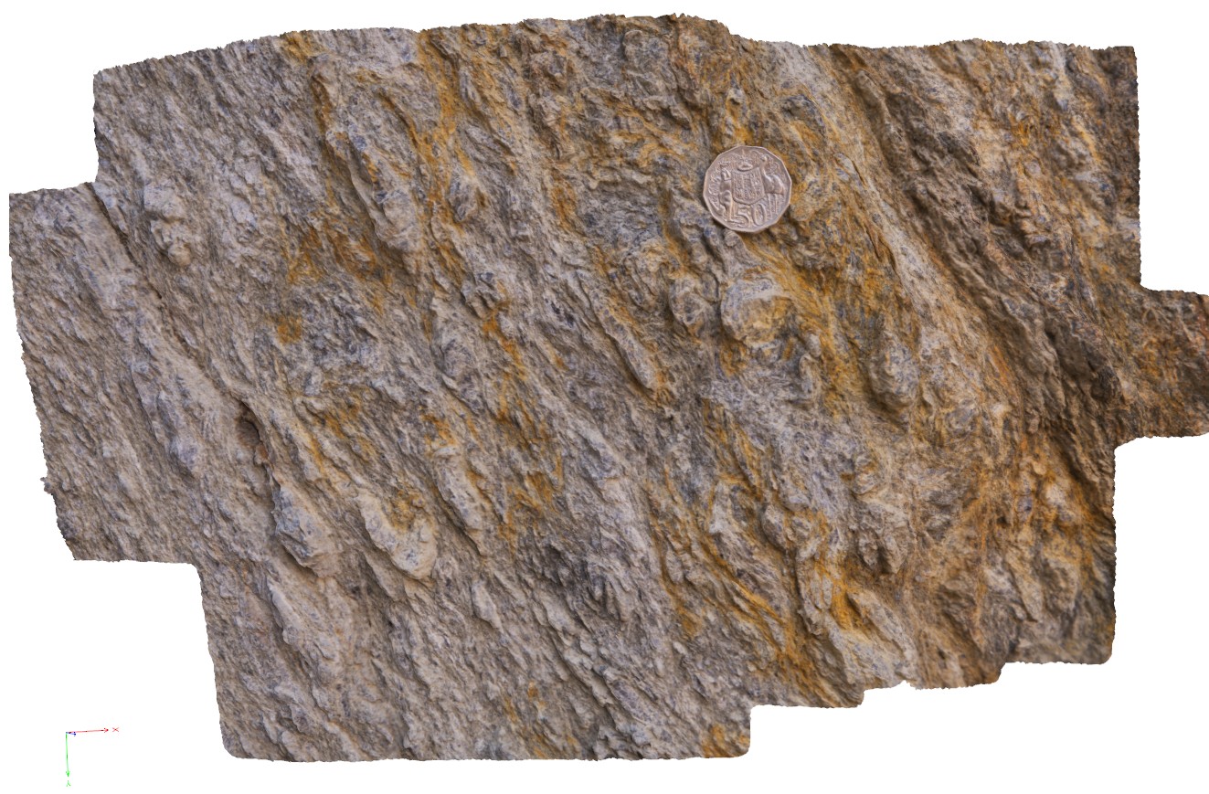
detail of deformation in the footwall of the Avoca Fault, showing development of coarse mica. Ballarat, Vic.
| Capture Date: | June 5, 2016, 10:36 a.m. |
| Latitude: | -37.72817000000 degrees |
| Longitude: | 143.62782000000 degrees |
| Elevation: | NA |
| Visualisation Type: | 3D |
| Location Accuracy: | 0 metres |
Keywords:
- fault zone
- deformation
| schist | |
|---|---|
| Form Type: | bedded |
| Description: | Marine turbiditic sandstone, siltstone, mudstone, black shale; minor granule conglomerate. |
| Min Geological Age: | Darriwilian |
| Max Geological Age: | Cambrian |
| Min Numerical Age: | 450.000 |
| Max Numerical Age: | 490.000 |
| Strat No: | 36202 |
| Supergroup: | |
| Group: | Castlemaine Group |
| Subgroup: | |
| Formation: | |
| Member: | |
| Province: | Bendigo Zone, Lachlan Orogen |