BellinghamUAV1
Site:
BellinghamUAV1
Downloads:
Map
3D Model:
Description:
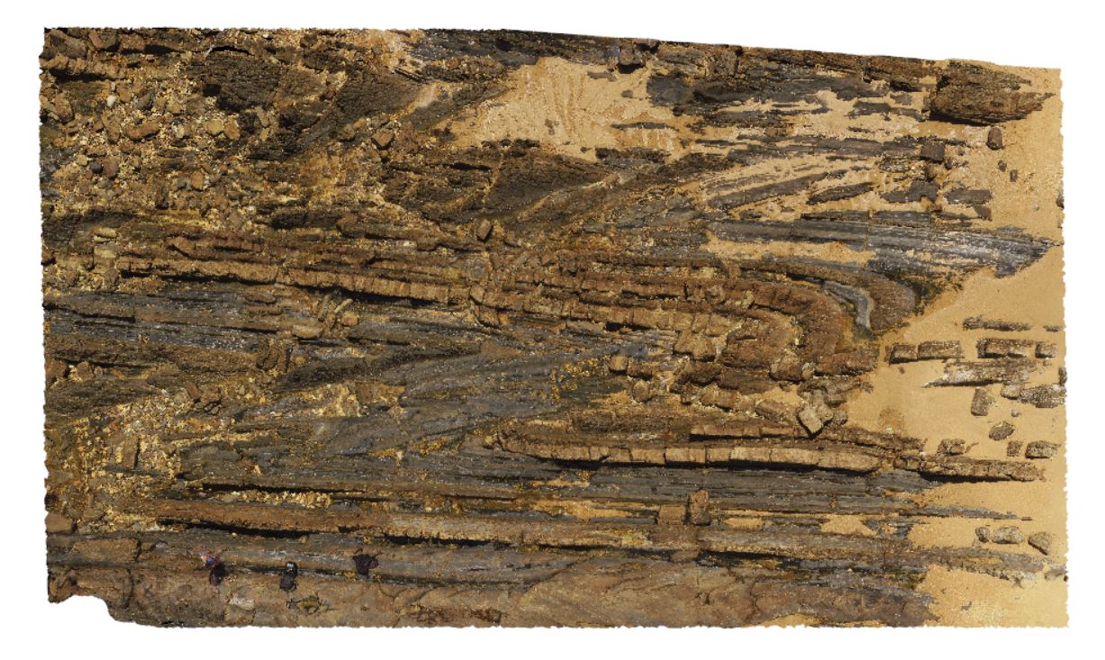
aerial overview of folded and faulted, thick turbidite package at Bellingham, NE Tasmania. View taken from 60m above the ground.
| Capture Date: | Undated |
| Latitude: | -41.00721400000 degrees |
| Longitude: | 147.16257300000 degrees |
| Elevation: | 186.700 metres |
| Visualisation Type: | UAV |
| Location Accuracy: | 20 metres |
Keywords:
- structure
- turbidite package
- fold
- fault
| turbidite | |
|---|---|
| Form Type: | bedded |
| Description: | interbedded turbiditic mudstones, siltstones and sandstones. |
| Min Geological Age: | Wenlock |
| Max Geological Age: | Wenlock |
| Min Numerical Age: | 427.400 |
| Max Numerical Age: | 433.400 |
| Strat No: | 75364 |
| Supergroup: | Mathinna Supergroup |
| Group: | |
| Subgroup: | |
| Formation: | Retreat Formation |
| Member: | |
| Province: |