BellthorpeFSP1
Site:
BellthorpeFSP1
Downloads:
Map
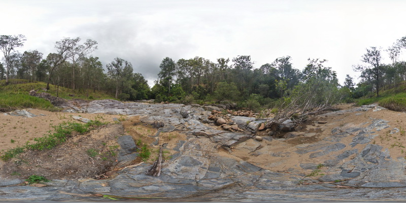
Description:
creek exposure next to Cedarvale Road, showing multiple intrusion phases and xenoliths in granite. Bellthorpe, QLD.
| Capture Date: | April 12, 2016, 1:43 p.m. |
| Latitude: | -26.82772000000 degrees |
| Longitude: | 152.62267000000 degrees |
| Elevation: | NA |
| Visualisation Type: | FSP |
| Location Accuracy: | 20 metres |
Keywords:
- xenolith
- igneous contact
- intrusion
| granite | |
|---|---|
| Form Type: | dyke |
| Description: | granite, with country rock xenoliths and intruded by multiple igneous phases, including grey granodiorite. |
| Min Geological Age: | Late Triassic |
| Max Geological Age: | Late Triassic |
| Min Numerical Age: | 201.300 |
| Max Numerical Age: | 237.000 |
| Strat No: | 31382 |
| Supergroup: | |
| Group: | Neurum Complex |
| Subgroup: | |
| Formation: | |
| Member: | |
| Province: | Wandilla Province |