BluestoneUAV1
Site:
BluestoneUAV1
Downloads:
Map
3D Model:
Description:
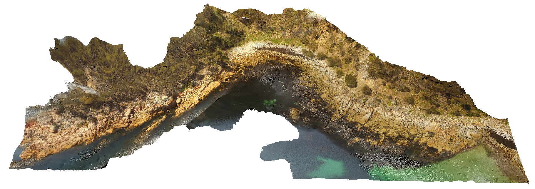
aerial view of Bluestone Bay granodiorite shore exposure, Freycinet. Tasmania.
| Capture Date: | Undated |
| Latitude: | -42.10529100000 degrees |
| Longitude: | 148.33442900000 degrees |
| Elevation: | 24.700 metres |
| Visualisation Type: | UAV |
| Location Accuracy: | 20 metres |
Keywords:
- granite
| granodiorite | |
|---|---|
| Form Type: | batholith |
| Description: | grey biotite-hornblende granodiorite |
| Min Geological Age: | Late Devonian |
| Max Geological Age: | Late Devonian |
| Min Numerical Age: | 371.000 |
| Max Numerical Age: | 374.000 |
| Strat No: | 79585 |
| Supergroup: | |
| Group: | Gardens Suite |
| Subgroup: | |
| Formation: | Bluestone Bay Granodiorite |
| Member: | |
| Province: | Lachlan Orogen |