BurnieUAV1
Site:
BurnieUAV1
Downloads:
Map
3D Model:
Description:
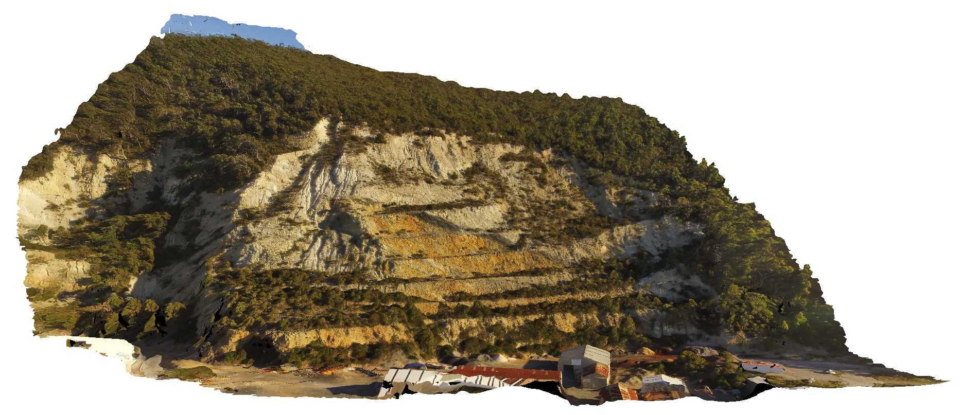
view of large quarry outcrop in quartzite? At the entrance to the township of Burnie. Burnie, north Tas.
| Capture Date: | Undated |
| Latitude: | -41.06717200000 degrees |
| Longitude: | 145.94652400000 degrees |
| Elevation: | 70.000 metres |
| Visualisation Type: | UAV |
| Location Accuracy: | 20 metres |
Keywords:
- quarry
- quartzite
| quartzite | |
|---|---|
| Form Type: | bedded |
| Description: | quartzite beds |
| Min Geological Age: | Cryogenian |
| Max Geological Age: | Cryogenian |
| Min Numerical Age: | 690.000 |
| Max Numerical Age: | 708.000 |
| Strat No: | 14603 |
| Supergroup: | |
| Group: | |
| Subgroup: | |
| Formation: | Oonah Formation |
| Member: | |
| Province: |