Camperdown1
Site:
Camperdown1
Downloads:
Map
3D Model:
Description:
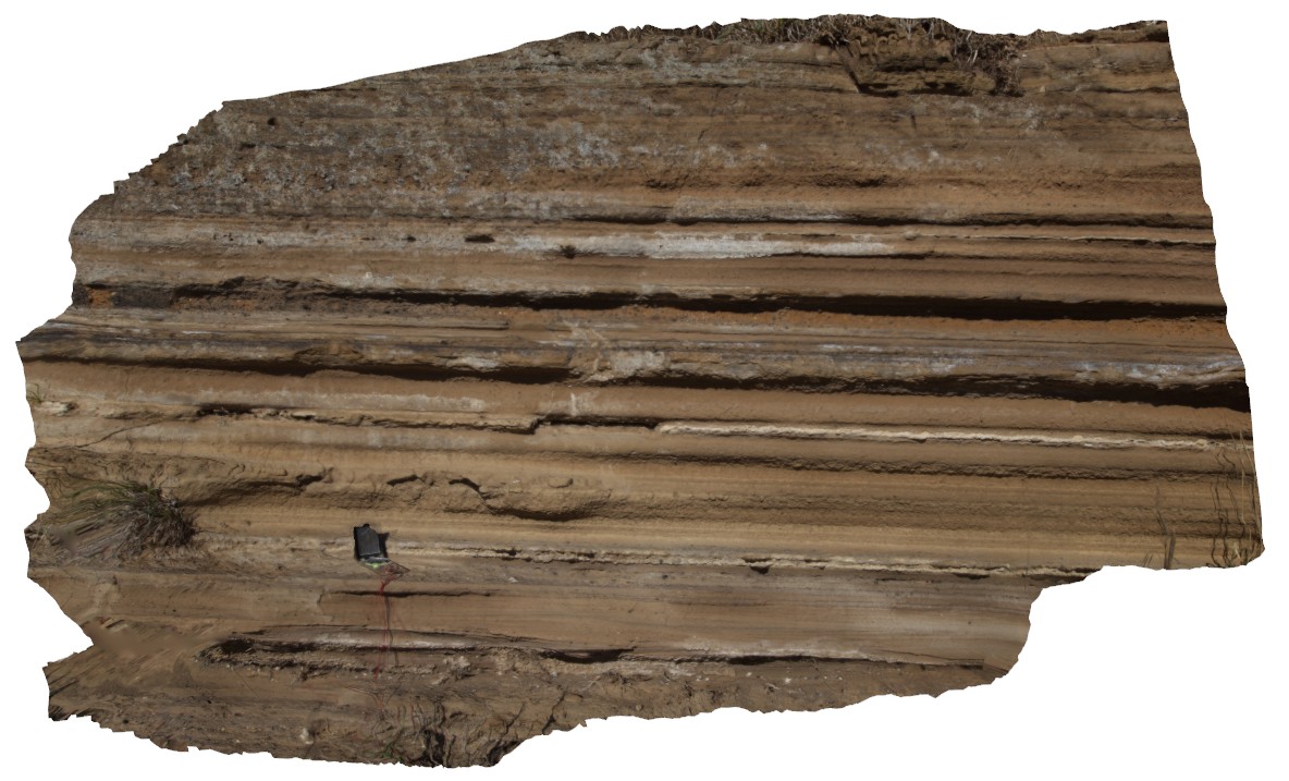
view of Maar volcanic / pyroclastic deposits, showing layered beds and accretionary lapilli. Camperdown, Vic.
| Capture Date: | June 5, 2016, 10:37 a.m. |
| Latitude: | -38.23459000000 degrees |
| Longitude: | 143.09209000000 degrees |
| Elevation: | NA |
| Visualisation Type: | 3D |
| Location Accuracy: | 0 metres |
Keywords:
- tuff
- pyroclastics
- maar volcano
- volcanics
- accretionary lapilli
| pyroclastic | |
|---|---|
| Form Type: | bedded |
| Description: | finely laminated pyroclastic deposits, showing layered beds and accretionary lapilli. |
| Min Geological Age: | Holocene |
| Max Geological Age: | Miocene |
| Min Numerical Age: | 0.100 |
| Max Numerical Age: | 8.500 |
| Strat No: | 38291 |
| Supergroup: | |
| Group: | Newer Volcanic Group |
| Subgroup: | |
| Formation: | |
| Member: | |
| Province: | Bendigo Zone, Lachlan Orogen, Stawell Zone, Torquay Sub-basin |