Canberra2
Site:
Canberra2
Downloads:
Map
3D Model:
Description:
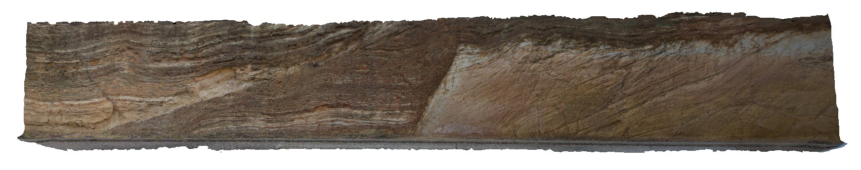
Faults and folds in Silurian metasedimentary rocks of the Canberra Formation at the top and left of the view. There is an angular unconformity between these rocks and the underlying Silurian State Circle Shale. A.C.T.
| Capture Date: | Sept. 8, 2015, 3:34 p.m. |
| Latitude: | -35.30429000000 degrees |
| Longitude: | 149.12701000000 degrees |
| Elevation: | 580.000 metres |
| Visualisation Type: | 3D |
| Location Accuracy: | 5 metres |
Keywords:
- folds
- faults
- structure
- unconformity
| sandstone | |
|---|---|
| Form Type: | bedded |
| Description: | Interbedded fine to medium sandstone and sandy mudstone |
| Min Geological Age: | Silurian |
| Max Geological Age: | Silurian |
| Min Numerical Age: | 419.000 |
| Max Numerical Age: | 433.000 |
| Strat No: | 24208 |
| Supergroup: | |
| Group: | |
| Subgroup: | |
| Formation: | Canberra Formation |
| Member: | Camp Hill Sandstone |
| Province: | Lachlan Orogen |
| shale | |
|---|---|
| Form Type: | bedded |
| Description: | Shale / siltstone |
| Min Geological Age: | Silurian |
| Max Geological Age: | Silurian |
| Min Numerical Age: | 433.000 |
| Max Numerical Age: | 440.000 |
| Strat No: | 17298 |
| Supergroup: | |
| Group: | |
| Subgroup: | |
| Formation: | State Circle Shale |
| Member: | |
| Province: | Lachlan Orogen |