CapeArid13
Site:
CapeArid13
Downloads:
Map
3D Model:
Description:
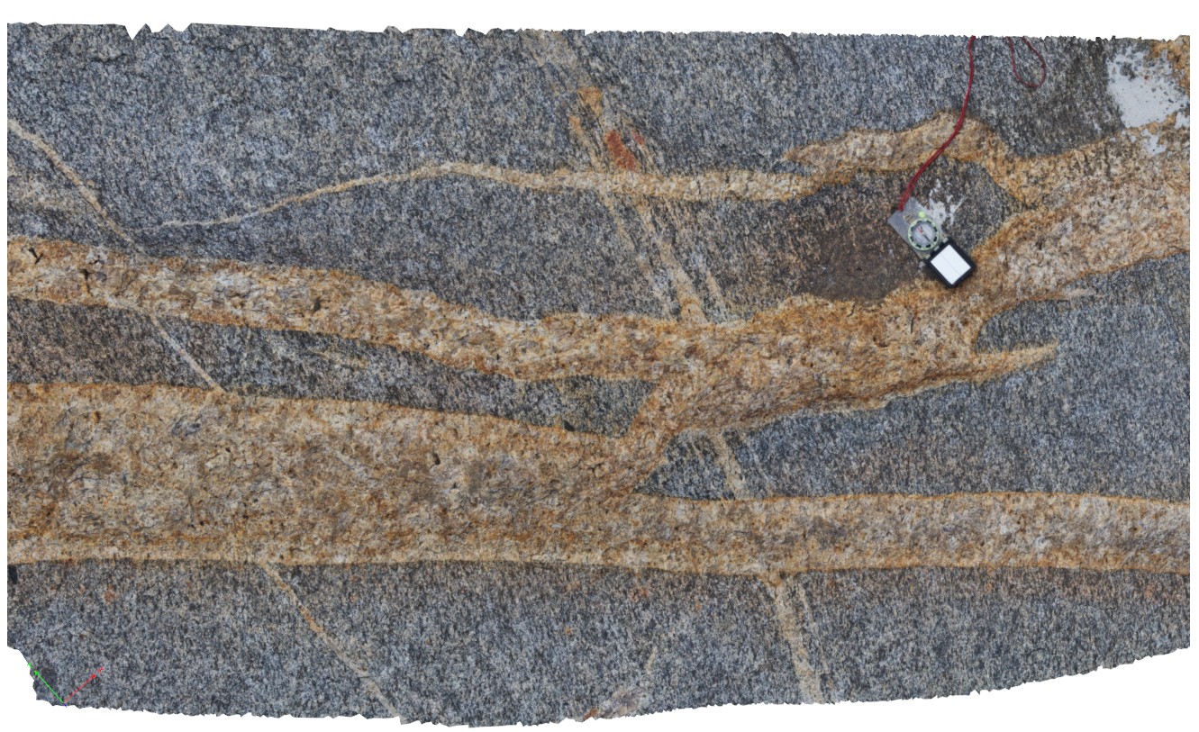
view of cross-cutting relationship between pegmatite dykes in gneiss. Selvage alteration apparent in dykes close to contact with wall rock. Cape Arid, W.A.
| Capture Date: | June 5, 2016, 10:36 a.m. |
| Latitude: | -33.87418000000 degrees |
| Longitude: | 123.00500000000 degrees |
| Elevation: | NA |
| Visualisation Type: | 3D |
| Location Accuracy: | 0 metres |
Keywords:
- gneiss
- pegmatite dyke
- cross cutting relationship
| gneiss | |
|---|---|
| Form Type: | |
| Description: | garnet-biotite-quartz-feldspar gneiss containing feldspar augen. |
| Min Geological Age: | |
| Max Geological Age: | |
| Min Numerical Age: | 0.000 |
| Max Numerical Age: | 0.000 |
| Strat No: | 0 |
| Supergroup: | |
| Group: | |
| Subgroup: | |
| Formation: | |
| Member: | |
| Province: |
| pegmatite | |
|---|---|
| Form Type: | dyke |
| Description: | age unknown |
| Min Geological Age: | |
| Max Geological Age: | |
| Min Numerical Age: | 0.000 |
| Max Numerical Age: | 0.000 |
| Strat No: | 0 |
| Supergroup: | |
| Group: | |
| Subgroup: | |
| Formation: | |
| Member: | |
| Province: |