CapeBridgewater8
Site:
CapeBridgewater8
Downloads:
Map
3D Model:
Description:
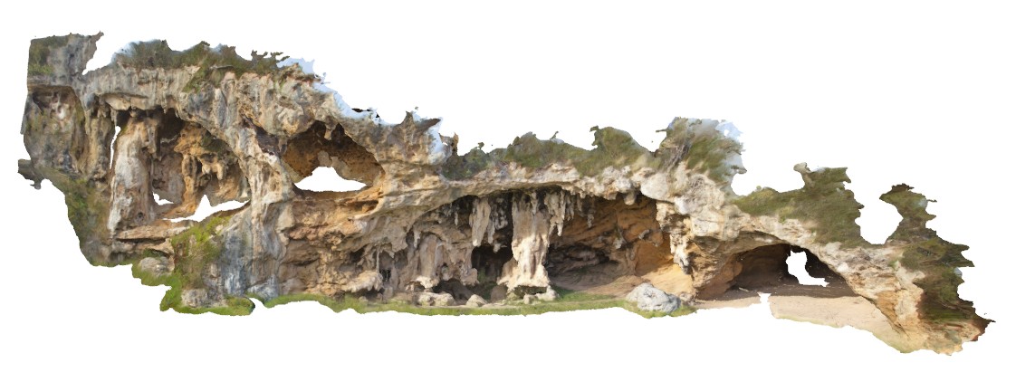
view of cave complex in Pleistocene, cross-bedded, calcareous sandstone?, with stalactites and stalagmites. Cape Bridgewater, Vic.
| Capture Date: | June 5, 2016, 10:39 a.m. |
| Latitude: | -38.31902000000 degrees |
| Longitude: | 141.40817000000 degrees |
| Elevation: | NA |
| Visualisation Type: | 3D |
| Location Accuracy: | 0 metres |
Keywords:
- cave
- calcareous sandstone
- stalactites
- stalagmites
| sandstone | |
|---|---|
| Form Type: | bedded |
| Description: | Poorly consolidated yellow pinkish-brown fine to coarse fossiliferous calcareous sand, calcarenite. Locally capped by calcrete. |
| Min Geological Age: | Late Pleistocene |
| Max Geological Age: | Pleistocene |
| Min Numerical Age: | 0.012 |
| Max Numerical Age: | 0.690 |
| Strat No: | 2543 |
| Supergroup: | |
| Group: | |
| Subgroup: | |
| Formation: | Bridgewater Formation |
| Member: | |
| Province: | Eucla Basin, Murray Basin, St Vincent Basin |