CapeLeGrandeUAV1
Site:
CapeLeGrandeUAV1
Downloads:
Map
3D Model:
Description:
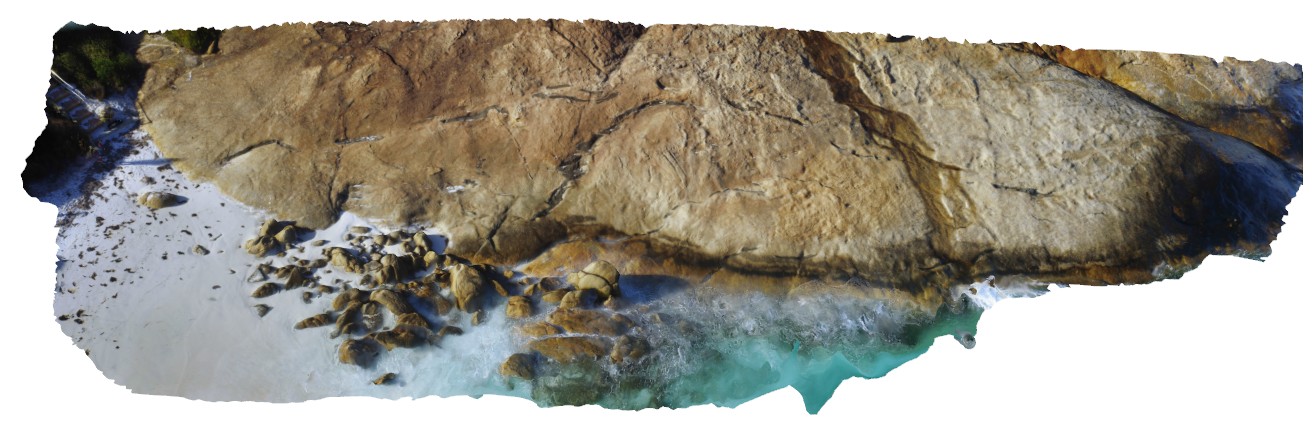
aerial view of disaggregated mafic dykes in gneiss, Cape Le Grande. South coast W.A.
| Capture Date: | Undated |
| Latitude: | -34.00378000000 degrees |
| Longitude: | 122.16901000000 degrees |
| Elevation: | NA |
| Visualisation Type: | UAV |
| Location Accuracy: | 0 metres |
Keywords:
- disaggregated mafic dyke
- gneiss
| gneiss | |
|---|---|
| Form Type: | |
| Description: | alternating bands and mixed rock composed of lath granite and gneiss in varying proportions. |
| Min Geological Age: | |
| Max Geological Age: | |
| Min Numerical Age: | 0.000 |
| Max Numerical Age: | 0.000 |
| Strat No: | 0 |
| Supergroup: | |
| Group: | |
| Subgroup: | |
| Formation: | |
| Member: | |
| Province: |
| mafic | |
|---|---|
| Form Type: | dyke |
| Description: | mafic dyke |
| Min Geological Age: | |
| Max Geological Age: | |
| Min Numerical Age: | 0.000 |
| Max Numerical Age: | 0.000 |
| Strat No: | 0 |
| Supergroup: | |
| Group: | |
| Subgroup: | |
| Formation: | |
| Member: | |
| Province: |