CapeWickham1
Site:
CapeWickham1
Downloads:
Map
3D Model:
Description:
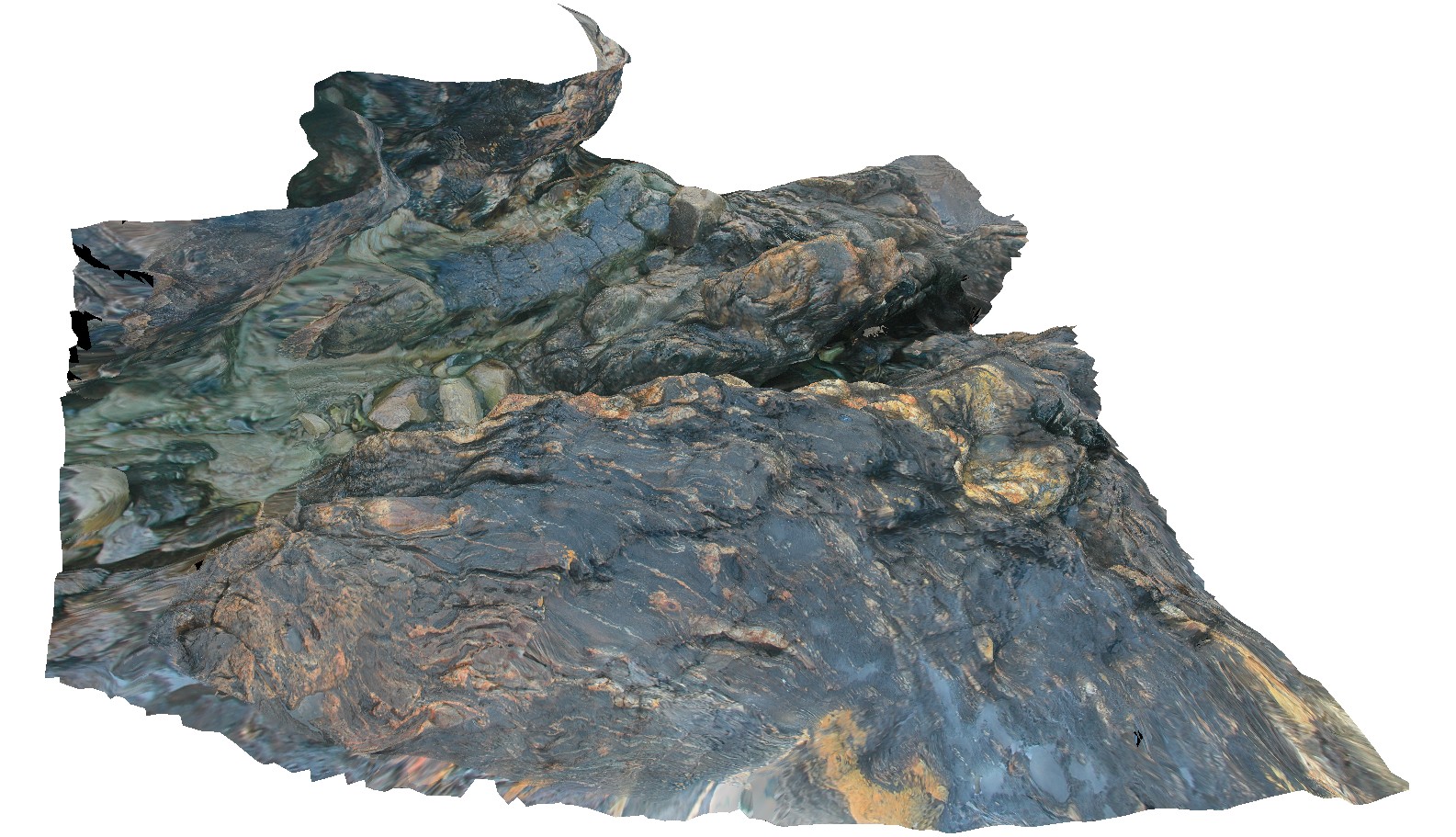
complex folding in metasediments and felsic dyke. Cape Wickham, King Island. Tasmania.
| Capture Date: | April 22, 2016, 9:57 a.m. |
| Latitude: | -39.59208286000 degrees |
| Longitude: | 143.92775993000 degrees |
| Elevation: | 2.000 metres |
| Visualisation Type: | 3D |
| Location Accuracy: | 5 metres |
Keywords:
- fold
- structure
| metasediments | |
|---|---|
| Form Type: | bedded |
| Description: | fine to medium-grained metasediments |
| Min Geological Age: | Mesoproterozoic |
| Max Geological Age: | Mesoproterozoic |
| Min Numerical Age: | 1290.000 |
| Max Numerical Age: | 1350.000 |
| Strat No: | 41157 |
| Supergroup: | |
| Group: | |
| Subgroup: | |
| Formation: | Surprise Bay Formation |
| Member: | |
| Province: |