CapeWickham4
Site:
CapeWickham4
Downloads:
Map
3D Model:
Description:
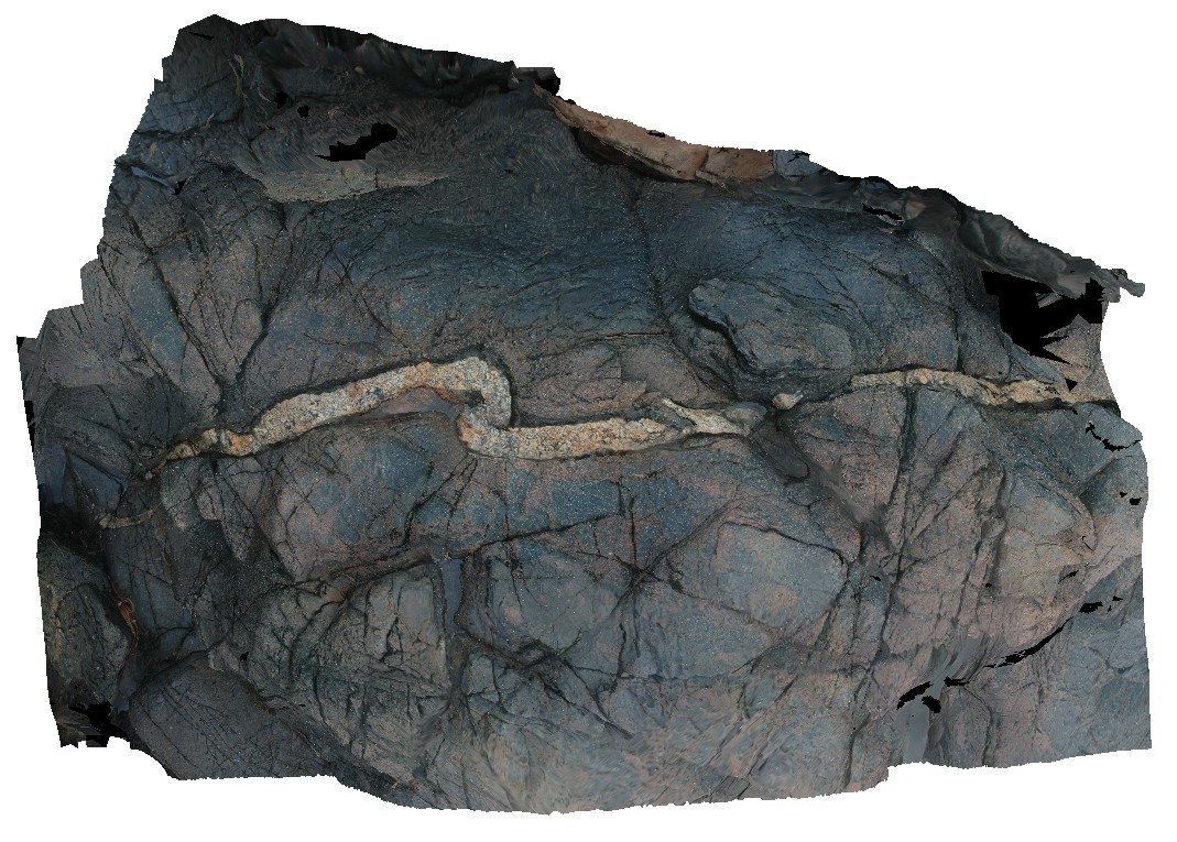
folded mafic intrusion? With cross cutting felsic dyke. Cape Wickham, King Island. Tasmania.
| Capture Date: | March 16, 2015, 2:24 p.m. |
| Latitude: | -39.59227327000 degrees |
| Longitude: | 143.92778293000 degrees |
| Elevation: | 2.000 metres |
| Visualisation Type: | 3D |
| Location Accuracy: | 5 metres |
Keywords:
- mafic dyke
- felsic dyke
- deformation
- folding
- structure
| dolerite | |
|---|---|
| Form Type: | dyke |
| Description: | medium-grained dolerite dyke |
| Min Geological Age: | |
| Max Geological Age: | |
| Min Numerical Age: | 0.000 |
| Max Numerical Age: | 0.000 |
| Strat No: | 0 |
| Supergroup: | |
| Group: | |
| Subgroup: | |
| Formation: | |
| Member: | |
| Province: |
| felsic | |
|---|---|
| Form Type: | dyke |
| Description: | Coarse-grained felsic dyke. |
| Min Geological Age: | |
| Max Geological Age: | |
| Min Numerical Age: | 0.000 |
| Max Numerical Age: | 0.000 |
| Strat No: | 0 |
| Supergroup: | |
| Group: | |
| Subgroup: | |
| Formation: | |
| Member: | |
| Province: |