ConranFSP2
Site:
ConranFSP2
Downloads:
Map
Description:
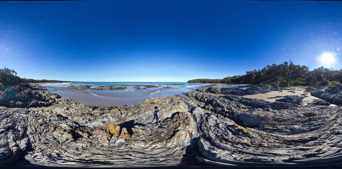
Folded and faulted turbiditic metasediments of the Ordovician Pinnak Sandstone. Cape Conran, Vic.
| Capture Date: | Sept. 2, 2015, 1:33 p.m. |
| Latitude: | -37.80036000000 degrees |
| Longitude: | 148.74254000000 degrees |
| Elevation: | 1.000 metres |
| Visualisation Type: | FSP |
| Location Accuracy: | 5 metres |
Keywords:
- turbidite
- fold
- structure
- sedimentology
| turbidite | |
|---|---|
| Form Type: | bedded |
| Description: | thinly bedded turbidite units consisting of fine sandstone and siltstone. Intensely deformed |
| Min Geological Age: | Ordovician |
| Max Geological Age: | Ordovician |
| Min Numerical Age: | 458.000 |
| Max Numerical Age: | 467.000 |
| Strat No: | 23907 |
| Supergroup: | |
| Group: | Adaminaby Group |
| Subgroup: | |
| Formation: | Pinnak Sandstone |
| Member: | |
| Province: | Lachlan Orogen |