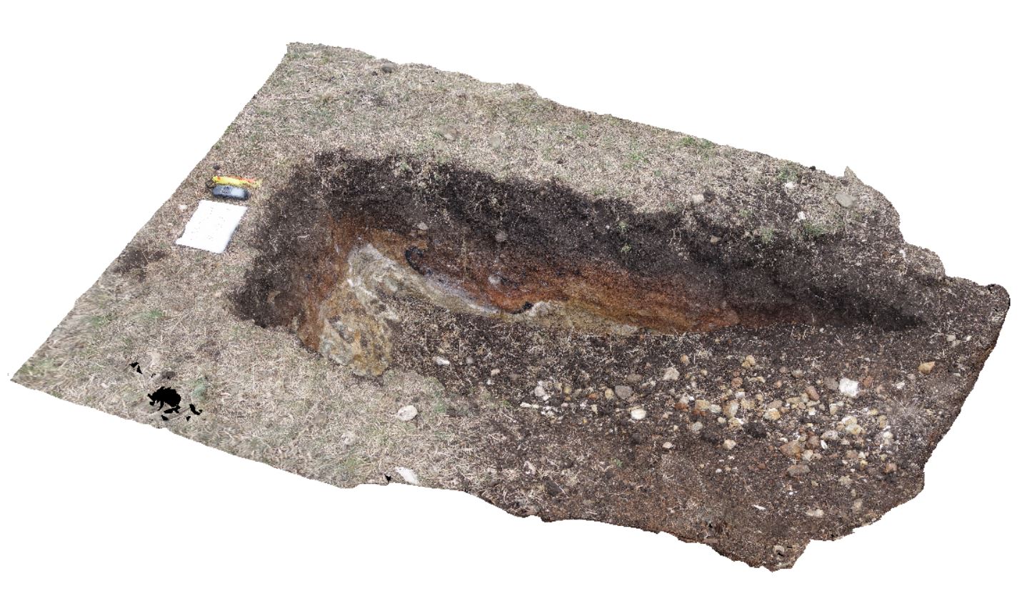
DaisyBanksPit10
Site:
DaisyBanksPit10
Downloads:
Map
3D Model:
Description:
~80cm deep pit into Cenozoic soil and clays overlying (inferred) Jurassic Dolerite. Richmond, Tas.
| Capture Date: | March 23, 2015, 11:20 a.m. |
| Latitude: | -42.73042400000 degrees |
| Longitude: | 147.42464400000 degrees |
| Elevation: | NA |
| Visualisation Type: | 3D |
| Location Accuracy: | 20 metres |
Keywords:
- Jurassic Dolerite
- Clay
- Alluvial
- regolith
| Clay | |
|---|---|
| Form Type: | |
| Description: | Undifferentiated alluvial dark grey soil overlying brown and white dolerite clays. |
| Min Geological Age: | Holocene |
| Max Geological Age: | Holocene |
| Min Numerical Age: | 0.000 |
| Max Numerical Age: | 0.012 |
| Strat No: | 0 |
| Supergroup: | |
| Group: | |
| Subgroup: | |
| Formation: | |
| Member: | |
| Province: |