DaisyBanksPit13
Site:
DaisyBanksPit13
Downloads:
Map
3D Model:
Description:
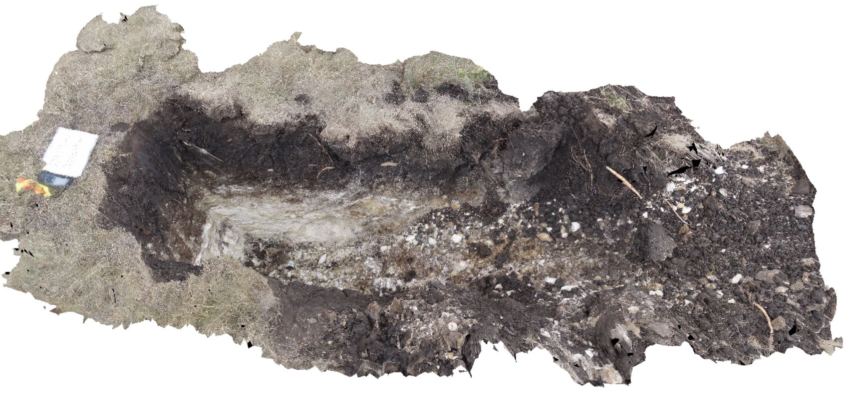
~80cm pit into dark grey sandy soils and white-brown sandy clay overlying Jurassic Dolerite. Richmond, Tas.
| Capture Date: | March 23, 2015, 12:07 p.m. |
| Latitude: | -42.72961200000 degrees |
| Longitude: | 147.42258600000 degrees |
| Elevation: | NA |
| Visualisation Type: | 3D |
| Location Accuracy: | 20 metres |
Keywords:
- clay
- Jurassic Dolerite
- regolith
| clay | |
|---|---|
| Form Type: | |
| Description: | Moderately well drained brown soils developed on Jurassic Dolerite bedrock and colluvium. |
| Min Geological Age: | Holocene |
| Max Geological Age: | Holocene |
| Min Numerical Age: | 0.000 |
| Max Numerical Age: | 0.012 |
| Strat No: | 0 |
| Supergroup: | |
| Group: | |
| Subgroup: | |
| Formation: | |
| Member: | |
| Province: |