DixonRangeUAV1
Site:
DixonRangeUAV1
Downloads:
Map
3D Model:
Description:
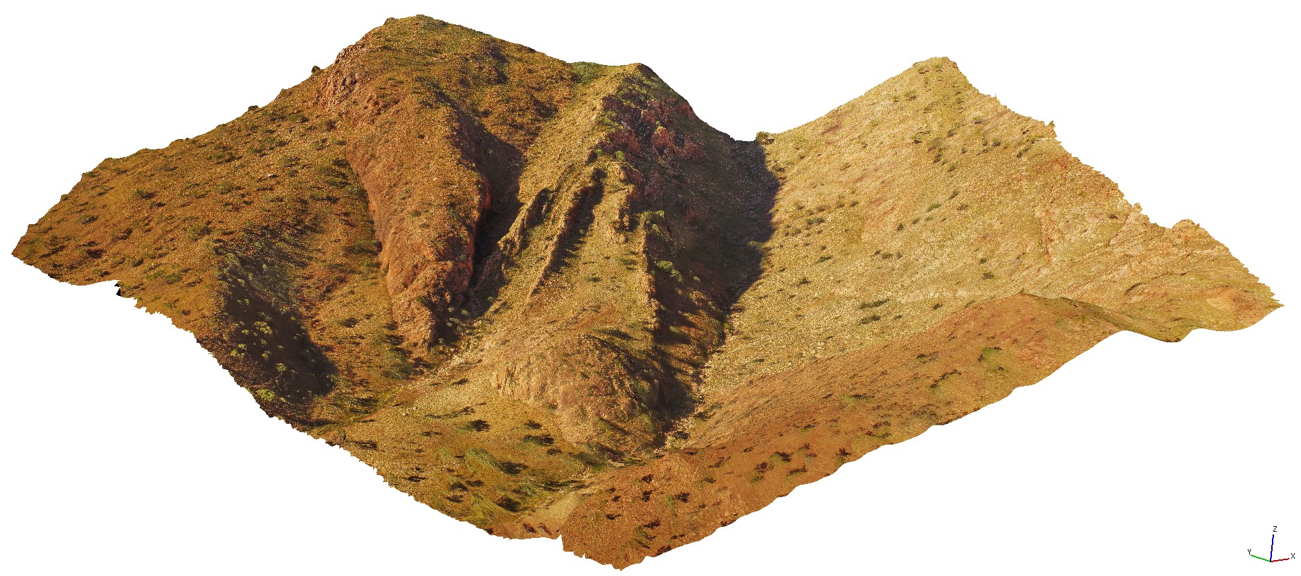
aerial view of steep faults in metasediments. Road to Dixon Range, W.A.
| Capture Date: | June 14, 2016, noon |
| Latitude: | -17.17800000000 degrees |
| Longitude: | 128.25186000000 degrees |
| Elevation: | NA |
| Visualisation Type: | UAV |
| Location Accuracy: | 0 metres |
Keywords:
- steep fault
- metasediments
- structure
| metasediments | |
|---|---|
| Form Type: | bedded |
| Description: | Metamorphosed greywacke, lithic sandstone, siltstone, mudstone, basalt, dolerite; carbonate rocks including calcareous siltstone and sandstone |
| Min Geological Age: | Neoproterozoic |
| Max Geological Age: | Orosirian |
| Min Numerical Age: | 541.000 |
| Max Numerical Age: | 1800.000 |
| Strat No: | 30609 |
| Supergroup: | |
| Group: | |
| Subgroup: | |
| Formation: | Texas Downs Formation |
| Member: | |
| Province: | Texas Downs Basin |