Dudley18
Site:
Dudley18
Downloads:
Map
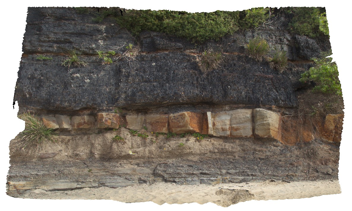
3D Model:
Description:
view showing the base of the 'Victoria Tunnel Seam' with floodplain sediments and channels. Dudley Beach, N.S.W.
| Capture Date: | Undated |
| Latitude: | -32.97065000000 degrees |
| Longitude: | 151.73265000000 degrees |
| Elevation: | NA |
| Visualisation Type: | 3D |
| Location Accuracy: | 5 metres |
Keywords:
- Victoria Tunnel Coal Seam
- floodplain sediments
- channel
- sedimentology
| coal | |
|---|---|
| Form Type: | bedded |
| Description: | Coal seams, claystone (tuffaceous), siltstone, sandstone, conglomerate. Medium to coarse-grained sandstone (Watts Sandstone). |
| Min Geological Age: | Late Permian |
| Max Geological Age: | Late Permian |
| Min Numerical Age: | 252.000 |
| Max Numerical Age: | 256.000 |
| Strat No: | 27861 |
| Supergroup: | Singleton Supergroup |
| Group: | Newcastle Coal Measures |
| Subgroup: | |
| Formation: | |
| Member: | |
| Province: | Lachlan Orogen, Sydney Basin |