EaglehawkFSP1
Site:
EaglehawkFSP1
Downloads:
Map
Description:
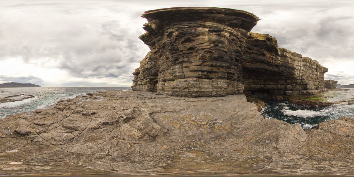
view from sea level platform of Permian pavement and layered buttress (Fossil Island). Eaglehawk Neck, Tasmania.
| Capture Date: | Undated |
| Latitude: | -43.03342000000 degrees |
| Longitude: | 147.94910000000 degrees |
| Elevation: | NA |
| Visualisation Type: | FSP |
| Location Accuracy: | 5 metres |
Keywords:
- Permian sediments
- sedimentology
| siltstone | |
|---|---|
| Form Type: | bedded |
| Description: | layered Permian siltstones and sandstones, with fossiliferous beds. |
| Min Geological Age: | Wordian |
| Max Geological Age: | Kungurian |
| Min Numerical Age: | 265.100 |
| Max Numerical Age: | 283.500 |
| Strat No: | 11075 |
| Supergroup: | Parmeener Supergroup |
| Group: | |
| Subgroup: | |
| Formation: | Malbina Formation |
| Member: | |
| Province: | Tasmania Basin |