EaglehawkUAV2
Site:
EaglehawkUAV2
Downloads:
Map
3D Model:
Description:
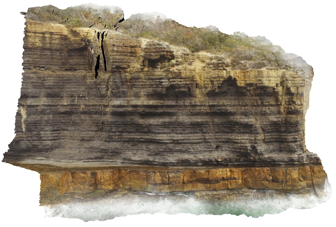
aerial view from the water of cliff, showing finely layered fine-grained mudstones / siltstones overlying blocky silt / sandstone beds. Eaglehawk Neck, Tasmania.
| Capture Date: | Undated |
| Latitude: | -43.03425300000 degrees |
| Longitude: | 147.94985100000 degrees |
| Elevation: | 41.000 metres |
| Visualisation Type: | UAV |
| Location Accuracy: | 20 metres |
Keywords:
- sedimentology
- sediments
- Parmeener Supergroup
| sediments | |
|---|---|
| Form Type: | bedded |
| Description: | layered Permian siltstones and sandstones, with fossiliferous beds. |
| Min Geological Age: | Late Triassic |
| Max Geological Age: | Late Carboniferous |
| Min Numerical Age: | 208.500 |
| Max Numerical Age: | 323.200 |
| Strat No: | 14900 |
| Supergroup: | Parmeener Supergroup |
| Group: | |
| Subgroup: | |
| Formation: | |
| Member: | |
| Province: | Melbourne-Mathinna Zone |