Elery1
Site:
Elery1
Downloads:
Map
3D Model:
Description:
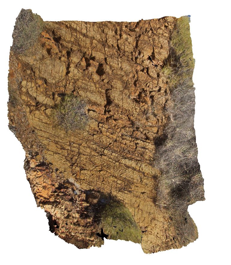
jointed and fractured dolostone layers west of Ellery Creek, Amadeus Basin. Ellery Creek Big Hole Dive. West MacDonnell National Park, N.T.
| Capture Date: | Aug. 2, 2016, 4:08 p.m. |
| Latitude: | -23.77911900000 degrees |
| Longitude: | 133.06724100000 degrees |
| Elevation: | 694.022 metres |
| Visualisation Type: | 3D |
| Location Accuracy: | 5 metres |
Keywords:
- dolostone
- sedimentology
- Amadeus Basin
- fracture
- joint
| dolostone | |
|---|---|
| Form Type: | bedded |
| Description: | layered, buff-coloured dolostone with abundant jointing and cracking. |
| Min Geological Age: | Cryogenian |
| Max Geological Age: | Tonian |
| Min Numerical Age: | 767.000 |
| Max Numerical Age: | 896.000 |
| Strat No: | 79261 |
| Supergroup: | |
| Group: | Bitter Springs Group |
| Subgroup: | |
| Formation: | |
| Member: | |
| Province: | Amadeus Basin |