Elery13
Site:
Elery13
Downloads:
Map
3D Model:
Description:
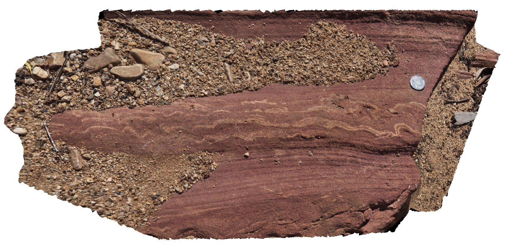
de-watering structures in red sandstone. Ellery Creek Big Hole. West MacDonnell National Park, N.T.
| Capture Date: | Undated |
| Latitude: | -23.79575000000 degrees |
| Longitude: | 133.07437000000 degrees |
| Elevation: | NA |
| Visualisation Type: | 3D |
| Location Accuracy: | 5 metres |
Keywords:
- de-watering structure
- sedimentology
- sandstone
| sandstone | |
|---|---|
| Form Type: | bedded |
| Description: | red sandstone with de-watering structures |
| Min Geological Age: | Cryogenian |
| Max Geological Age: | Cryogenian |
| Min Numerical Age: | 635.000 |
| Max Numerical Age: | 720.000 |
| Strat No: | 8223 |
| Supergroup: | |
| Group: | |
| Subgroup: | |
| Formation: | Heavitree Formation |
| Member: | |
| Province: | Amadeus Basin |