Elery4
Site:
Elery4
Downloads:
Map
3D Model:
Description:
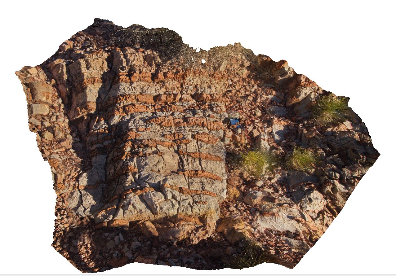
Fe-oxide rich layers in dolostone (blue rock). Ellery Creek Big Hole Dive. West MacDonnell National Park, N.T.
| Capture Date: | Aug. 2, 2016, 5:10 p.m. |
| Latitude: | -23.78378700000 degrees |
| Longitude: | 133.07203600000 degrees |
| Elevation: | 670.707 metres |
| Visualisation Type: | 3D |
| Location Accuracy: | 5 metres |
Keywords:
- dolostone
- Ellery Creek Big Hole
- sedimentology
| dolostone | |
|---|---|
| Form Type: | bedded |
| Description: | discontinuous Fe-oxide rich layers in bedded dolostone |
| Min Geological Age: | Cryogenian |
| Max Geological Age: | Tonian |
| Min Numerical Age: | 767.000 |
| Max Numerical Age: | 896.000 |
| Strat No: | 79261 |
| Supergroup: | |
| Group: | Bitter Springs Group |
| Subgroup: | |
| Formation: | |
| Member: | |
| Province: | Amadeus Basin |