Elery7
Site:
Elery7
Downloads:
Map
3D Model:
Description:
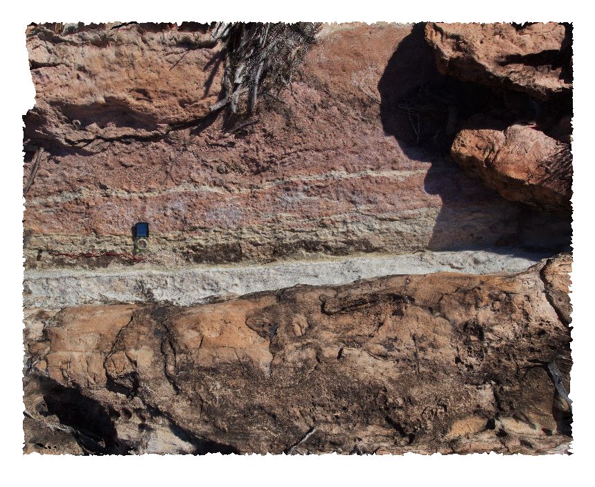
contact between dolostone (red, white) and sandstone (yellow) layers. Ellery Creek Big Hole Dive. West MacDonnell National Park, N.T.
| Capture Date: | Undated |
| Latitude: | -23.81763000000 degrees |
| Longitude: | 133.63610000000 degrees |
| Elevation: | NA |
| Visualisation Type: | 3D |
| Location Accuracy: | 5 metres |
Keywords:
- geological contact
- sedimentology
| sandstone | |
|---|---|
| Form Type: | bedded |
| Description: | Fine-, medium- or coarse-grained, planar and cross-bedded, variably feldspathic quartzose sandstone |
| Min Geological Age: | Cryogenian |
| Max Geological Age: | Cryogenian |
| Min Numerical Age: | 635.000 |
| Max Numerical Age: | 720.000 |
| Strat No: | 8223 |
| Supergroup: | |
| Group: | |
| Subgroup: | |
| Formation: | Heavitree Formation |
| Member: | |
| Province: | Amadeus Basin |
| dolostone | |
|---|---|
| Form Type: | bedded |
| Description: | red and white banded dolostone |
| Min Geological Age: | Cryogenian |
| Max Geological Age: | Tonian |
| Min Numerical Age: | 767.000 |
| Max Numerical Age: | 896.000 |
| Strat No: | 79261 |
| Supergroup: | |
| Group: | Bitter Springs Group |
| Subgroup: | |
| Formation: | |
| Member: | |
| Province: | Amadeus Basin |