Emu5
Site:
Emu5
Downloads:
Map
3D Model:
Description:
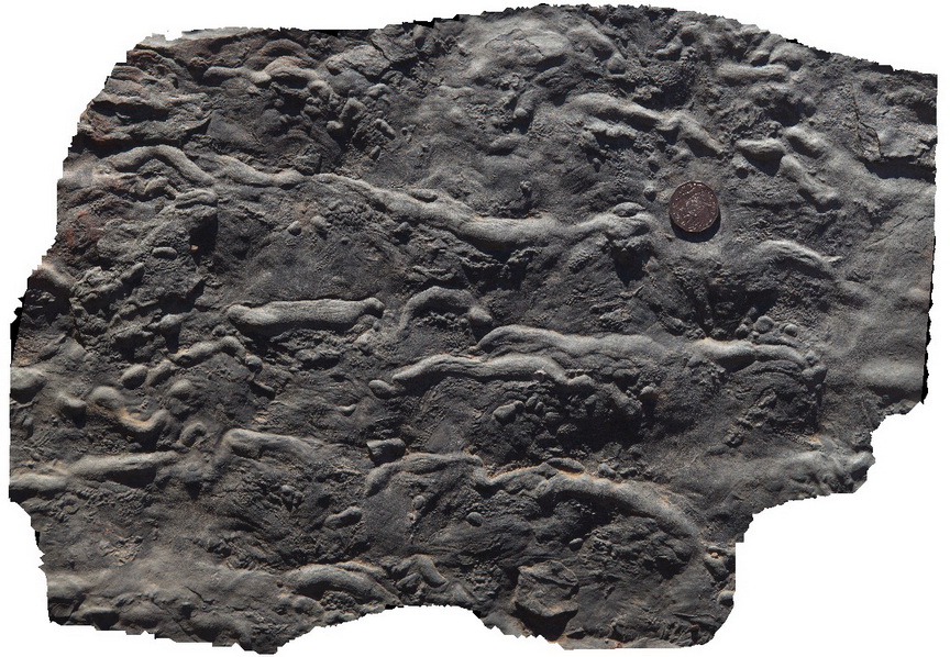
trilobite feeding tracks in shale, Emu Bay, Kangaroo Island. S.A.
| Capture Date: | Nov. 11, 2015, 12:36 p.m. |
| Latitude: | -35.57024000000 degrees |
| Longitude: | 137.57770000000 degrees |
| Elevation: | NA |
| Visualisation Type: | 3D |
| Location Accuracy: | 0 metres |
Keywords:
- trilobite feeding track
- sedimentology
- fossil
- palaeontology
| shale | |
|---|---|
| Form Type: | bedded |
| Description: | micaceous shale? Silty shale, with trilobite feeding trackways |
| Min Geological Age: | Early Cambrian |
| Max Geological Age: | Early Cambrian |
| Min Numerical Age: | 509.000 |
| Max Numerical Age: | 541.000 |
| Strat No: | 6152 |
| Supergroup: | Moralana Supergroup |
| Group: | |
| Subgroup: | |
| Formation: | Emu Bay Shale |
| Member: | |
| Province: | Delamerian Orogen, Stansbury Basin |