Fishery13
Site:
Fishery13
Downloads:
Map
3D Model:
Description:
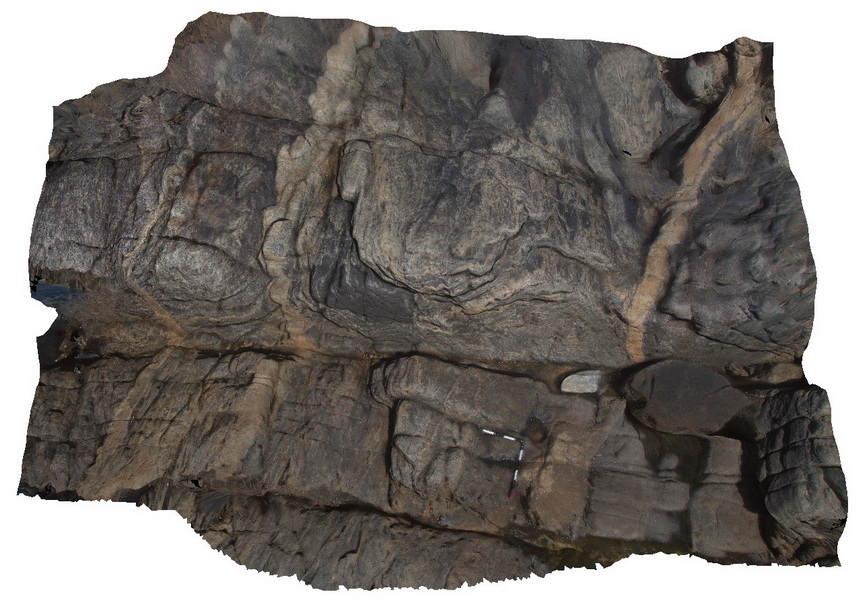
folds and shearing of intruding dykes in gneiss. Fisherys Bay, S.A.
| Capture Date: | Nov. 6, 2015, 9:56 a.m. |
| Latitude: | -34.91346000000 degrees |
| Longitude: | 135.69218000000 degrees |
| Elevation: | NA |
| Visualisation Type: | 3D |
| Location Accuracy: | 0 metres |
Keywords:
- folding
- shearing
- intrusive contact
| gneiss | |
|---|---|
| Form Type: | |
| Description: | fine-grained, banded gneiss intruded by felsic? Dykes. |
| Min Geological Age: | Siderian |
| Max Geological Age: | Neoarchean |
| Min Numerical Age: | 2300.000 |
| Max Numerical Age: | 2450.000 |
| Strat No: | 28206 |
| Supergroup: | Sleaford Complex |
| Group: | |
| Subgroup: | |
| Formation: | Carnot Gneiss |
| Member: | |
| Province: |
| felsic | |
|---|---|
| Form Type: | dyke |
| Description: | felsic dyke, age unknown |
| Min Geological Age: | |
| Max Geological Age: | |
| Min Numerical Age: | 0.000 |
| Max Numerical Age: | 0.000 |
| Strat No: | 0 |
| Supergroup: | |
| Group: | |
| Subgroup: | |
| Formation: | |
| Member: | |
| Province: |