FisheryFSP6
Site:
FisheryFSP6
Downloads:
Map
Description:
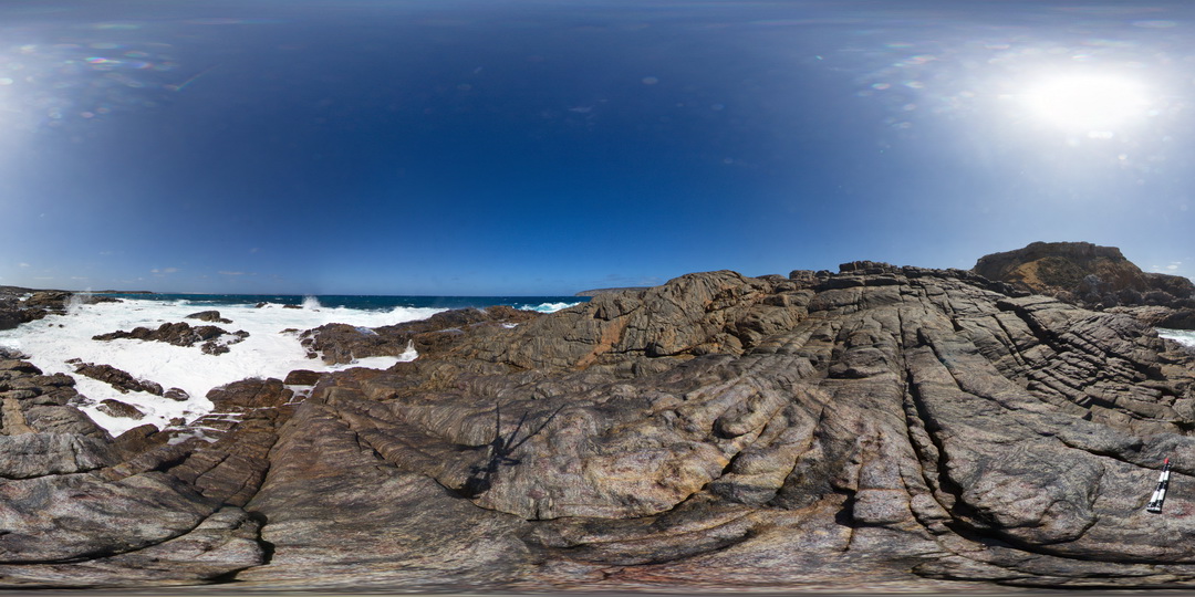
view of exposed shore platform, showing finely banded and folded gneiss with garnet porphyroblasts. Fishery Bay, S.A.
| Capture Date: | Oct. 27, 2015, 9:26 a.m. |
| Latitude: | -34.91376000000 degrees |
| Longitude: | 135.69217000000 degrees |
| Elevation: | NA |
| Visualisation Type: | FSP |
| Location Accuracy: | 0 metres |
Keywords:
- porphyroblasts
- gneiss
- fold
- banding
| gneiss | |
|---|---|
| Form Type: | |
| Description: | fine-grained, banded gneiss with garnet porphyroblasts intruded by felsic? Dykes. |
| Min Geological Age: | Siderian |
| Max Geological Age: | Neoarchean |
| Min Numerical Age: | 2300.000 |
| Max Numerical Age: | 2450.000 |
| Strat No: | 28206 |
| Supergroup: | Sleaford Complex |
| Group: | |
| Subgroup: | |
| Formation: | Carnot Gneiss |
| Member: | |
| Province: |