GibbRiver23
Site:
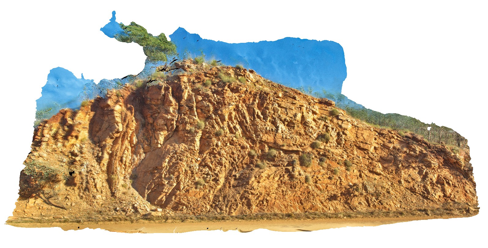
GibbRiver23
Downloads:
Map
3D Model:
Description:
folding and faulting of sandstone beds, associated with the Broadhurst thrust Fault. Derby - Gibb River Road, W.A.
| Capture Date: | June 6, 2016, noon |
| Latitude: | -17.12448000000 degrees |
| Longitude: | 125.24685000000 degrees |
| Elevation: | NA |
| Visualisation Type: | 3D |
| Location Accuracy: | 0 metres |
Keywords:
- fault
- fold
- structure
- Broadhurst Fault
- sandstone
| sandstone | |
|---|---|
| Form Type: | bedded |
| Description: | White to pale brown, medium- to coarse-grained quartz sandstone and pebbly quartz sandstone. |
| Min Geological Age: | Statherian |
| Max Geological Age: | Orosirian |
| Min Numerical Age: | 1790.000 |
| Max Numerical Age: | 1834.000 |
| Strat No: | 9602 |
| Supergroup: | |
| Group: | Kimberley Group |
| Subgroup: | |
| Formation: | King Leopold Sandstone |
| Member: | |
| Province: | Kimberley Basin |