GordonDamUAV2
Site:
GordonDamUAV2
Downloads:
Map
3D Model:
Description:
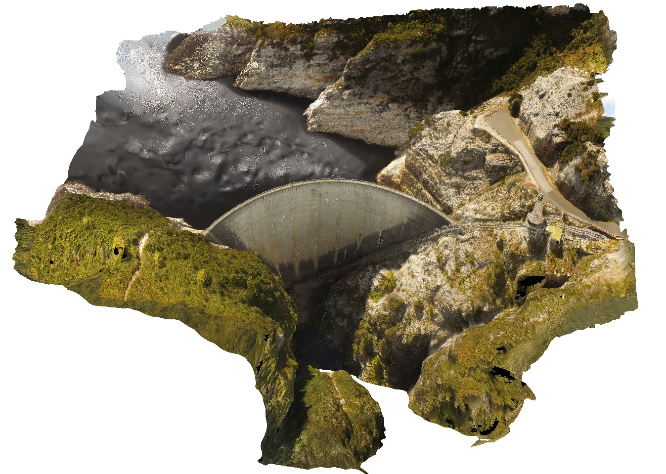
Aerial view of the Gordon Dam, showing folded quartzite and phyllite metasediments outcrop. Gordon Dam. Tasmania.
| Capture Date: | Feb. 23, 2016, 9:14 a.m. |
| Latitude: | -42.73044300000 degrees |
| Longitude: | 145.97555560000 degrees |
| Elevation: | NA |
| Visualisation Type: | UAV |
| Location Accuracy: | 20 metres |
Keywords:
- dam
- quartzite
- phyllite
- structure
| quartzite | |
|---|---|
| Form Type: | bedded |
| Description: | Pelitic schist and quartzite, some schistose conglomerate |
| Min Geological Age: | Neoproterozoic |
| Max Geological Age: | Mesoproterozoic |
| Min Numerical Age: | 541.000 |
| Max Numerical Age: | 1600.000 |
| Strat No: | 37490 |
| Supergroup: | |
| Group: | Tyennan Group and correlates |
| Subgroup: | |
| Formation: | |
| Member: | |
| Province: |