GordonRd7
Site:
GordonRd7
Downloads:
Map
3D Model:
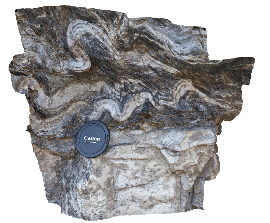
Description:
detail of disharmonic folding on the boundary of quartzite unite. Gordons Dam Road. Tasmania.
| Capture Date: | Feb. 29, 2016, 1:40 p.m. |
| Latitude: | -42.73633000000 degrees |
| Longitude: | 145.97752000000 degrees |
| Elevation: | NA |
| Visualisation Type: | 3D |
| Location Accuracy: | 0 metres |
Keywords:
- disharmonic folding
- structure
- phyllite
| phyllite | |
|---|---|
| Form Type: | bedded |
| Description: | Pelitic schist and quartzite, some schistose conglomerate |
| Min Geological Age: | Neoproterozoic |
| Max Geological Age: | Mesoproterozoic |
| Min Numerical Age: | 541.000 |
| Max Numerical Age: | 1600.000 |
| Strat No: | 37490 |
| Supergroup: | |
| Group: | Tyennan Group and correlates |
| Subgroup: | |
| Formation: | |
| Member: | |
| Province: |