Gosse1
Site:
Gosse1
Downloads:
Map
3D Model:
Description:
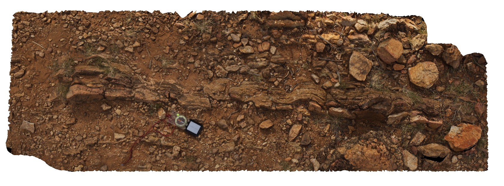
siltstone and thinly bedded sandstone showing possible load and clast sorting features. Gosse Bluff Conservation Reserve. N.T.
| Capture Date: | Undated |
| Latitude: | -23.81855800000 degrees |
| Longitude: | 132.31356200000 degrees |
| Elevation: | 734.142 metres |
| Visualisation Type: | FSP |
| Location Accuracy: | 5 metres |
Keywords:
- sedimentology
- fold
- impact shock
- impact load features
| siltstone | |
|---|---|
| Form Type: | bedded |
| Description: | Thinly bedded, fine to medium clean sandstone |
| Min Geological Age: | Late Ordovician |
| Max Geological Age: | Early Ordovician |
| Min Numerical Age: | 458.000 |
| Max Numerical Age: | 478.000 |
| Strat No: | 26147 |
| Supergroup: | |
| Group: | Larapinta Group |
| Subgroup: | |
| Formation: | Stairway Sandstone |
| Member: | |
| Province: | Amadeus Basin |