Gosse2
Site:
Gosse2
Downloads:
Map
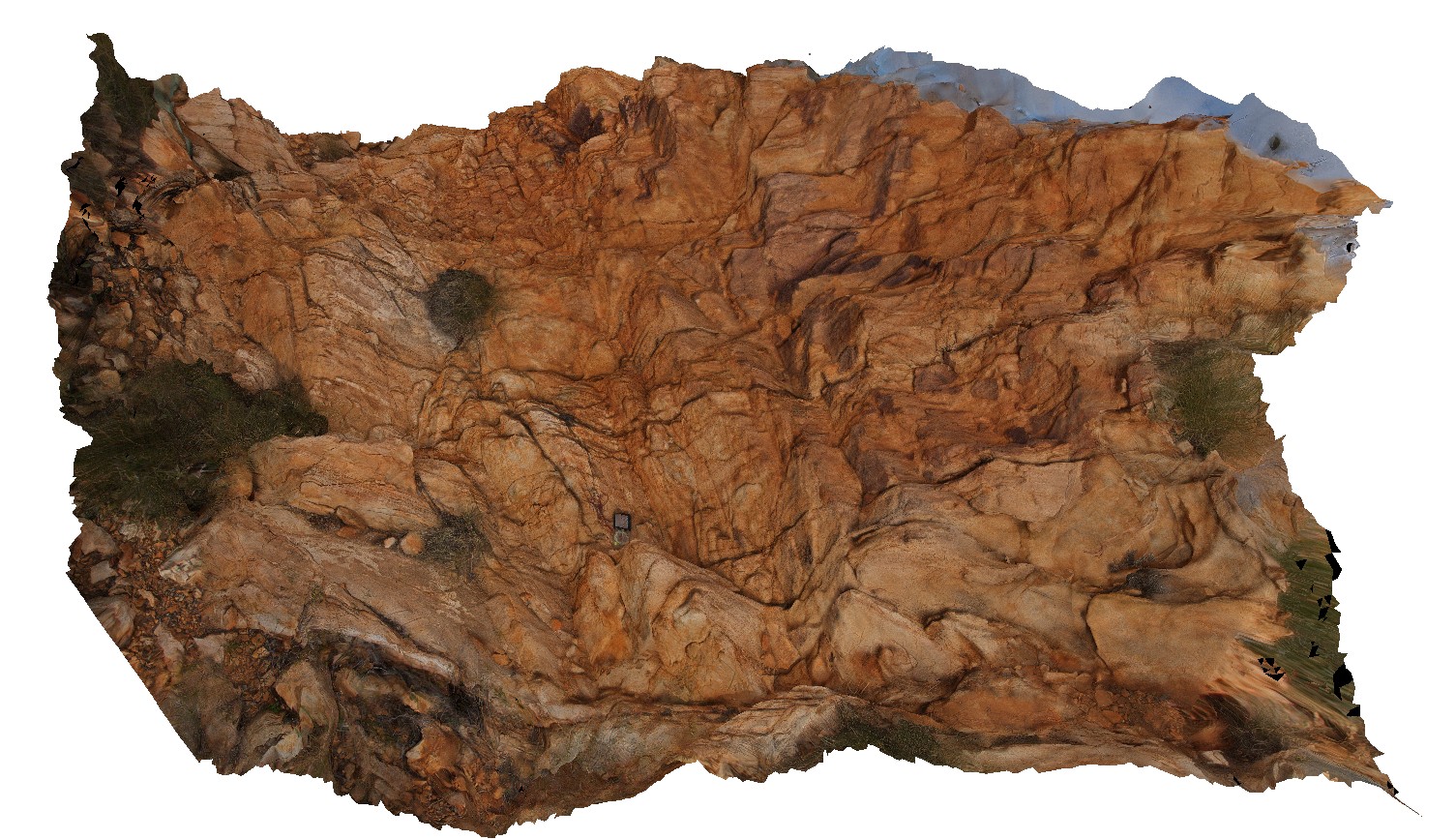
3D Model:
Description:
thinly bedded, disrupted, sub-vertical sandstone on hill on the east side of Gosse Bluff. Gosse Bluff Conservation Reserve. N.T.
| Capture Date: | Aug. 1, 2016, 10:55 a.m. |
| Latitude: | -23.81670600000 degrees |
| Longitude: | 132.31661400000 degrees |
| Elevation: | 746.476 metres |
| Visualisation Type: | 3D |
| Location Accuracy: | 0 metres |
Keywords:
- sub-vertical bedding
- impact crater
- disrupted bedding
| sandstone | |
|---|---|
| Form Type: | bedded |
| Description: | Thinly bedded, fine to medium clean sandstone |
| Min Geological Age: | Late Ordovician |
| Max Geological Age: | Early Ordovician |
| Min Numerical Age: | 458.000 |
| Max Numerical Age: | 478.000 |
| Strat No: | 26147 |
| Supergroup: | |
| Group: | Larapinta Group |
| Subgroup: | |
| Formation: | Stairway Sandstone |
| Member: | |
| Province: | Amadeus Basin |