Granville2
Site:
Granville2
Downloads:
Map
3D Model:
Description:
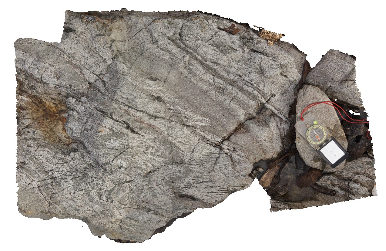
folds in interbedded phyllite and quartzite with axial planar cleavage and cross-cutting crenulation cleavage. Granville Harbour, West Coast Tasmania.
| Capture Date: | Aug. 9, 2016, noon |
| Latitude: | -41.80755000000 degrees |
| Longitude: | 145.03352000000 degrees |
| Elevation: | NA |
| Visualisation Type: | 3D |
| Location Accuracy: | 0 metres |
Keywords:
- axial planar cleavage
- crenulation cleavage
- fold
- structure
| quartzite | |
|---|---|
| Form Type: | bedded |
| Description: | interbedded phyllite and quartzite |
| Min Geological Age: | Cryogenian |
| Max Geological Age: | Cryogenian |
| Min Numerical Age: | 690.000 |
| Max Numerical Age: | 708.000 |
| Strat No: | 14603 |
| Supergroup: | |
| Group: | |
| Subgroup: | |
| Formation: | Oonah Formation |
| Member: | |
| Province: |